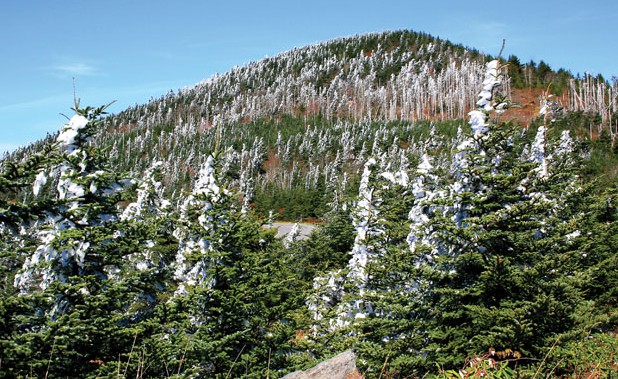
Rime of the Ancient Mountain: Snow, ice, and rime cover the spruce and fir of Mount Mitchell.
![]()
There’s a restaurant near the top of Mount Mitchell, and rangers will give you a golf cart ride to the summit if you ask. But make no mistake: Mount Mitchell is wild. The 6,684-foot peak stands tall in a line of fellow 6,000-footers, protected as a 1,946-acre state park adjacent to Pisgah National Forest. There are easy nature hikes, but also brutally rugged singletrack, some with mandatory scrambling, others with thousands of feet of elevation gain. Here are three ways to explore this iconic Southern peak.
1. The Classic Route
Mount Mitchell Trail begins at the base of the mountain at the Black Mountain Campground and climbs for 5.5 miles up the Mitchell’s eastern slope. You’ll gain 3,600 feet, beginning in a mixed hardwood forest on the edge of the Toe River and finishing in a high alpine mountain peak dominated by a spruce-fir forest. In all likelihood at this time of year, you’ll move from 50-degree temps at the base to a bit of snow on the summit. The steepest bits of the hike are the first and last mile, but you can’t exactly take it easy in the middle either. If you want to break this summit march into two days, take the Higgins Bald detour half way up the mountain, where established campsites sit near an old cabin site. Finish the hike by taking in the 360-degree view from the newly rebuilt observation platform, which sits, literally, at the top of the Eastern United States.
2. The Overnight
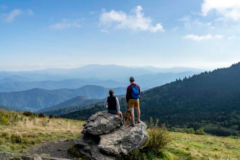
Head for the Deep Gap backcountry campsite, 4.5 miles north of Mitchell’s summit via the Deep Gap Trail. You’ll knock off four 6,000 footers as you rock hop boulders and ascend and descend steep ridges cresting Mount Craig, Big Tom, Cat Tail Peak, and Balsam Cone. Some of the climbs are so steep, ropes are installed to help. But the work is worth it, as you oscillate from rock outcroppings with expansive views to patches of dense fir forest. After cresting Potato Hill, you’ll have a dramatic drop in elevation down to Deep Gap, a saddle in the Black Mountain Range ridgeline that sits at a lowly 5,700 feet in elevation. It’s primitive camping at its finest: flat ground, tree protection from the wind, and spring water down the ridge.
3. The Casual Jaunt
The Balsam Nature Trail forms a loop near the peak of Mount Mitchell, carving a path through Fraser firs and red spruce. It’s less than a mile-long hike with little elevation change, but you’re above 6,500 feet the entire time in a forest that’s often dark with a clean understory, like something out of a Grimm Brothers fairy tale. If you need more of a leg stretcher, hook up the Balsam Nature Trail with the Old Mitchell Trail, which also stays above 6,000 feet for two miles, offering the occasional long-range view.
Fast Facts
• The weather can be brutal on Mitchell, particularly in the fall when the snow and ice begins to hit. • It’s also common to climb to the peak of Mitchell and see nothing but the clouds five feet in front of your face. • There are nine walk-in tent sites in the park open year round (weather permitting) and primitive camping on Commissary Ridge, two miles from the ranger station. • Black bear tend to get frisky around the campsites on Commissary Ridge. Cook away from your tent and hang your bags. • If the Parkway is closed, access Mitchell via Highway 80 out of Burnsville.


