It’s like choosing your favorite child. Inconceivable. With so many amazing trail systems in the Southern Appalachians, is it even possible to pick one trail that’s better than all the rest?
BRO recently challenged our readers to do just that and name the Single Best Trail in the Southeast, and after wading through numerous entries we’ve come to a conclusion.
The winner of our Best Trail Contest is Jon Livengood, who offers a vivid and detailed description of the Honey Creek Loop in Tennessee’s Big South Fork National River and Recreation Area. Opinions were (literally) all over the map, but Honey Creek seems to have a little something for everyone. But don’t just take our word for it. Here’s Jon’s take on his favorite footpath…
My favorite trail is the Honey Creek Loop in the Big South Fork National River and Recreation Area near Rugby, Tennessee. This trail has the biggest variety of conditions per mile that I’ve every seen. It doesn’t have the longest climb, or highest peak, but it makes up for that by having almost every kind of terrain packed into six miles you could ever want. It’s a slow moving six miles, due to the amazing natural obstacles and beautiful distractions along the way—rock scrambles and squeezes (must remove backpacks on some of them), big views, canyon hiking, Indian rock houses, waterfalls (one in a cave), wooded sections, steep ladder climbs, and open rock faces. It also connects with the John Muir Trail to allow you to expand your mileage and do a longer weekend hike.
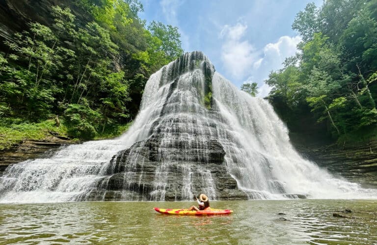
The trail starts among pristine wooded forests along, beautiful cascading creeks, and winds around many unique trees. It then passes by huge rock walls with amazing embedded formations. Portions remind me of coral. Next, it gives you the option to climb up a couple of ladders to get an incredible view of the Big South Fork Cumberland River and the gorge it has carved out. You then descend from the overlook to get up and personal with the river with options to set up camp or take a swim. The trail changes again, as now you start hiking thru 50-feet wide canyons and crawling thru tight crevasses in the rocks. Hikers should expect to get wet, as the trail and the creek cross at times. You can take a short ladder to a huge Indian rock house that over looks the trail. It has a second room that requires you to get down on your stomach and crawl through a small opening to gain access. Back on the trail, you pass through a few more tight squeezes and a rock tunnel that has a waterfall in it. Finally, you climb up the hill to a flat slab of rock—maybe 50 feet long by 100 feet wide—a fantastic place to absorb some sun and have a bite to eat. Finish out the trail by walking along the rim of the gorge and pass above and then below Honey Creek Falls. It’s hard to do Honey Creek justice with words, but it is a trail I hope everyone in the Southern Appalachians has a chance to experience.
——————–
Runners Up

Bartram Trail from Nantahala River to Cheoah Bald
The North Carolina trail starts at mouth of Ledbetter Creek and goes four miles to the top of Cheoah Bald following Ledbetter’s cascades most of the way. You gain close to a 1,000 feet in the first mile and have to give one last good effort along the Appalachian Trail to the bald. There are great views in both the north and south directions from the peak. From the top you can see Wesser Bald, Wayah Bald, Blood Mountain, and most of the mountain peaks in Georgia. Northern views include Lake Santeetlag, Snowbird Mountains, Clingman’s Dome, Lake Fontana, and the Stecoah Valley.
-Reeve McNamara
Apple Orchards Falls
This seven-mile loop trail with multiple waterfalls starts near Arcadia, Va.
– Tim Moses
Bays Mountain Park

Bays Mountain Park, Kingsport, Tennessee
The combination of the Indian Pipes, Kiner Hollow, Laurel Run, and Lakeside Trails in the park includes a 3,440-acre nature preserve, a 44 acre-lake, steep ridges, gorges, waterfalls, creeks, and opportunities to see wildlife.
– Mark Skelton
Slickrock Creek Trail (Cheoah Dam to Lower Falls)
The Slickrock Creek Trail in North Carolina’s Slickrock Wilderness is a 13.3-mile trail filled with stream fords, cascades, waterfalls, swimming holes, and much more. However, you don’t have to hike the entire trail to enjoy all this. From Cheoah Dam (famously seen in the film “The Fugitive”), you can hike just 3.1 miles to enjoy all the aforementioned scenes. Within the first mile and a half a few of the scarce yellowwood trees can be seen to the observant viewer. After hiking a sketchy portioned of the trail washed out by a mud slide several years back, the trail turns sharply following the creek. The trail then becomes adventurous as you hop boulders and large rocks along the river. After a little more than 2.5 miles you reach the first ford of the creek and our now in Tennessee. Be careful of the “slick rocks.” Heavy rains could make this creek impassible so use caution. Just 3/10 of a mile after the crossing you come to the spectacular Lower Falls. The large pool below the falls makes for a nice swimming area. This hike will be thoroughly enjoyed on the warmest of summer days. Turn around and head back after a swim, or hike just 7/10ths of a mile to the Ike Branch Trail for a loop back towards Slickrock Creek. Adding the Ike Branch loop will give you an additional two miles.
-Jerry Span


