The Sheltowee Trace is a National Recreation Trail spanning 323 miles through the Daniel Boone National Forest and Big South Fork National River Recreation Area in both Kentucky and Tennessee. It’s Kentucky’s long trail and a premier thru-hike in the area, showcasing a side of Kentucky that most people don’t know.
Scott Hess, Wes Murphy, and I decided to attempt the first end-to-end bike ride of the Sheltowee in March.
On a cool, early spring morning, we set off down the trail headed south. The first day was gorgeous, but on the second day, rain punished us the whole way. Since the Sheltowee Trace through the Red River Gorged is closed to bike travel, we biked around it, stopping a Miguel’s Pizza to camp and enjoy the our best meal of the trip.
Early on day three, we carried our bikes up 2,000 steps in Natural Bridge State Park to the ridge top, where we were met with a beautiful view and inspiring start to the day. But then, while riding through backwoods singletrack, Scott got a rip in his rear tire sidewall. It was small, and the repair was fairly easy, so we were able to put in nearly a 50 mile day.
We started day four on an old ATV trail that had a good amount of flow. However, it also had a lot of fork-deep mud holes in the middle of the trail that we had to avoid.
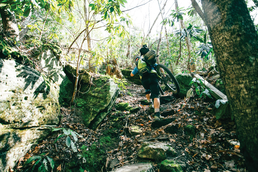
Up to this point, the terrain was very average, nothing too crazy. Sometimes we would push uphills because, with the weight of the bike, it was easier to save energy that way.
But as we neared the halfway point, we began to have a serious issue: Wes’s knee. Through the pain, he pushed on to our camp spot for the day. We discussed if completion was a doable thing with half of the trail still to go. The terrain was only going to get steeper and more technical as we went farther south. All of our stomachs started to turn with worry about completion.
Day five was our coldest morning at just over 20 degrees. Wes’s knee was still giving him some issues, and later that morning, he said, “My knee is killing me. I got it duct taped, but it’s popping, tearing, and grinding.” He decided to ride to our cache spot and reevaluate there.
Before the ride, we planted a storage box off the trail near a highway intersection. The cache had a restock of food, fresh clothes, and a couple other supplies to restock on. A tricky part about the Sheltowee is having very few places to restock along the way. The cache was the only way. If it had been stolen, our trip would have ended.
The time was now to ask Wes his decision to continue or bail. After a hearty breakfast and a lot of ibuprofen, his decision was to continue. It was relief for us all, as we were all in it together.
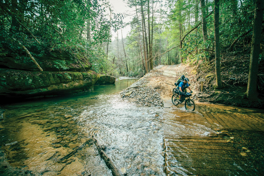
We camped for the night just off Laurel Lake before diving into what would be the most difficult section of trail. It has awkward rock features that are difficult when riding, let alone bikepacking, and lots of downed trees due to heavy winds in the area, along with narrow and technical creek crossings. All of us were able to bunny hop over downed logs, even with all of our gear weight. Some of the most scenic and beautiful landscapes are found through here, but we were happy to be past it and into Big South Fork, where we crossed the state line into Tennessee.
The final day was cold, constant rain. Then the small tear in Scott’s rear tire completely opened up into a massive hole. Away from any roads, or civilization in general, we had to make due with what we had. After going through our bags, the best option seemed to be a Sam Splint, the medical device used for broken bones. We used it to create structure for the sidewall, packed with pieces of old tubes and held together with zip-ties. Far from perfect, it was somehow holding air.
With about 30 miles left, I got a flat on a descent and ripped my tire in a very rocky and fast section. Sidelined again, I used the last of our tubes.
Scott’s tire needed to be inflated every quarter mile, and eventually he had to push the bike for two miles to reach the Bandy’s Camp Visitor Center. According to our map, we still had 20 miles to go. But when we asked the visitor center ranger about the rest of the trail, he informed us that bikes were not allowed on the remaining 20 miles. We had never been so delighted to be denied access.
It took a minute for it to sink in. Was it real? Did we just complete it? After 7 days, 7 hours, and 2 minutes, we had just bested the Sheltowee via bike.


