5 Days of big adventure in the southeast.
DAY 1: GANGSTA RAP
Best Mountain Bike Trail
TEA CREEK MOUNTAIN, SLATYFORK, W.VA.
We left our homes in Asheville and headed straight for Slatyfork, West Virginia, home to the best mountain biking in the Southeast. Keener made a road trip mix with 147 songs specifically designed for this trip. It bothers me a little because only middle-school girls make “mixes,” but I let it go until Milli Vanilli makes an appearance somewhere near the West Virginia border.
“Interesting choice,” I say as M.V. blames it on the rain. I crack open my first Red Bull for the trip.
“I’m not ashamed,” Keener says.
We’re giddy as we hit Marlinton, a town about ten minutes from Tea Creek Mountain’s trailhead, so we roll down the windows and crank the music. We creep through downtown Marlinton, population 1206, at seven miles per hour, blasting Snoop Dogg and getting mad respect from the locals on their lunch break.
Best Road Trip Band: Allman Brothers, followed closely by Widespread Panic. Right now, Snoop brings up the rear at third.
We eat lunch at Dirt Bean, a café, bike shop, inn, and a gym all wrapped up in one. This is how it’s done in small towns. Businesses must multi-task. The menu at Dirt Bean is extensive: veggie sandwiches, coffees, and Life Transformation Classes.
Tea Creek Mountain is a legendary downhill in Monongahela National Forest. By all accounts, it has the world’s most difficult boulderfield. Nobody can ride this thing. But downhillers love the trail because it’s technical and flowy, fast and dangerous.
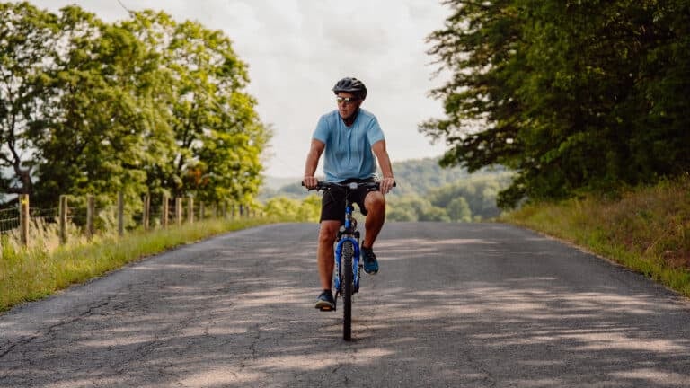
Keener and I park at Tea Creek Campground, pump our tires, fill our hydration packs, and start pedaling up the forest road which will connect with Scenic Highway 150 which will eventually connect with the top of Tea Creek Mountain. It’s about four miles of continuous climbing on the highway from the campground to the top of the trail. It’s hot, so I ride “redneck,” stripping off my shirt and helmet, the sweat stinging my eyes as we crank up the steep grades toward the top of the mountain.
Keener, uneasy with my toplessness, makes his first Brokeback Mountain joke of the trip.
My legs feel good as we take in the view from the road next to the trailhead and I’m looking forward to the downhill, which, according to locals is “hairy.”
“You can get into trouble real quick on Tea Creek Mountain,” says Kristy Lanier, a pro mountain biker living in Marlinton. “It’s not the kind of trail where you want to take unnecessary chances.”
I’m thinking about what she meant by “unnecessary chances” when I hop back on my bike and realize that my front shock is blown. I push down on the handlebars and my front end sinks toward the ground.
“Dude,” Keener says, realizing my predicament.
Tea Creek Mountain is six miles of technical challenge. Boulders, baby heads, roots, creek crossings, drops, downed logs. Would riding the trail with a blown front fork be what Lanier calls an “unnecessary chance?”
I contemplate riding back to the car and driving to Marlinton to have the shock fixed. I contemplate riding back to the car and drinking beers while Keener rides the trail solo. Then I think about how people used to ride trails without suspension all the time. So I lock out my front shock and pedal. Everything is fine as we climb for a half-mile through a series of rooty switchbacks surrounded by ferns, and I think, maybe I don’t need a full suspension rig after all. Maybe when I get back to Asheville, I’ll sell my plush 4” travel bike and become one of those crazy hardcore bikers who hits Pisgah on rigid steel frames.
As soon as the downhill kicks in, I realize I am not one of those rigid tough guys. It begins innocently enough. Some roots and small rocks thrown in for good measure on a trail that weaves between huge evergreens. Then the small rocks become bigger rocks strewn between moss-covered boulders. Without suspension, I feel like I’m pedaling a jack hammer. Even the dead pine needles rattle my forearms. It’s not ten minutes before I have to slam on the brakes and shake out my hands and forearms.
We reach the infamous boulder field and neither of us bother trying to ride it. The rocks are white and jagged and not quite as big as I was expecting, but they’re everywhere. After the boulders, we pedal through a field of stinging nettles, then the true fun starts as the trail turns into a ridiculously steep bench cut line hugging the side of the mountain. It’s a testament to the insanity of mountain bikers that they’ve chosen this trail above all others in the Southeast.
Without suspension, it’s hard to find the rhythm of the trail and I flounder, stopping repeatedly to shake out my forearms. After a few decent drops, the lockout on my shock is blown and the front end sinks whenever I hit anything remotely technical. Without the tension in the front end, I come dangerously close to launching over my handlebars. All together, I almost die 17 times making my way down the mountain.
We hit the campground and open a couple of PBRs I stashed in the cooler. Everything we need for the next five days is packed into the vehicle. Cans of Chef Boyardee, extra socks, tents, sleeping bags, magazines, cooler full of beer, energy bars, pork rinds. There’s a certain satisfaction to being completely self-contained and still totally absorbed in our consumer culture. We’re like gypsies, but with cooler stuff.
We head back to Marlinton and eat at a classic small-town diner. Keener holds up a greasy slice of bacon and says, “Best Food Ever: Bacon. It’s a side dish, a condiment, and a main dish. It transcends all food boundaries, like a good presidential candidate transcends party lines.”
DAY 2 : TRUST FALLS
Best Climbing
NEW RIVER GORGE,
FAYETTEVILLE, W.VA.
Fastest Lawnmower in the World: Dixie Choppers. How fast? The Xcaliber 3366 reaches a peppy 15 mph. It cuts eight acres per hour, a speed which would allow me to cut my lawn in roughly 2.2 minutes. Not bad.
We pass a proud distributor for the Dixie Chopper on the two-plus hour drive from Marlinton to Fayetteville. Two Red Bulls and a dozen socially awkward songs from Keener’s playlist later, and we’re sitting inside Elliot’s Whitewater Pub in the wee hours of Monday night, watching a one-armed elderly man pound as many bottles of Bud Light as he can before his taxi arrives to take him home.
Keener and I close Elliot’s down, pumping quarters into the jukebox until there is no more Journey left to be played, sleep hard, and are out on the New River Gorge’s magnificent rock the next morning before 9am.
Our guide, Mike, sets up an 80-foot rappel from the top of Junkyard Wall, a beginner-friendly crag not far from the New River Bridge.
“This rappel lets me know right away what my clients are up for,” Mike says. “If you can handle dangling 80 feet up on a rope, then you should do just fine on the climbs I have in mind for you today.”
Keener and I look at each other, each of us secretly hoping the other will freak out while rappelling off the nose of the wall. Like most friends, we jump at the opportunity to ridicule any sign of human frailty in the other. At the very least, I’m hoping Keener pees his pants a little.
I’m nervous as I walk backward over the lip of the wall, but as soon as I take a few big steps down the rock face, I relax. Soon, I’m hanging completely free from the rock, slowly inching my way down the rope. The harness is uncomfortable, but not painful, and I’m actually enjoying the fact that I’m dangling from a rope, high enough off the ground to cause certain death if something goes wrong.
Keener’s rappel goes off just as smoothly, no urination to speak of, and Mike sets us up with a 5.7 climb inside “the Cave,” a dark, skinny fissure inside the Junkyard Wall. With Mike on belay, we each take turns scaling the route, which is muggy, dirty, and a little bit cramped. Exactly, I think, like climbing inside the belly of a whale. At one point, the route is so narrow, I have to brace myself on both sides of the cave, my feet on one side, my shoulders on the other, and shimmy up the chute. I top out on a ledge near the peak of the cave and sit down, hanging my feet over the ledge and enjoying the small victory that comes with sending any route.
We move to the outside wall and as the day goes on, the climbs get better. The sandstone on Junkyard Wall is featured and colorful, a swirl of faded oranges and blues, like a vintage Grateful Dead t-shirt.
My knees get torn up as I scramble through the crux of one route, trails of blood dripping down my shins and into my shoes. Eventually, Mike lets Keener and me belay each other, which makes Keener a little nervous. On a 5.7 that we make look like a 5.12, Keener starts climbing really slowly, looking down at me and constantly asking, “You got me?”
He’s sweating more than usual and is overly cautious. He keeps asking me to stop talking. The lack of trust is palpable.
DAY 3 : SCAVENGING FOR FOOD
Best Hiking
APPALACHIAN TRAIL AT MASSEY GAP
The plan for day two was to climb for half a day with a guide and then do some bouldering on our own. At lunch, we sit at Pies n’ Pints (a Fayetteville institution) and have that awkward conversation where neither of us wants to say we’re too tired to carry out the original plan. Nobody wants to be the one who backs out, but eventually we come to the only rational conclusion: we’ll scrap the second half of the climbing day and drive directly to Grayson Highlands State Park in Virginia, set up camp, and go to sleep as soon as possible.
Two hours and two Red Bulls later, we’re sitting in our camp chairs at 4,000 feet, reading a collection of alpine disaster stories, trying to get psyched about the 12-mile hike we have scheduled for day three. It’s not that the hike isn’t worthy of our excitement, it’s just hard to maintain high levels of enthusiasm for days at a time. Red Bull helps. So does the disaster porn.
On the edge of Grayson Highlands State Park, near the Mount Rogers Recreation Area, the Appalachian Trail runs through the open fields of Massey Gap. Wild ponies roam the high elevation fields, which are surrounded by miles of uninterrupted views on all sides. I’m not making this up. Massey Gap is something out of a fairy tale. And it’s the most boring part of our 12-mile hike.
We hike the A.T. through Massey Gap and take the obligatory pictures of the wild ponies and keep following the A.T. onto Wilburn Ridge, a narrow crest littered with huge, pale gray boulders that line the ridge like a dragon’s back. We’re actually giddy as we scramble over the rocks, trying to find the best view from each outcropping. The hiking offers full exposure, and the bald ridge covered with massive rocks gives the experience a “Rocky Mountain” feel, like we’re 14,000 feet up, well above the tree line.
“I want to bring my dad up here. He’d love it,” Keener says.
“I want to bring everyone I’ve ever met up here,” I counter.
We drop off the ridge and hook up with Pine Tree, a trail that cuts through a dank forest of ferns, evergreens, and small boulders. It couldn’t be more different from Wilburn Ridge and Massey Gap, but it’s just as exciting. Our pace slows as we hit a grove of blueberry bushes. We move from one to the next like locusts, stuffing our pie-holes with sweet, tiny berries.
Pine Tree hooks back up with the A.T. at Scales. There’s an outhouse there and a mowed field where hippies and rednecks camp during the summer and pick buckets of blackberries from the surrounding fields, which roll away in all directions offering more long-range views.
We rest in the field, eating blackberries and the energy bars we packed for lunch, and listen to a couple argue as they pack up their truck. They both seem to blame each other that the blackberry crop wasn’t more productive this year.
The hiking gets a little dull toward the end of the loop and I secretly hope that every bend in the trail will deliver us to the car. We decide to head straight for the nearest Cracker Barrel for dinner.
Best Road Trip Meal: Catfish Platter at the Cracker Barrel.
DAY 4 : THE TROUBLE WITH SUPERMODELS
Best Trail Running
ART LOEB TRAIL, N.C.
The drive back to Asheville is long and quiet. I’m on Red Bull #8, but I don’t think they’re having the desired effect. Basically, I’m just maintaining a low-volume buzz.
I’ve commandeered the stereo so now we’re into the moody, introspective portion of the road trip playlist. The Shins, The National; nice, quiet music perfect for contemplating big questions, like, “Why am I such a pansy?”
I’m three-fifths of the way through the most adventurous week of my life, and yet I find myself daydreaming about skipping the trail run for day four and spending the day in the office sipping coffee and checking emails.
I think maybe my dad was right all along. I really am an ungrateful little bastard.
When I drop Keener off at his house, he says he’ll only run the Art Loeb with me in the morning if it’s mandatory. The original plan was to sleep in our own houses tonight and reconvene for the Best Trail Run in the morning, but I don’t bother calling Keener when I wake up on Day Four. Instead, I drag my wife and dog up to Black Balsam (a 6,200-foot bald mountain on the edge of the Blue Ridge Parkway) for moral support.
You can’t run the entire Art Loeb Trail. Okay, some people can, but I can’t. In its entirety, the trail travels 32 miles, climbing from the Davidson River valley floor to Black Balsam and into the Shining Rock Wilderness, an area known for entrapping hikers with a bad sense of direction.
I’m cherry-picking the best of the Art Loeb, running an out and back over Black Balsam and Tennet Mountain, into the Shining Rock Wilderness and then back. It’s not a particularly long trail run, but it’s packed with massive views.
As the Art Loeb climbs Black Balsam from the forest road, it’s a skinny line of granite, full of big rock steps. Eventually, the rock widens as it crests the peak, spreading over a large portion of the mountain. From the top of Black Balsam, you’ve got the whole world at your feet. The Blue Ridge Parkway is a pencil-thin line of road cutting through a series of green peaks.
The trouble with running the Art Loeb is that you never want to run anywhere else. It’s like dating a supermodel. Where do you go from there?
Not that running the Loeb is all roses and pancakes. At 6,000 feet, I’m having a hard time catching my breath as I crawl up the side of the mountain. When the trail levels out and rolls across the bald dome, my breathing gets easier and I find a nice pace. At this point, the trail is actually a narrow trench, about shin-deep. You have to watch every foot fall—a misstep could mean a broken ankle.
My dog Moses runs ahead of me—high on the cool air and open expanse of the bald. I can’t believe I actually thought about skipping this run and going into the office.
Best Trail Run Song: Gomez, “See the World.”
DAY 5 : BANJOs + FLORIDIOTS
Best Whitewater
CHATTOOGA RIVER, Ga/s.c.
“What do you call a raft guide without a girlfriend? Homeless.”
Rob McCormick, our guide on the Chattooga, knows all the jokes. He likes to keep his clients happy during the down time between rapids.
“What’s the difference between a raft guide and a stock portfolio? Eventually, the stock portfolio will mature and make money.”
We’re rafting section IV of the Chattooga, a class IV/V run on one of the most scenic rivers in the country. The Chattooga was one of the first rivers to be designated as “Wild and Scenic” by the federal government. Basically, what that means is that the Chattooga is so ridiculously beautiful that even the suits that run Congress recognize its importance. The fact that this Wild and Scenic River is packed with world-class whitewater is just a bonus.
We hit the first major rapid, the class IV Seven-Foot Falls, within 15 minutes of putting in. It’s the biggest drop on this section of the river, and it usually bucks boaters from the raft, giving them a chilly swim early in the trip. We head over the thing a little sideways, and the boat goes vertical, the nose and edge disappearing into the tumultuous whitewater below. I feel myself going into the water with it until one of the other paddlers in the raft grabs my leg, keeping me in the boat. I’ve never been more relieved to have a strange man paw my thigh.
I’m heading down the river in a large group mixed with vacationing contractors, farmers, and a British couple that manages to confirm a number of stereotypes I have (they actually swim with their t-shirts on to avoid the sun).
The Chattooga is a drop-and-pool river that stair-steps down the landscape in a series of waterfalls. It’s a free-flowing river (no dam releases) so the character of the whitewater changes every day with the rise and fall of the water levels. Today, it’s running a little low, which makes some of the drops steep, and all of the rapids technical. Instead of barreling over the rapids in a pillow of big water, we have to choose our lines carefully, maneuvering through the mazes of exposed rock with elaborate paddle strokes.
I like the technical aspect of the river—it demands all of your attention, like a rock climb or technical mountain bike downhill.
The Chattooga isn’t like any other whitewater river in the Southeast. The water divides Georgia and South Carolina and is surrounded by public land. On the left side is the Sumter National Forest. On the right is the Chattahoochee National Forest. There are no roads, no houses, no outposts, no development whatsoever along the river. Just steep, wooded slopes, massive white boulders, and the occasional hiking trail. No wonder Hollywood chose this river as the setting for Dickey’s Deliverance.
We eat lunch at Long Creek Falls, a dramatic two-tiered waterfall that empties into the edge of the Chattooga. The entire trip is broken up with distractions like this. We jump from rocks, we check out waterfalls, we swim through a small cave. Given the remote nature of the river and the intensity of the rapids (even in low water), it is the most fulfilling rafting trip I’ve ever experienced.
Along the way, Rob points out rocks that are named after people who died on the river. Allison’s Rock, Rachel’s Rock, Girl Scout Rock.
The trip climaxes with the Five Falls, a series of difficult class IV/V rapids running between picturesque boulders and cliffs. At low water, the drops are technical and a couple are too difficult to run, so we portage what we have to, and milk the runnable water for everything it’s worth. Like all good things, the whitewater is over too fast and I find myself wanting more, even though my body is exhausted and my mind is overloaded from a week of too much exhilaration.
When the Chattooga dumps into Lake Tugaloo, we tie our rafts together and get pulled through the calm water by a fishing boat. I slink into the raft, propping my head on my PFD, and soak up the sun, enjoying the last few minutes of the Best Week Ever. I’m exhausted and the hum of the boat’s engine almost lulls me to sleep.
I’ve biked a killer West Virginia downhill, climbed in one of the most scenic gorges in the country, trekked 12 miles through classic hiking backcountry, run one of the greatest trails in the Southeast, and rafted the quintessential Southern whitewater river. I’ve done more in the last five days than most people have the fortune to do in their entire lifes.
And now, I want to nap.

