There are reasons why some destinations are more popular than others, and on a recent 16-mile circuit, I found out why so many hikers flock to the Shining Rock Wilderness. The area has almost everything that makes hiking worthwhile in western North Carolina: magnificent views; rhododendron-lined streams filled with trout; cascades and inviting swimming holes; forest glens contrasting with open meadows; thousands of wildflowers; opportunities for quiet campsites; and environments that make it seem as if you are hiking through various parts of the world.
The magic of the place makes itself known less than a mile from the Shining Creek Trailhead. The stream flows over boulders and through narrow chutes, creating sparkling cascades and deep pools that reflect the emerald green of the surrounding vegetation. The route gets steeper after 3 miles by ascending switchbacks along the narrowing headwaters. The tumbling stream, rocks covered in neon green moss, and towering hemlock and spruce call to mind New England’s evergreen forests.
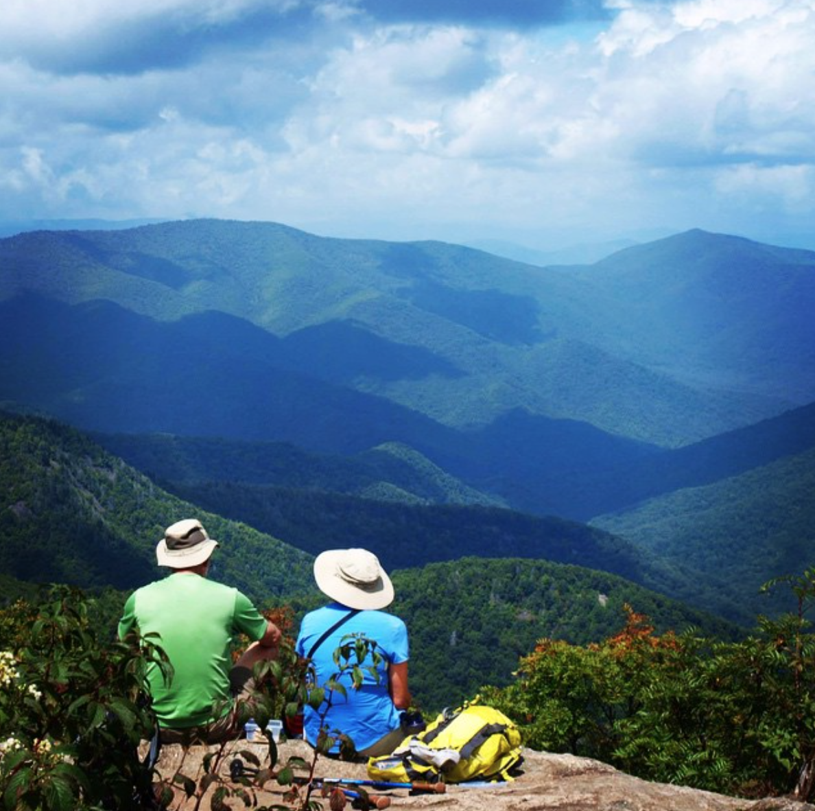
Upon topping out at Shining Rock Gap and turning right on the Art Loeb Trail and then left onto the Ivestor Gap Trail, it’s goodbye eastern U.S., hello Europe. Now above 5,000 feet, miles of alpine meadows furnish dazzling views of the Great Balsam Mountains’ deep valleys and high peaks. The scene so reminded me of my ramblings in the Alps that I expected to find Julie Andrews twirling around and singing.
Other times, it feels like America’s Continental Divide. Montana may be the Big Sky Country, but to stand here in open fields and gaze to where mountains meet earth’s canopy is to be filled with a sense of immense space.
After rising above 6,000 feet along the Art Loeb Trail, it’s a downward trend along the Mountains-to-Sea, Bridge Camp Gap, and Big East Fork trails. The sheer number of swimming holes, chutes, crashing waterfalls, ferns, and wildflowers may make you want to linger here, delaying the return to the modern world.
There are miles of pathways in the area and National Geographic’s Trails Illustrated 800-962-1643; www.nationalgeographic.com/maps Pisgah Ranger District map shows them in detail.


