A must-do hike on the Blue Ridge Parkway, the Fryingpan Mountain Lookout Tower is easy to find, easy to hike, and offers some of the best views in the area.
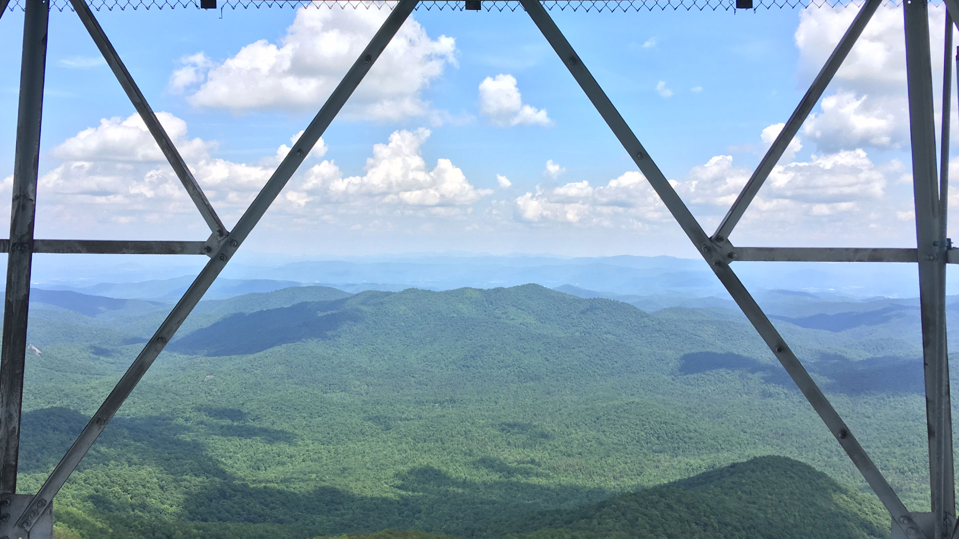
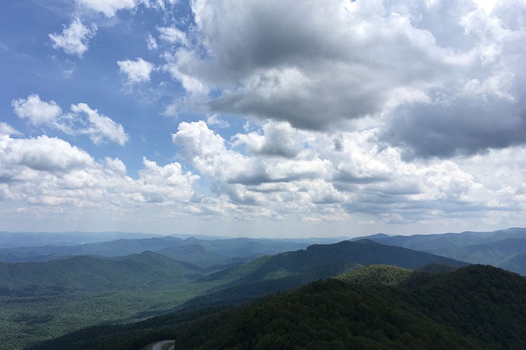
Due to its ease of access, close proximity to Asheville, and stunning views, the Fryingpan Mountain Lookout Tower is the first place I take friends and family who are visiting the area. There are many fire towers in the mountains of WNC, but this one is the tallest. It’s a dog-friendly trail and perfect for the whole family. From the fire tower, visitors have views of Mt. Pisgah, Looking Glass Rock, Cold Mountain, and the surrounding areas that are second-to-none.
Scared of heights? Face your fears. It’s worth it.
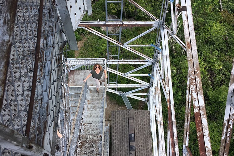
If you’re scared of heights, this might not be the hike for you. While the views from Fryingpan are breathtaking, the tower itself can be a little terrifying. On top of Fryingpan Mountain, you’re already at 5,340 feet in elevation. So why not climb five stories higher? The tower might seem a little rickety, but it’s safe and well worth the challenge. Don’t worry about that loose floor panel or the gusty wind; those are just there for effect.
Sunsets and sunrises alike are incredible here. Climb it in the fall and you’ll never want to leave. It’s one of the few places where you’re actually a part of the clouds, above everything else, looking down on the world below. The vastness of the surrounding mountains and valleys really makes you feel small.
Getting there ain’t half bad either.
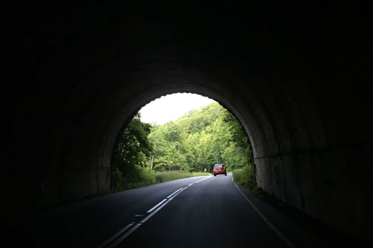
Winding past scenic vistas and through mountain tunnels, the drive to Fryingpan is almost as beautiful as the tower itself. Heading west on the parkway from Asheville, Fryingpan is a 30-45 minute drive depending on where you’re at. Located at Milepost 409.6, the parking area to access Fryingpan is pretty unassuming. Luckily, this trail shows up in your favorite navigation app, making navigation a breeze.
The tower, jutting out of the mountain above, is a good indicator that you’re in the right spot. There is a gated entrance to a gravel service road heading up the mountain. Pull off and park to the sides of the entrance or the sides of the parkway nearby. Be sure not to block the gate as service vehicles will need access.

You’re going to be walking uphill the whole time.
After walking in around the gate, head past the little trails on your right and continue up the main road. While the hike doesn’t offer any views itself, it’s lined with beautiful wildflowers and buzzing insects. Groundwater seeps across the road and over the side of the mountain in some places. About halfway through the hike, you pass a gate that leads to private property. There is a little respite of flat ground at the end right before the steepest part, which is the last haul up to the tower. After a heavy rain, portions of the road can be rutted and a little difficult to walk. Stick to the higher sides of the road for ease of use and the sanctity of your ankles’ wellbeing.

You won’t need a ton of gear.
This is a short hike with a regular amount of visitors so you don’t need to bring your survival rations or Camelbak here. A water bottle and a full tummy will suffice. The road is all gravel, so any old sneakers will get you up just fine. I regularly see folks in flip-flops making the haul to the top. Bring your trusty DSLR of course and if you have binoculars laying around, bring them too!
Things to keep in mind:
While it is a fire tower, and you can climb it, you cannot access the quarters at the top level. It is locked and for official use only. You can, however, access the landings at the top of each flight of stairs up to the 5th level.
Take turns with other folks accessing the tower. The landings are limited on space, so respect others that are there before you. Most folks are just up for a quick selfie anyway. Let them share how awesome they are with Facebook and then take your turn.
Like all other trails in the area, there are no trash cans, so only bring in what you plan to take out. I’m tired of seeing water bottles stuck into the chain link on the tower. Please don’t leave your trash on the mountain.
Fryingpan By The Numbers:
- Hike Distance: 1.5 miles out and back.
- Elevation: 5,340 ft
- Hike Elevation Gain: 347 feet
- Year Built: 1941
- Height: 70 feet
- Best Times: Spring-Fall
Justin Forrest is an outdoor writer, fly fishing addict, and co-founder of Narrative North—based in Asheville, N.C. He posts pictures of cats and fishing on Instagram sometimes.


