“I ate 20 bananas today.” My friend Shane Robinson made this proclamation as we were sitting at his dining room table, packing our gear for an adventurous hike we were undertaking the next day. I had questioned his choice of food for the hike, which as far as I could tell consisted of a bag of apricots and a bag of mixed nuts. I stared at him for several seconds as I considered whether or not he was joking. He was not.
We were attempting to hike the entire Maryland section of the Appalachian Trail in one day, 41.5 miles from the Mason-Dixon line to Harpers Ferry, West Virginia. The full AT, as it’s known, is 2,175 miles long and stretches from Georgia to Maine. The trail is marked every few hundred feet with a white blaze on a tree, a boulder, or a post. The Maryland section of the trail is the perfect distance for hardy hikers to do the whole thing in a day. This endeavor even has a name: The Maryland Challenge.
Shane is an ultrarunner. He has competed in 50-mile races, trains religiously and tracks his diet like a clinical scientist. He was experimenting with a new raw vegan diet, hence the apricots and nuts being his only provisions.
I jog a few times a week, eat whatever I want and know nothing about nutrition. I packed energy bars, trail mix, dried mango slices, salami and cheese stuffed in mini-pitas and some chocolate covered goji berries. I wasn’t going to starve on this trip.
I had a 32-oz hydration pack and a 32-oz water bottle, and I stored these along with my food in my 9-year old son’s backpack. Shane had a racing vest, something that ultrarunners use that has a small storage compartment on the back and a pocket on the front of each shoulder strap to store a 16-oz water bottle. He fit a third water bottle on the back of the vest.
We woke up at 5:30 a.m. and got our gear together. We were both wearing orange shirts. I was sporting a child’s backpack and Shane had a racing vest on. We did not look cool.
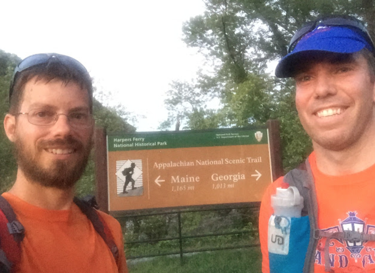
Shane’s Father-in-law Joe dropped us at Pen-Mar Park at 7:15 a.m. After the dropoff, we headed north for the quarter-mile hike to the Mason-Dixon line and posed for our obligatory selfie, after fiddling with our phones’ camera settings until we got the timers to work. There was a notebook kept next to the sign, and I signed our names with the time and indicated we were doing the Maryland Challenge. Then we headed back south, the official start of our 41.5-mile journey.
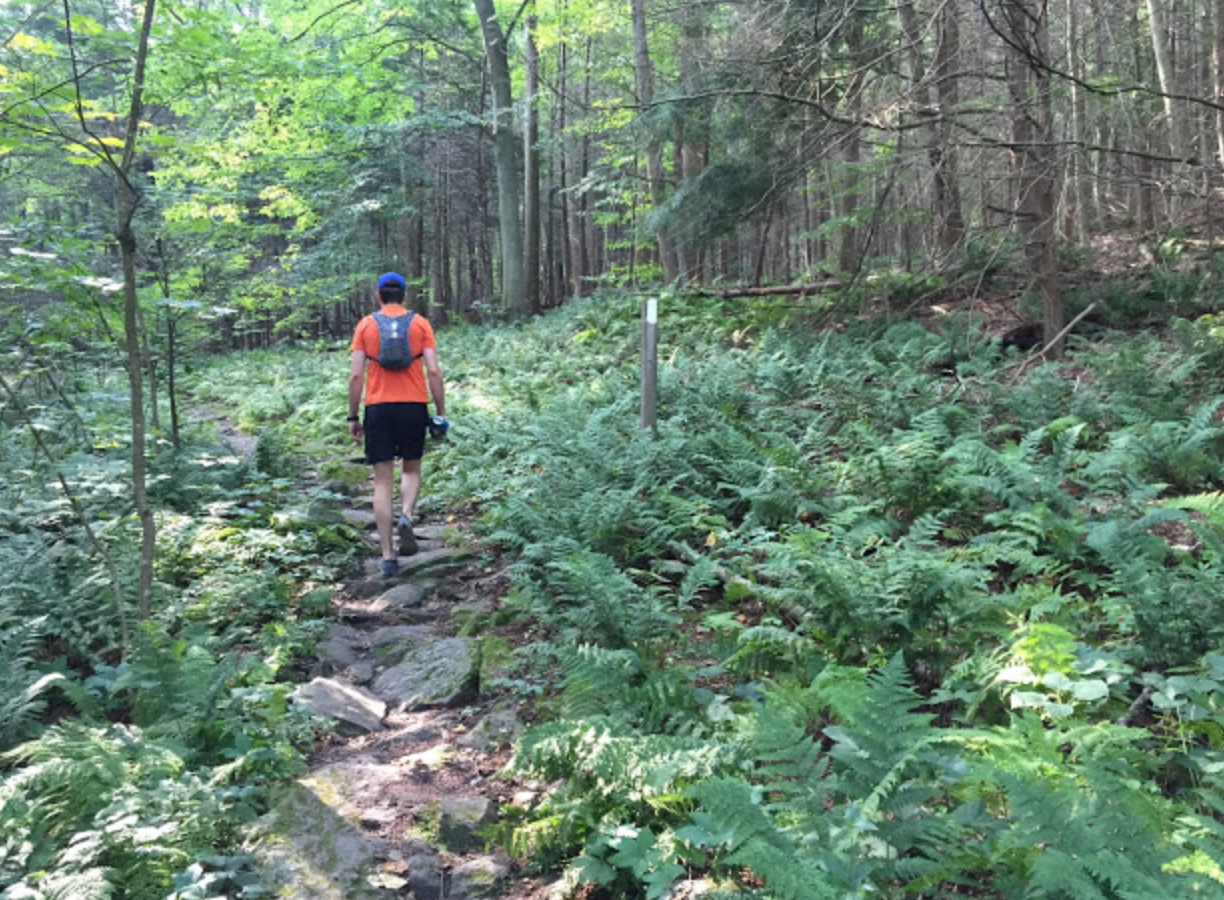
For some reason, we had set an arbitrary goal of completing the hike in 12 hours. While we intended to run at least some of the trail, we started at a brisk walk. After Pen-Mar Park, the trail weaves through a pretty forest, strewn with boulders and ferns. The trail was wide enough that Shane and I could walk abreast of each other, talking in easy conversation, still excited about the day’s adventure. When we weren’t talking, the only sounds besides our shoes hitting the ground were birds singing, cicadas chirping or woodpeckers pecking.
The quiet and solitude were actually surprising to me. It was a beautiful Saturday morning – especially for August – sunny with low humidity. Where was everybody? We had hiked for two full hours until we encountered another person, a teenage boy who nodded a quick, but polite, hello as we passed. “I wonder where he came from,” I thought aloud to Shane, since the boy had no gear other than a walking stick.
We crossed a road, then a nice babbling brook. A few miles later, we came to the Ensign Cowall Shelter, one of half a dozen lean-to style shelters on the Maryland section of the AT. Each shelter has an outhouse-style privy and usually a nearby spring. At Cowall we met John, a pleasant fellow who was taking a break on the front step of the shelter. I struck up a conversation with him, and he told us he was finishing up the last leg of a trip from several years ago. On his previous trip, he had gotten to this shelter and abandoned the hike because his boots were falling apart. So today he started at Pen-Mar, like us, hiked to this shelter and now would head back to officially complete the trip. He was at the halfway point of his hike. We were still just getting started.
Shane was running low on water, so we stopped at a spring a few hundred feet down the trail from the shelter. I got out my ultra-violet water sterilizer to treat the water. Treating water from streams or springs is recommended to protect against giardia and other intestinal infections. Unfortunately, as I pressed the button to activate the sterilizer, a red warning light flashed, indicating that the batteries were too low. I had forgotten extra batteries. We had our first drama of the trip.
I still had a decent amount of water left, but Shane was almost out. I knew we could get water at Washington Monument State Park, but that was 10 miles away. We debated whether we should risk drinking the spring water or try to make it to the water fountain at the state park. I’ve had giardia before – it’s no fun at all. Shane suggested we could drink the spring water and then just go to the doctor and get some antibiotic. A good fallback plan, but we decided we could hold out. We pressed on.
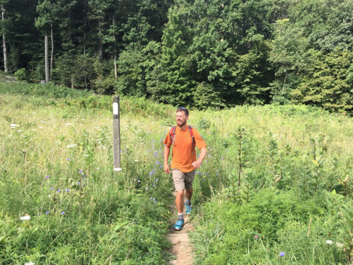
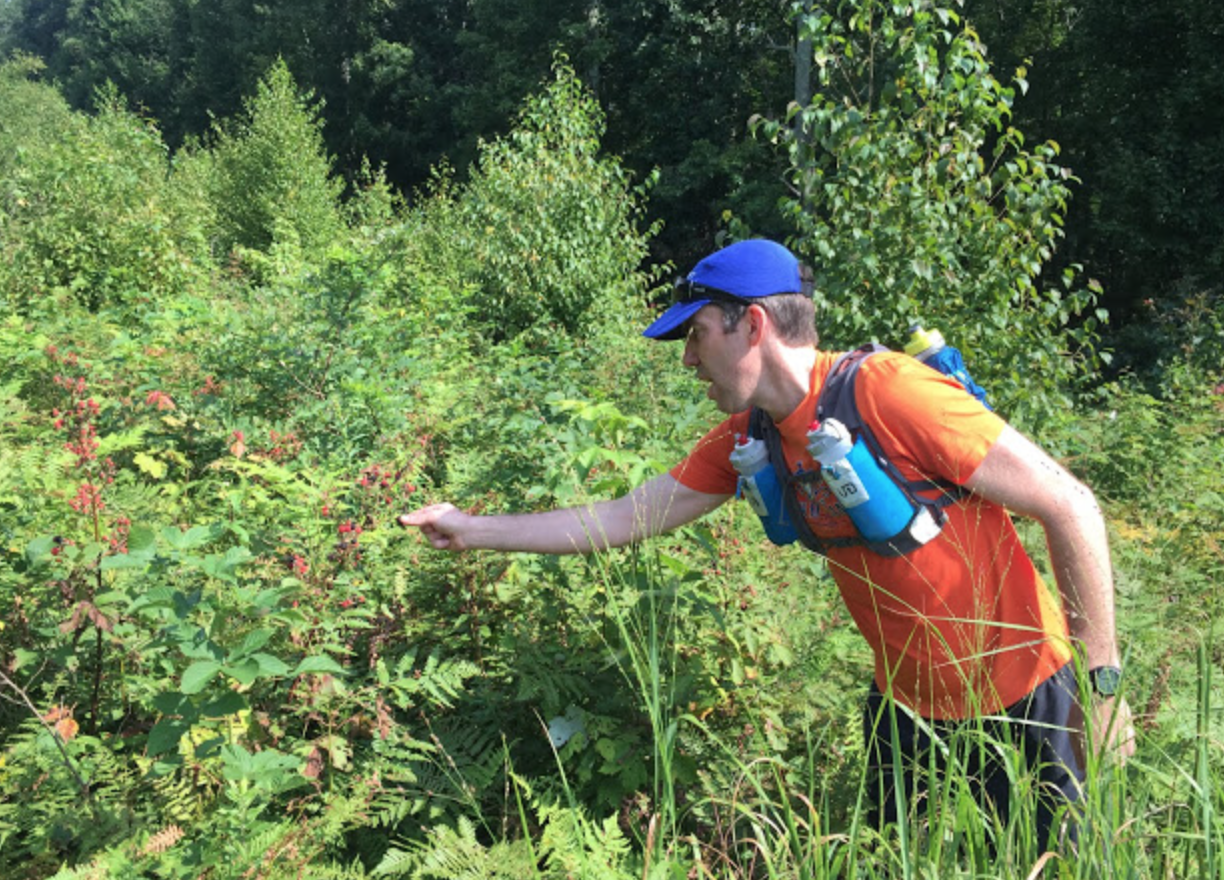
The trail generally stayed on top of ridges but under the forest canopy, which meant we didn’t have to worry about sunburn on this sunny summer day. Occasionally, though, we would come to a meadow or clearing, usually a right-of-way for power lines. The open patches sometimes offered a tasty treat – ripe wild blackberries. Pausing for a minute or two to pick some berries and drink some water provided a nice mini-break. Neither Shane nor I wanted to dally, however, since we were running a little behind our projected pace.
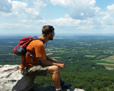
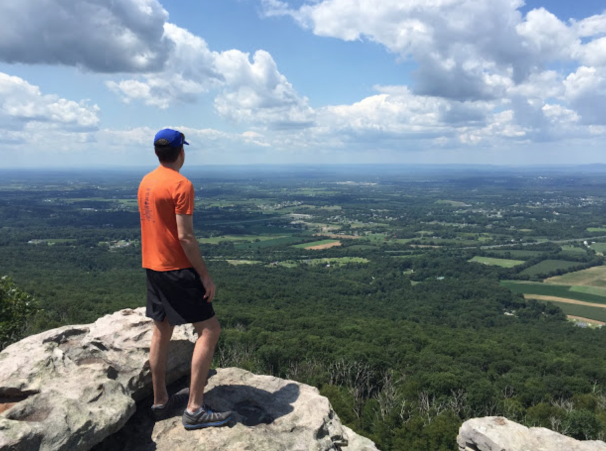
We took a small side trail to the impressive overlook at Black Rock, about 15 and a half miles into our trip. We were both still feeling good, and snapped a few pictures of each other on a rocky outcrop perched above the expansive valley below us. We had been hiking for about 5 hours. “All we have left is a marathon,” Shane offered cheerily. Regardless, if we wanted to make it to Harpers Ferry before dark, we needed to pick up the pace.
The trail from Black Rock to Interstate 70 is mostly downhill, and we decided to jog it. We passed by the side trail to Annapolis Rock, a popular day-hiking destination with a similar view to Black Rock, and came down to the highway. We crossed the footbridge – the din of the cars and trucks beneath us creating quite a contrast to the forest sounds of birds and cicadas we had grown accustomed to.
We were both out of water, but I knew the state park was only two miles away. The two miles were largely uneventful, except that Shane mentioned he wasn’t feeling that great. A mild nausea, nothing to be worried about, he said.
“Think it has to do with the 20 bananas sitting in your gut?” I asked. “Maybe,” he admitted. “Experimenting with my diet before a 40-mile hike might not have been the best idea.” Regardless, he politely declined my offers to share my food, and stuck with his apricots and nuts.
We emerged out of the woods onto a gravel trail that lead to the Washington Monument, a 34-foot stone tower that looks like part of a medieval castle. The structure was built in 1827 and is the first official monument to be dedicated to George Washington. Unfortunately, rope fencing surrounded the tower, and signs declared it temporarily closed. I was disappointed – I had been to the top of the tower years ago, and I remember it being a nice view.
We were both more interested in refilling our empty water containers, however, so we continued down the park trail to a convenient spigot in front of a picnic pavilion. We took a ten-minute break to eat, drink and stretch out a bit. We were a little more than halfway done and it was 2:30 p.m.
Back into the woods and we came across a Ridge Runner from the Potomac Appalachian Trail Club. These folks patrol the AT from Pine Grove Furnace State Park in Pennsylvania to the southern end of Shenandoah National Park. He told us the monument was closed because it was hit by lightening. Three hikers were taking shelter in the monument during a recent storm when the lightening hit and they got “blasted out.” One hiker was injured, but not seriously. Experts needed to inspect the structure and repair it before it could be reopened.
Shortly after talking to the Ridge Runner, we came to Dahlgren Backpacker Campground, a trailside oasis complete with real restrooms and managed by the state Department of Natural Resources.
After Dahlgren we faced one of the steepest and longest uphill stretches of the day – the climb to Lamb’s Knob. It was late afternoon and we had a long way to go. For the first time, I was glad that we had brought our headlamps, even though I was still hopeful we wouldn’t have to use them. I decided to give myself a boost and downed a citrus flavored energy gel packed with caffeine, carbs and electrolytes. Yum. Its effects were almost immediate.
I picked up the pace, but noticed Shane was falling slightly behind. This was surprising to me, since at the start of the hike I was worried he would leave me in the dust. I was perfectly happy to slow down – after all, we weren’t in a race. We finally reached Gathland State Park, and took a short break on a bench within site of the 50-foot-tall arch honoring Civil War correspondents. We blissfully restocked our water and ate some more food. “Home stretch,” I said. It was 5:30 p.m. and we had ten miles to go.
I think Shane and I were both in a bit of a daze for the six miles between Gathland and Weverton Cliff, the last scenic overlook before the trail quickly descends to the C&O Canal Path. My knees and ankles were aching. Not in an acute “ow – that hurts” way, but more like a “this is going to hurt tomorrow” way. Shane gave me a 15-minute long treatise on his experience in Africa as a member of the Peace Corps. We talked about politics, food and I told a few jokes. We passed a group of middle school aged backpackers, some of whom looked like they would rather be anywhere but hiking the AT. Would we ever get to Weverton?
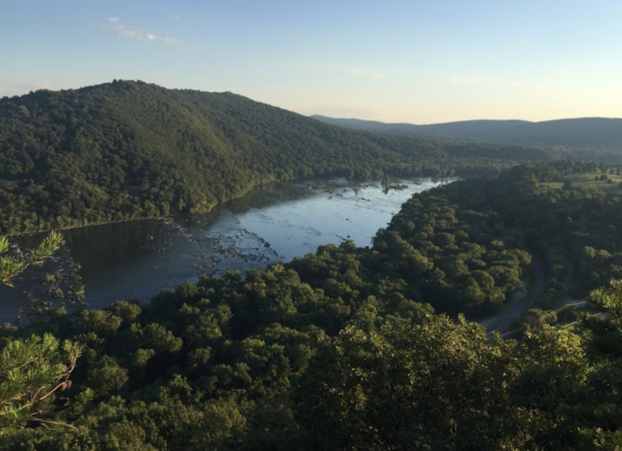
Finally we came to the spur trail to the cliff, which overlook the Potomac River just downstream of Harpers Ferry. We were both pretty exhausted, but we couldn’t pass up a good view. We gingerly made our way down the rock-strewn path to the cliffs, where we encountered a young couple setting up camp for the night. I was amazed they were the only ones at this popular spot on a Saturday night. The young woman snapped a picture of us on the cliff, backlit by the low angle of an early evening sun. We wished them a good night, and left them to their cozy solitude.
The trail down to the towpath was a series of steep switchbacks. My knees were really starting to rebel, and I was making old man grunts whenever I had to hop over a rock. The trail flattened out and we crossed beneath Interstate 340, the road into Harpers Ferry, and then over some train tracks and spilled out onto the canal path. We were out of the wilderness, but we still had three miles to go.
I popped another energy gel, and suggested we jog the last 3 miles. Jogging actually seemed less stressful to my knees, and Shane was game. We set a leisurely pace and headed east. The light was waning but it wasn’t dark yet. We were going to make it.
We crossed the Byron Memorial Footbridge over the Potomac River just as the sun was setting. The journey had taken a little over 13 hours. We posed for another selfie in front of a sign, and then walked up Potomac Street to find Shane’s wife Mary who had graciously offered to pick us up. We found her in her minivan, playing a game on her cellphone. “How was it?” she asked.
A simple question but surprisingly hard to answer. The day was fun, but also challenging – full of highs and lows. Too physically and emotionally drained to articulate the full experience, I said the first word that came to my mind.
“Bananas” I replied.


