The Mason-Dixon line—the dotted line running along the border of Maryland and Pennsylvania—remains a symbol of a time when the division between North and South was as deep and wide as the Grand Canyon. These days, there is more to the Mason-Dixon line than territory disputes and regional dissection: there is a long-distance hiking trail.
The Mason-Dixon Trail was conceived in the early 1980s by York County, Pennsylvania native Bob Yost and some friends. Their original aim was to connect eastern Pennsylvania’s Brandywine Trail with the banks of the Susquehanna River; thus it was called the Brandywine Susquehanna Trail. Through the work of area hiking club volunteers, the trail was eventually expanded and the Brandywine Susquehanna Trail deemed too much of a mouthful so it was renamed the Mason-Dixon Trail (MDT). Although the MDT does not share a direct path with the original Mason-Dixon line laid out in 1767, the two cross at several points and the MDT does not lack for historic markings along its way.
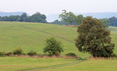
The trail runs a total of 193 miles from its eastern terminus at the Brandywine Trail at Chadds Ford to its western terminus at its intersection with the Appalachian Trail at a small town called Whisky Springs. Heading west out of Chadds Ford, the trail dives south through the Delaware arc and Elk Neck State Forest toward the mouth of the Susquehanna where it crosses at Havre de Grace, Maryland. The trail then traces the west bank of the Susquehanna for about 65 miles to Wrightsville, Pa. before heading west toward the A.T. The 30 miles of this section of trail between Wrightsville and the Norman Wood Bridge was designated a National Recreation Trail in 2010, and is one of the finest sections according to Rick Maerker, treasurer of the Mason-Dixon Trail System.
“Some parts of it would remind you of a national park if you didn’t know where you were,” he said.
Maerker should know. The retired teacher was one of the first to thru-hike the MDT in the early 1990s. He actually made a large loop by taking the MDT to its western end, heading north on the A.T. to link up with the Horseshoe Trail, which brought him back east to the Brandywine Trail. He averaged 40 miles a day in preparation for not one, but two A.T. thru-hikes – one in each direction.
“I can remember my very first hike I ever did,” he recalled. “I was substitute teaching and I had a day off, I think it was a Wednesday in October, and I said, ‘I’m going to check out that Mason Dixon Trail.’ So I went down to Chadds Ford and started following the sky blue blazes. It was a beautiful fall morning and I just thought, ‘Man, this is really cool.’”
Even given its fairly robust history, the trail continues to be a work in progress. Maerker estimates that 30 percent of the trail is along roads, albeit mostly backcountry roads that see little traffic. Given that the trail is not very remote, gathering supplies during a thru-hike is no problem, but camping can be a challenge. There are designated camping areas, but they are limited to the state parks or forests and can be some distance apart. Maerker says that many MDT hikers stealth camp along the way.
The MDT is just another piece of the long-distance trail puzzle linking different portions of the East Coast by footpath. Although it does not share much historical accuracy with its namesake, one can only hope the trail is around as long as the line has been.
Day Hikes
Day hiking on the Mason-Dixon Trail is easy due to the accessibility of the trail system. Here are a few favorites:
Pinchot State Park (8.5 miles)
Take the loop around the lake for great views of this park located near the western end of the trail.
Otter Creek Loop (5 miles)
This loop beginning at the Otter Creek Campground affords stunning views of the river from the Urey Overlook.
Eagles Nest (2.3 miles)
Short hike to nesting bald eagles (March – June) and Lock 12 of the Susquehanna Canal.


