Photo by: Sam Dean Photography
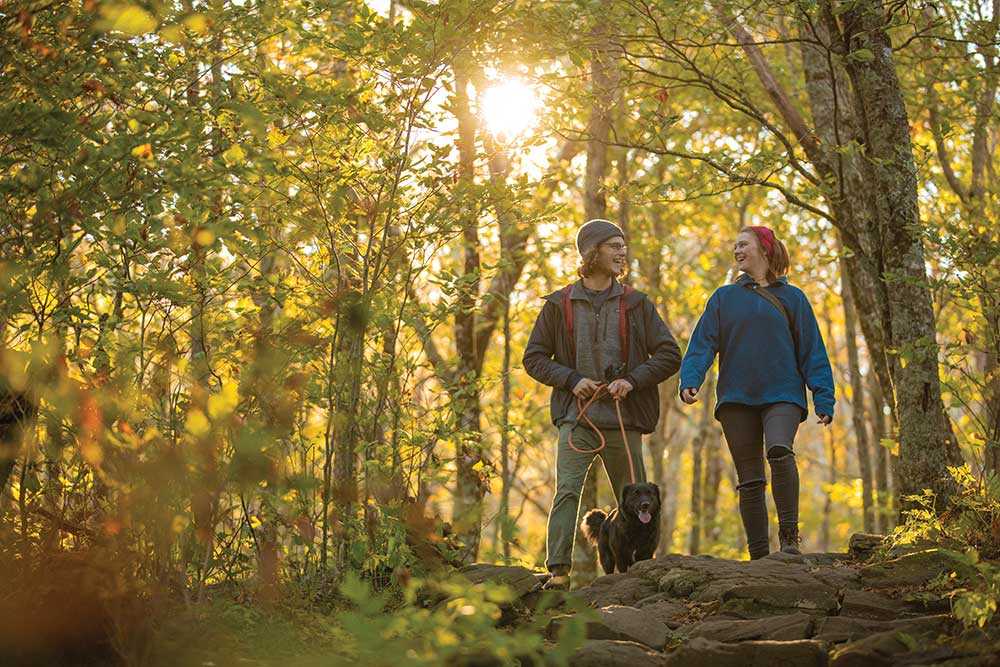
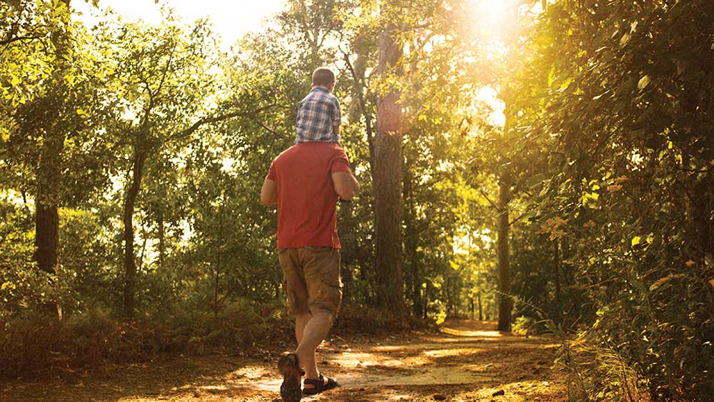
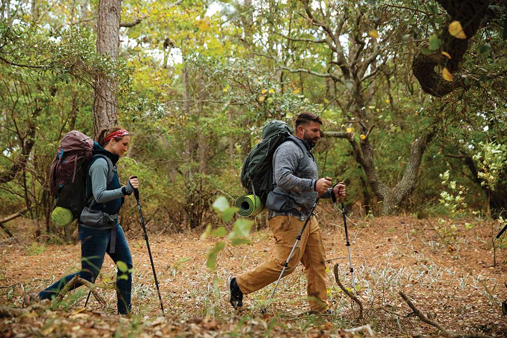
FROM CITY GREENWAYS TO REMOTE STRETCHES OF FOREST, GET OUTSIDE THIS FALL ON THE TRAILS OF THESE ICONIC SOUTHEAST HIKING DESTINATIONS.
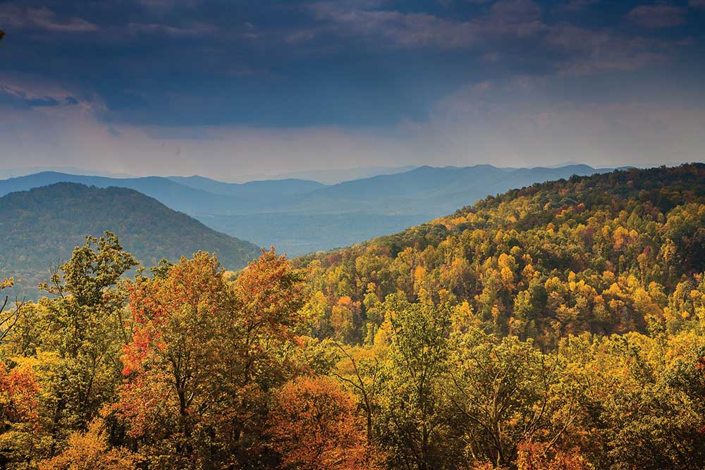
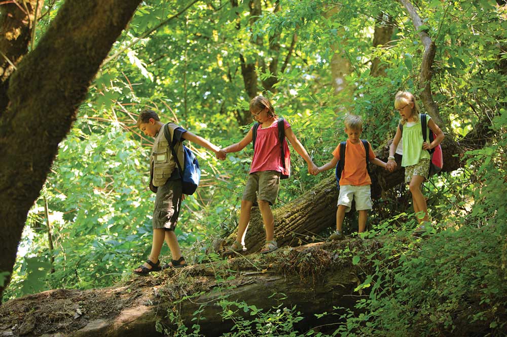
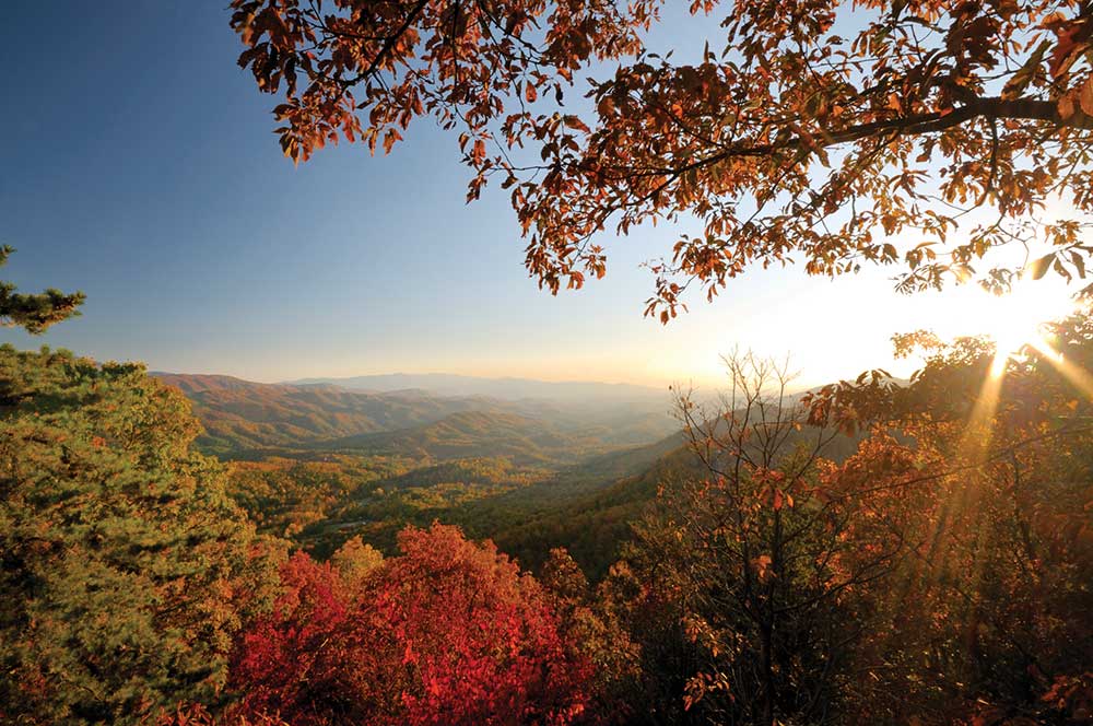
Hike miles of trails in one of Virginia’s state parks, including Shenandoah River State Park and Pocahontas State Park.
Virginia State Parks
Virginia is home to a variety of landscapes, from mountain peaks thousands of feet above sea level, to the Atlantic Ocean and the Chesapeake Bay, the largest tidal estuary in the world.
Virginia State Parks trails are as diverse as
the parks, but regardless of your experience level, you’ll find a challenging trail in a Virginia State Park.
Find an adventure on one of these trails:
Douthat State Park’s Mountain Side Trail is narrow and mountainous. The 1,269-feet elevation gain is fairly intense, and care must be taken along the steep edge. It’s not for children or the inexperienced. From the 1.2-mile trail, take the equally difficult 2.4-mile Mountain Top Trail. Serious hikers can strap on a pack and hike the 16 miles of trails on the park’s perimeter.
Hungry Mother State Park offers 12 miles of trails encircling the lake, and Clyburn Ridge Loop Trail is the most demanding. Beginning at 2,215 feet, the trail climbs to 2,584 feet at the lake overlook, drops, and climbs again to 2,566 feet at the Stone Lick intersection, offering commanding views of the lake. Add in the Stone Lick Trail and Clyburn Hollow Trail, and you can cover unique terrain, including crossing the creek several times.
Shenandoah River State Park offers 24 miles of trails, from one edge of the park to the other. The west side of the park takes you along Culler’s Trail, to Shale Barrens Trail, to the Bear Bottom Loop for a stimulating 8-mile hike.
A half-hour from the state capitol, Pocahontas State Park hosts 11 hiking trails over 5 miles. At 2.3-miles, Beaver Lake Trail is a moderate loop with slight elevation changes. For an additional challenge, head over to the 4 mile-long Co-op Trail. With views of Swift Creek Lake, you’ll see why this is quickly becoming the most popular trail in the park. Four-legged pals can come along but must be on a leash.
False Cape State Park is a remote barrier spit that allows visitors to observe maritime forests, swamps, marshes, and the bay. The West Dike, Barbour Hill, SandRidge Beach Loop is an 8.9-mile hike through remote sand along the Atlantic Ocean. This is not a hike for beginners. Make sure you carry plenty of water. Trails are closed November 1 – March 31.
Virginia DGIF Wildlife Watching Opportunites
Looking for some destinations to explore Virginia’s great outdoors? The Virginia Department of Game and Inland Fisheries offers two excellent resources to help you find the perfect spot to hike, paddle, or view wildlife.
The Virginia Bird and Wildlife Trail (VBWT) makes it easy to discover Virginia’s wild side. This online guide highlights the 600 best outdoor sites to see birds and wildlife in the Commonwealth. Walk a nature trail, paddle a river, or enjoy a scenic overlook to experience Virginia’s wealth of natural diversity, ranging from brown pelicans and bottlenose dolphins along our Atlantic Coast to bald eagles and black bears in the Blue Ridge Mountains. Find a site near you using the online guide.

DGIF also maintains 47 Wildlife Management Areas (WMAs) that offer bountiful natural resources and a variety of recreational opportunities, including hiking, paddling, and wildlife viewing. For a full list of WMAs and their locations, check DGIF’s website. To visit a WMA or DGIF-owned lake, all you need is a Restore the Wild membership, a Virginia hunting or freshwater fishing license, or a boat registration.
Explore the VBWT and Wildlife Management Areas and you’ll soon see why Virginia is a premier destination for hiking, birding, and wildlife viewing!
dgif.virginia.gov/
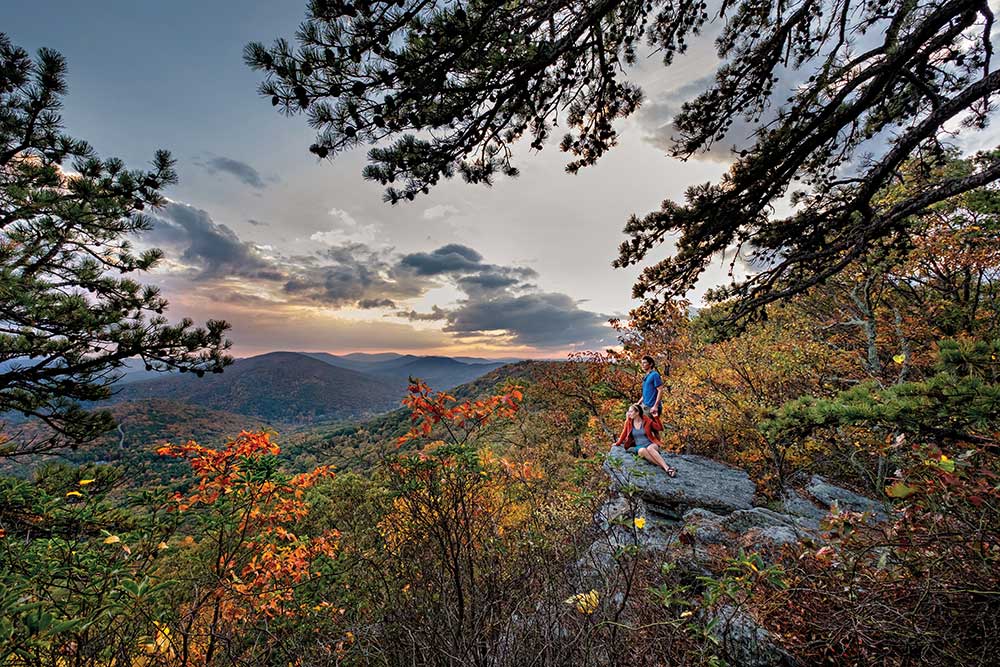
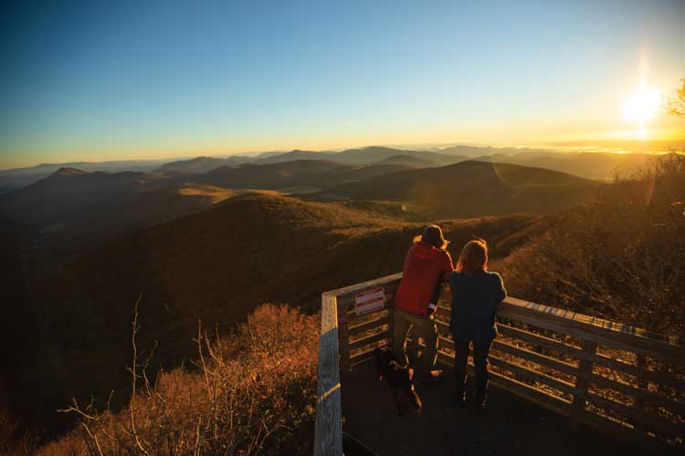
Roanoke, VA
Virginia’s Blue Ridge
The mountains of Virginia’s Blue Ridge make the perfect fall backdrop when you visit the Roanoke Valley for a few days of outdoor adventure and leisure.
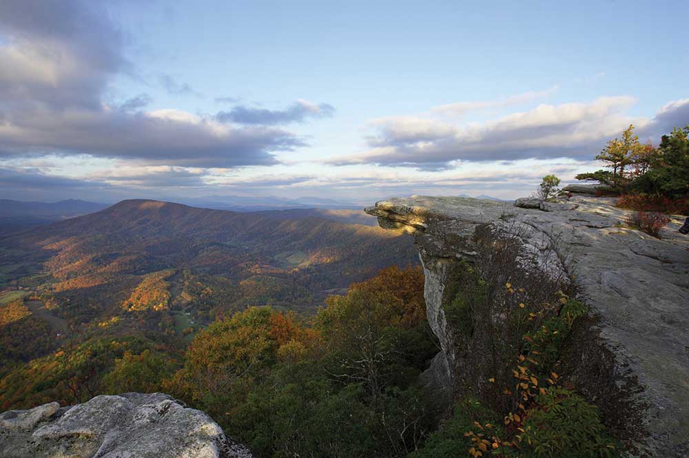
If you’re looking for a full weekend of hiking, try Virginia’s Triple Crown. Begin your weekend with a hike to Dragon’s Tooth as you walk along streams and test your bouldering skills. Make your way to McAfee Knob and the iconic overlook that makes it one of the most popular spots on the Appalachian Trail. Finish your trip off with Tinker Cliffs, featuring almost 2,000 feet of elevation gain. Complete the Triple Crown in sections or connect the three legs with a 32-mile backpacking trip on the Appalachian Trail.
These trails offer stunning views of the leaves turning colors and the valley below.
Head out of the city to Smith Mountain Lake State Park for miles of shoreline to explore. The 13 miles of trails will take you through hardwood forests to quiet coves and waterfront overlooks. Spend a relaxing day on the water, paddling and fishing for bass. Stick around for a beautiful sunset over the lake. Plan your visit for November in time for the Smith Mountain Lake Chili and Craft Festival at Bridgewater Marina.
Climb the Mill Mountain Star Trail to see the Roanoke Star and views of the valley. Dogs on leashes are welcome to join your trip. While at Mill Mountain Park, check out the mountain biking trails and wildflower garden.
Hikers of all abilities will find a trail to experience the Peaks of Otter. On a clear day, you can see for hundreds of miles from Sharp Top Mountain, Flat Top Mountain, and Harkening Hill. Flat Top Trail offers a strenuous hike to the top of the tallest of the three sister peaks. Stroll along Abbott Lake Trail, an ADA compliant loop around the water. Take the Fallingwater Cascades Trail, a 1.6-mile loop, for views of a waterfall. Stick around after the sun goes down for brilliant views of the night sky.
Want to take in the fall landscape without getting out of the car? Go for a scenic mountain drive along Route 311 as you drive over Catawba Mountain and Potts Mountain. Take the car off road on the Potts Mountain Jeep Trail for steep climbs and incredible views. While you’re in the area, don’t forget to make a stop on the Blue Ridge Parkway. Head north or south for views off of “America’s Favorite Drive.”
Stay Awhile

After a day exploring the mountains, fill up with the best local food Virginia’s Blue Ridge has to offer. Sit in front of a fire while you dine on a bison burger or brown beans and cornbread from The Swinging Bridge Restaurant. If you’re looking for comfort food, check out some of the best at The Homeplace. Stop by Ruth’s Place for breakfast served all day. And don’t forget to try the pies, freshly baked every day, from The Hub Restaurant.
Visit the Homestead Creamery for all of your favorite ice cream flavors, including a seasonal pumpkin flavor. Call ahead for a tour of the farm and manufacturing area. Don’t miss the hay rides, pumpkin patches, and corn mazes at Layman Family Farms, Sinkland Farms, and Jeter Farm.
Taste your way through the valley with Virginia’s Blue Ridge Cheers Trail. With nearly 30 different stops, you’re sure to find a craft beer, wine, or spirit that fits your style. Don’t forget to download the Cheers Trail Passport (text ‘CHEERS’ to (540) 253-4311) for awesome savings on drinks and merchandise.
Take in the sights, sounds, and flavors of the Roanoke Valley when you visit Virginia’s Blue Ridge.
visitvbr.com
Virginia Beach, VA
Whether you’re into invigorating hikes, adventurous trails, or breathtaking routes, the state parks, wildlife refuges, and miles of beaches offer an abundance of trails in this unique, coastal environment that are ready to be explored. From short thru-hikes to scenic loops, here are a few of Virginia Beach’s more popular hiking trails to help you get started.
At six miles, Cape Henry Trail is the longest trail in First Landing State Park, stretching from the park’s northern border to southern-most entrance off of Atlantic Avenue. Accessible to both hikers and bicyclists and running parallel to Shore Drive, the Cape Henry Trail passes through an old-style beach neighborhood where salt boxes sit comfortably next to contemporary renovations. The flat trail, shaded in places by pine and live oak trees, is perfect for avid bird watchers as you’ll see osprey and egrets, and maybe even an elusive eagle. The trail heads through the park, past the beaches of the secluded narrows, and connects at the northern tip of the Virginia Beach Boardwalk.
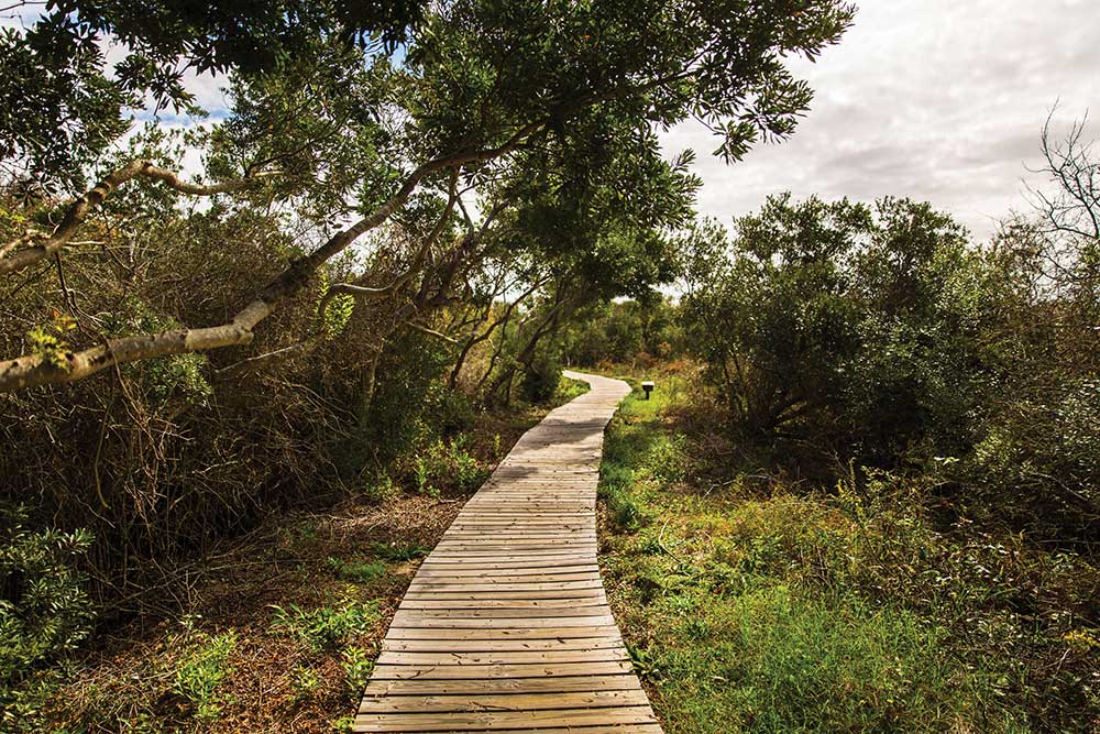
For a scenic hike through the enchanting cypress swamps, Bald Cypress Trail offers a 1.6-mile loop, including several boardwalks and platforms overlooking the low wetlands, making for several great photo-ops. This trail at First Landing features an abundance of wildflowers throughout and is ideal for all experience levels. Dogs are also able to use this trail while on a leash. The trailhead is located at the park’s trail center, accessed through the south entrance off of Shore Drive, which is the main hub for accessing the nine interpretive trails running through First Landing’s seven distinct ecosystems.
With 15 hiking and biking trails, varying in length and ranging from easy to difficult, there are many ways to explore one of the last remaining undeveloped areas on the East Coast in False Cape State Park. Sand Ridge Trail, the longest and most difficult trail at 6.2 miles, is better for families with more experienced hikers and bikers. The trail leads from near the entrance of the park all the way down to the North Carolina state border. For families who are up for a challenge, navigate the entire 15.3 miles of trails in the park, where you will experience beaches of both an ocean and a bay, dunes, maritime forests, marshes, and wooded swamps, all in one visit.
The 42-acre Lake Lawson/Lake Smith Natural Area includes 1.5 miles of hiking paths great from hikers and bikers alike. The trail loop can be hiked in a little over 30 minutes at a steady pace. With an abundance of trees surrounding the two lakes, this is a great spot to enjoy the changing seasons. The natural area also features several overlook platforms where you can spot largemouth bass, white catfish, and bluegills swimming in the water beneath you.
Totaling 1.5 miles in length, the Stumpy Lake Loop overlooks the beautiful Stumpy Lake and is perfect for hiking, walking, trail running, and nature trips. The Stumpy Lake Natural Area is located along the south-central City boundary with Chesapeake and features a 278-acre lake with a raised overlook and a 174-acre golf course. More than 970 acres of undeveloped, forested land surround the lake, including 1.65 miles of soft shared-use trails.
From a short stroll through the woods to a challenging hike, Virginia Beach is the perfect place to get outside on a fall getaway.
visitvirginiabeach.com
Heart of Appalachia
Virginia

A challenging hike for some may be an average hike for others. But the new Virginia Mountain Hiking and Biking Guide, published by the Heart of Appalachia, offers a hike or two for every demographic. From the beautiful section of the Appalachian Trail that offers breathtaking views of Burke’s Garden (God’s Thumbprint) in Tazewell, to the great Pine Mountain Trail that hugs the Virginia and Kentucky border in Wise, you will find an amazing weekend of hiking to do in Southwest Virginia, regardless of your skill level.
Follow Chief Benge’s Run from High Knob, through two other counties – landing you near the Devil’s Bathtub, another popular hike, in Scott County. If long hikes aren’t your thing, then perhaps you’d enjoy the Sugar Hill loops in the newly formed Clinch River State Park. One particularly popular trail is the Lonesome Pine Loop on the Bird and Wildlife Trail in Buchanan. From it, you can spot scores of species of beautiful feathered creatures and Virginia’s Elk Restoration project. Book an elk viewing tour through Southern Gap Outdoor Adventure or Breaks Interstate Park for a side adventure or explore 114 miles of trail at Coal Canyon. The Great Channels Natural Area Preserve in Russell is an awe-inspiring hike that has left many speechless as they ponder the meaning of creation.
These hikes, and many others, are featured in the Virginia Mountain Hiking and Biking Guide. Rent a bike at one of the many area outfitters, or bring your own, and do the 128-mile Heart of Appalachia Bike Route or part of the Route 76 Transamerica Bike Trail. The Guest River Gorge is another great bike route. Regardless if your game is hiking, biking, or both, this map has something for you!
Rick Barton, owner of Outdoor Adventure Centers, says, “If you categorize the toughest hikes in Virginia, the five out of the top ten most extreme hikes will be in this map of Southwest Virginia.” The beauty of these trails is the fact that many of them are “unexplored,” or not over saturated with hikers. “Having somewhere new to go is exciting to me. It is adventure in its rawest form,” says Barton. The Virginia Mountain Hiking and Biking Guide can be obtained, FREE, by calling 276-762-0011 or emailing [email protected].
heartofappalachia.com
Winchester-Frederick, VA
Winchester, Virginia is perfectly situated at the northern end of the Shenandoah Valley, nestled between the Blue Ridge and Allegheny Mountain ranges. Just an hour outside of the congestion of Northern Virginia, Winchester has developed its own culture and vibe dating back 275 years.
While the Appalachian Trail is easily accessible from Winchester, either at Snicker’s Gap, Sky Meadows State Park, or Front Royal, the real gem for true outdoor enthusiasts is the Tuscarora Trail.
Known locally as the “Old Blue” trail due to the blue hash marks, it’s an official contiguous bypass trail of the AT, stretching 252 miles from Pennsylvania to central Virginia. This trail is oftentimes rugged and unforgiving, but the lack of crowds and beautiful ridgeline hikes with stunning views of the Shenandoah Valley are worth the extra work.
Managed by the PATC, it still bears the clear markings, maintained pathways, campsite clearings, and shelters that the AT has.
One of the easiest access points is in Frederick County, about 25 minutes southwest of Old Town Winchester, at the Eagle Rock Trailhead. This is also one of the easiest access Tuscarora day hikes in the region.
If you’d like to test the waters with the trail, consider a stay at the Pembroke Springs Retreat, a Japanese-style bed and breakfast very near Eagle Rock. Relax after a day’s exploratory hike on the trails in their authentic, spring-fed Japanese baths and indulge in a Japanese fusion dinner on most weekends.
To really get away, consider a rustic lakefront cabin or campsite at The Cove Campground, also just steps from the Tuscarora.
If you are interested in the Appalachian Trail, there are some beautiful and easily accessible points near Winchester. One of the easiest day hikes with a beautiful pay-off vista is at Snicker’s Gap just off Rt. 7, about 25 minutes from Old Town Winchester. Ample parking and a smooth trail make for a busy trailhead on nice weekends.
Old Town Winchester acts as the hub of the region, with a vibrant walking mall, over 20 local restaurants, shops, 4 craft breweries, and 3 local coffee shops. Winchester Brew Works pays homage to the hiking in the area, with brews like “Big Schloss” and “2200 Mile NEIPA.”
Need supplies? Make sure to hit Mountain Trails Outfitters in Old Town Winchester, with a full line-up of premium camping and hiking gear, maps, and experienced hikers on staff.
visitwinchesterva.com
Townsend, TN

Get your fill of fresh mountain air, cascading waterfalls, and breathtaking views when you visit the Peaceful Side of the Smokies this fall.
Take the scenic route to Abrams Falls, considered the most voluminous waterfall series in the Great Smoky Mountains National Park. At five miles roundtrip, you’ll pass by exquisite geological formations, abundant wildlife, and hemlock forests.
Experience the fall foliage of the Smokies in all of its glory on Ace Gap Trail. At just over 10 miles out and back, you can take your time on this trail. Explore the park further on various paths that break off from the main route, leading to more scenic views and caves.
Take in 360 degrees of views from the observational lookout on Clingmans Dome. At 6,645 feet, you’ll stand on one of the highest peaks east of the Mississippi, overlooking the valley of the national park. The half mile paved trail to the tower is steep but worth it for the views. On a clear day, you’ll be able to see over 100 miles across the mountains.
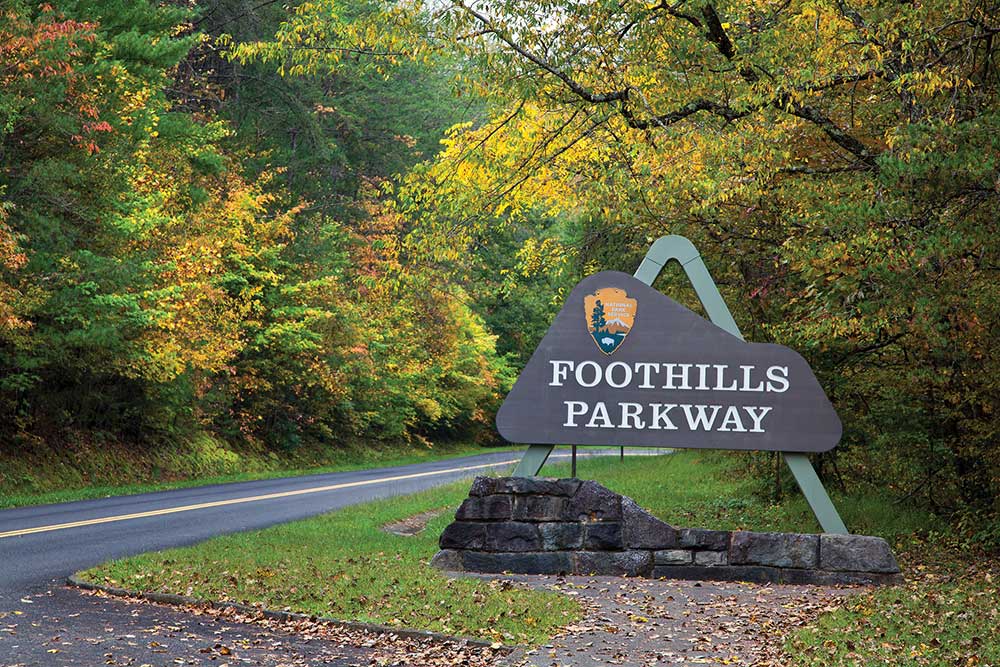
If you prefer to enjoy the fall colors from your car or bike, try the Foothills Parkway. Follow miles of road to overlooks like Look Rock, featuring a picnic area and campground. When completed, the 72-mile route will connect Chilhowee and Cosby, Tennessee through the mountains.
Explore the 17 local parks in Blount County on the greenway system. These family-friendly trails are perfect for walking, running, and biking through the area. There are more than 18 miles of trails to enjoy during a perfect fall day. Hop on the Townsend River Walk for a quiet stroll by the water and through the arboretum.
Head below ground into the Tuckaleechee Caverns and explore the depths of Earth’s oldest mountain chain. Experience cave formations reaching up to 12 feet tall. Estimated to be between 20 to 30 million years old, this is the highest-rated caves series in the Eastern United States.
While you’re in town, the Smoky Mountain Outdoor Center can provide you with all the gear and equipment you’ll need, featuring the top brands to fit any outdoor adventure. Rent a bike and spend the day exploring the roads and trails of Townsend and the Smoky Mountains. Whether you’re spending the weekend car camping or backpacking, stop by the Little River Trading Company for gear and local’s recommendations. Keep an eye out for their monthly hikes and gatherings to help inspire your next adventure.
Stay Awhile
Refuel after a day outside at Full-Service BBQ, home to some of the best barbecue in the area. Fill up on local made comfort food at this gas station turned food joint. Take in views of the Smoky Mountains just a few blocks from downtown Maryville.
If you’re looking for a taste of the mountains, head to Blackberry Farm Brewery for a cold beer or two. In addition to their freshly crafted brews, snack on cheeses, charcuterie, preserves, and a lineup of local food trucks.
At the end of a long day, recharge with a stay at RT Lodge. Tucked away in the serene woods of Maryville, it is the perfect location to unwind and relax. Each room features custom-crafted furniture and plush robes. Make sure to try the restaurant located on the property. The head chef has been nationally recognized for his approach to classic dishes. Many ingredients, including the bread, pickles, and pimento cheese, are made onsite.
Play all day and unwind at night during your getaway to the Peaceful Side of the Smokies.
Experience: One of the highest peaks east of the Mississippi at Clingmans Dome.
smokymountains.org
Boone, NC

Whether you’re looking for a challenging hike to the top of a mountain or a stroll through the woods to admire the changing leaves, head to Boone, North Carolina for a fall getaway.
Spend a few hours, or a few days, exploring the Linville Falls Recreation Area. Hike to overlooks with views of waterfalls, mountainous vistas, and the Linville Gorge. Trails on either side of the gorge will give you a full picture of the Linville River below.
Take a trip to Grandfather Mountain State Park, using ladders and cables to reach MacRae Peak. Hike the Profile Trail, three miles of a strenuous climb leading to the ridge of Grandfather Mountain. Backpack into one of the 13 backcountry campsites to experience more of the park. Check the calendar for free weekend programming, including a Fall Colors Hike on October 6th. All visitors are required to register for a free hiking permit at the state park office before heading into the park.
Located at the foot of Grandfather Mountain and just off the Blue Ridge Parkway, Julian Price Memorial Park has something for everyone. The Price Lake Loop Trail, a flat 2.7 miles, will take you around the fully stocked lake. Head out on Boone Fork Trail, a five-mile wooded trail featuring waterfalls and wildflowers. Long-distance hikers will enjoy 13 miles of challenging terrain on the Tanawha Trail. Extend your trip as the Tanawha is part of the longer Mountains-to-Sea Trail.
Visit Elk Knob State Park, one of North Carolina’s newest state parks. Take the strenuous Summit Trail to the top of Elk Knob, one of the highest peaks in the state. On a clear day, you’ll be able to see the mountains of North Carolina, Tennessee, and Virginia.
Bring the whole family to Valle Crucis Community Park to walk the paved trail and enjoy the playground. The park borders the Watauga River, making it a great spot to do some fishing in the morning. Walk, run, or bike the Boone Greenway Trail, a mostly paved path along the South Fork of the New River. The Moses Cone Estate features 25 miles of old carriage trails in addition to bass and trout lake fishing.
Check out the wide variety of outfitters and gear shops in the area for all of your outdoor recreation needs. Footsloggers stocks all of the clothing and equipment you’ll need for your outing. Regear offers great prices on consignment gear.
Experience: Elk Knob State Park, one of North Carolina’s newest state parks.

From the trails at Elk Knob State Park to Booneshine Brewing Co.’s new tasting room, there’s something for everyone in Boone.


