It is easy to assume that hiking trails – and the forests they travel through – are always going to be there. The ancient Appalachians have a feeling of permanence. The fact is, though, that hundreds of hiking trails are threatened by logging, mining, development, and road-building. The Appalachians are already scarred by a century of exploitation, and unfortunately that has not ceased. BRO highlights the South’s five most threatened trails, with the hope that you will use your legs and lungs – as well as your letters and e-mails – to help save them.


Fires Creek Rim Trail /
Chunky Gal Trail
Nantahala National Forest, N.C.
Length: Fires Creek Rim Trail: 26-mile loop; Chunky Gal: 21 mil
More about Chunky Gal Trail.
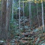
North Carolina’s Nantahala National Forest is criss-crossed with a number of high-quality hiking trails, but one of the best is the Fires Creek Rim Trail, a 25.5-mile loop trail that follows the ridgeline around Fires Creek, one of the most well-preserved watersheds in the Southeast.
“The backcountry recreation potential for this area is amazing,” says Mark Shelley, director of the Southern Appalachian Forest Coalition (SAFC).
On top of containing an untouched stream system, Fires Creek is a bear sanctuary, a designated Natural Area and a trout habitat.
“It’s got too many good things going for it at this point,” Shelley said. “It’s just a gem.”
But within Fires Creek is a 50-acre inholding that threatens this pristine habitat. The owners want to develop houses on the property, and they are petitioning the Forest Service to build a road to provide access to it.
An old logging road already exists that runs mere feet away from the creek. After a storm washed it out a few years ago, the road was repaired and upgraded, but a 1.5-mile section would have to be completed to access the inholding.
“It is our position that [the owners] knew this [parcel] was surrounded by Forest Service land when they bought it, and at our expense – at the public’s expense – they’re looking to gain access to it,” Shelley says.
Because of a law that requires the Forest Service to provide access to landowners surrounded by federally owned land, many believe the road will be completed. A ruling has yet to come, but in the meantime, the SAFC and other groups are trying to get the word out that this area is worth saving.
“Flying over it in the air, you can tell it’s an intact 21,000 acres of land that you just don’t see flying up and down the East Coast,” Shelley says.
As Fires Creek Trail makes its way up to scenic Tusquitee Bald, it intersects with the Chunky Gal Trail, a 21-mile-long footpath that later connects to the nearby Bartram Trail from the Fires Creek Rim Trail. The Chunky Gal faces its own threat, this time from a proposed outdoor shooting range that would be built near where the trail passes Boteler Peak.
The Clay County Shooting Range would be constructed in the Perry Creek area less than a half-mile from the trail, which would make the sound of gunfire a constant companion on the trail. The construction of a road leading to the range would also leave a mark on the previously roadless area. The Wilderness Society and SAFC have named it a Mountain Treasure area, and have come out publicly against the shooting range, but a decision has yet to be reached.
Directions for Fires Creek Rim Trail:
From Hayesville, N.C: From Main Street, take Tusquitee Street (SR 1300) about 4.4 miles to SR 1344. Turn right, then follow that road 0.7 mile until it turns into a gravel road (FR 340). Drive 0.1 mile to the Fires Creek Hunt Camp and 0.3 mile to the trailhead.
Blackwater Canyon Trail
MONONGAHELA NATIONAL FOREST, W.VA.
Length: 12 miles
West Virginia’s Monongahela National Forest has been known to attract outdoor enthusiasts of every stripe. The Blackwater Canyon is no exception, and one of the main draws is the Blackwater Canyon Trail, a 26-mile former railroad grade that cuts a straight line through the canyon.
The steep grade follows the path of the former Western Maryland Railroad along the north fork of the Blackwater River from Thomas to Hendricks. Hikers and bikers flock to it, and kayakers have been known to use it to access the good whitewater the Blackwater River provides.
The issue with the Blackwater Canyon Trail is that the uphill section of the trail is owned by the Forest Service and the downhill section is owned by Allegheny Wood Products. The two parties have diverging interests for the trail: the Forest Service wants to turn the grade into a true hiking trail, linking it to other rail trails in the area; and AWP wants to turn the trail into a logging road so it can access the stands on its property.
Neither side wants to concede, but a solution may lie somewhere in the middle. Dave Saville, public lands and forest advocate for the West Virginia Highlands Conservancy, believes a reciprocal agreement will be reached, in which the public and AWP will have dual access to the road. Still, conservation groups would rather have the trail in public hands.
“There’s a lot of anticipation and maybe even optimism that someone will step forward and buy some of the canyon, and that Allegheny Wood Products may be willing to sell it,” Saville said.
Directions: The trail runs between the cities of Thomas and Hendricks. Since the trail is not marked, the easiest way to find it is to park at the trailhead for the Allegheny Highlands Trail, which ends where the Blackwater Canyon Trail begins. The trailhead is located on 2nd Street in downtown Hendricks.
Root Run Trail
GEORGE WASHINGTON NATIONAL FOREST, VA.
Length: 1.5 miles
While the Root Run Trail may not be as long as some of its counterparts, it is no less threatened. The trail consists of a closed forest service road that winds through Beech Lick Knob, a 14,000-acre roadless area located within Virginia’s George Washington National Forest. While not designated a trail, the path is frequently used by hikers wishing to access the mountain treasure.
“It’s a large and remote area [that] is relatively undisturbed,” says Sarah Francisco, a staff attorney with the Southern Appalachian Forest Coalition. “It’s a beautiful place to hike…and provides a great opportunity for remote, backcountry recreation.”
But the proposed Marshall Run timber sale would see the road reopened and extended as a logging road. The Forest Service is proposing to cut 185 acres, including two stands that meet old growth forest criteria.
As part of the recent George Washington plan revision, the Beech Lick Knob area was identified as meeting roadless criteria, which would protect it from logging if the designation was conferred. Conservation groups are trying their best to get the timber sale stopped, as well as working to get the area declared wilderness.
The Southern Environmental Law Center, along with almost every major conservation group in Virginia, collectively sent a letter to the Forest Service asking that the sale be cancelled, but the Forest Service has yet to respond.
Directions: From Interstate 81, take Route 259 west through the town of Broadway. Turn left on Route 819 and left again on Forest Service Road 235. Park just before the gate and rockhop across Root Run to find the unmarked trail.
Cumberland Trail
CUMBERLAND STATE PARK, TENN.
Length: approximately 300 miles planned; roughly half of the trail is complete.
The Cumberland Trail has quickly made an impression in the hiking community, even though it is only half-complete. The trail will eventually bisect the state of Tennessee from north to south – stretching from Cumberland Gap south through 11 counties to just outside Chattanooga. But while Cumberland Trail is still a work-in-progress, a portion of it is already threatened.
While the portion of the trail located in Hamilton County is owned by the government as part of the state park, the mineral rights are owned by a private party, which has been conducting a commercial rock extraction operation practically on top of the trail. It has been removing sandstone, which unlike subsurface minerals, has to be dug out from the surface rather than mined.
“The extraction that has occurred is unsightly and damaging, and if it occurs more within the park – even if it doesn’t actually obliterate the trail itself – it is virtually inevitable that it will have a significant, adverse effect on the scenic natural surroundings of the trail,” Francisco said.
But the extraction has already caused damage. In 2007, a portion of the Cumberland Trail was buried by debris from the project, but was later restored. It was around this time that the state filed a lawsuit against the company to halt the rock extraction. The state lost the case in local court but won an appeal in state court in July of last year. Some conservation groups are moving forward with the lawsuit, and the Southern Environmental Law Center has filed a motion to intervene in the case, which will be heard in the early part of this year. While the extraction has not continued since last year, conservation groups are doing their best to make sure it can’t happen again.
“This is an issue that the people of Tennessee are very concerned about,” Francisco said.
Directions: Visit cumberlandtrail.org for directions to open trail segments.
Iron Mountain Trail
CHEROKEE NATIONAL FOREST, TENN. & VA.
Length: 19 miles
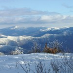
The Iron Mountain trail is a 19-mile ridgeline trail that follows the Iron Mountains from the Cherokee National Forest into Damascus, Va. Many comment that the trail feels like being on a less crowded version of the Appalachian Trail, which makes sense because the trail was once part of the A.T. before the trail was rerouted. Following the ridgeline gives hikers a beautiful view of Iron Mountain, as well as many other scenic peaks.
“It’s a premier trail in the area…It parallels the Appalachian Trail and there is great potential for a multi-day loop trail making use of the A.T. and the Iron Mountain Trail,” said Hugh Irwin, conservation planner and program director for SAFC.
It is this view that could eventually pose a problem if the Forest Service goes through with the proposed 700-acre Beaverdam Creek timber sale. Many of the stands put up for sale are situated less than a mile from the trail, meaning that the sounds of heavy equipment and the eyesores of a patchwork, clear-cut forest would be unavoidable from the trail. Many are also older stands of trees.
“We’re disappointed that so much timber production is primarily in areas with mature timber,” Irwin said.
With logging will also come new road construction and existing road upgrades; Irwin and others like him are doing their best to get the Forest Service to focus more on conservation in the area and less on selling timber. Conservation groups up in arms about the proposed sale have also been joined by local citizens.
“There’s a lot of local sentiment against heavy-duty logging in the area and opening up a bunch of new roads,” Irwin said.
A decision is expected to come from the Forest Service this year, which will be followed by an environmental assessment. But the fight to stop this sale is far from over.
Directions: from Exit 19 off Interstate 81, take Route 58 east for 12 miles. Once within the town of Damascus, look for Damascus Town Park. Trailhead parking is here.


