Explore the top ten flatwater paddling paradises.
Whitewater paddling is like nature’s own Mountain Dew commercial, with torrential rapids, dramatic drops, and water crashing over rocks. But paddling into a tranquil flatwater paradise can be just as powerful as a whitewater run.
“Whitewater paddling is like driving a race car,” says Terry Kepple, a former Olympic paddler who now guides on the calm New River in North Carolina. “But flatwater, that’s like taking a scenic cruise through backroads. You get to enjoy the scenery a bit more.”
Whether you’re looking for a calm paddle through a swamp or an overnight excursion on a mountain river, you’re next epic paddling adventure begins here.
GREAT DISMAL SWAMP NATIONAL WILDLIFE REFUGE • VIRGINIA
The refuge covers 112,000 acres of forest and wetlands that have played a complex role in American history. Slaves hid in the swamp while moving north on the Underground Railroad. Robert Frost visited the swamp to try to kill himself. George Washington bought most of the swamp as part of a get rich land scheme, building canals and removing valuable timber. Colonel William Byrd, an early explorer of the area, inadvertently named the swamp by describing it as a “vast bog of dirt and nastiness; a dismal place to be.”
We respectfully disagree. Those canals that Washington built now serve as paddling and hiking avenues to the crown jewel of the refuge, 3,100-acre Lake Drummond, one of Virginia’s only natural lakes. The most distinguishing characteristic of the lake is its water, which is black from the peat deposits that dominate the floor. At its deepest, Drummond is only six feet, so you’ll find bald cypress trees punching through the black waters even when paddling in the middle of the lake.
day one
Put in at the Great Dismal Boat Ramp on U.S. 17 and paddle the 50-foot-wide Dismal Canal south to the Feeder Ditch, which runs for 3.5 miles to the edge of Lake Drummond. Hook up your boat to the innovative marine railway, which will portage your craft from the canal to the lake.
camp here
The Lake Drummond Reservation is a canoe-only campground and the only place to camp inside the refuge. Expect open, grassy camping with restrooms and running water.
day two
Paddle the black waters of Lake Drummond, photographing the patches of bald cypress that thrive in the wet environment, and taking dips in the dark waters. The high acid content actually slows the growth of bacteria, and people say you can drink the water straight from the lake. We say, why not purify it too? It’s also worth it to park the boat on the western shore of Drummond and explore some of the hiking trails that meander through the forest.
paddle with friends
Paddle for the Border is an annual boat trip from Great Dismal Swamp State Park in North Carolina into the wildlife refuge in Virginia. Nearly 300 paddling boaters make the 7.5-mile pilgrimage up the Dismal Canal every year.
SOUTH FORK OF THE NEW RIVER • NORTH CAROLINA
Over 26 miles of the South Fork and main stem of the New River are designated as Wild and Scenic, and deservedly so. From the Confluence of Dog Creek to the Virginia state line, the New twists its way through the foothills of the Southern Appalachians in a series of languid elbow turns. Forested hills and manicured pastures roll away in either direction as the New makes its way north. The wild, un-dammed river is comprised primarily of long flatwater sections interspersed with bumpy ripples. The state operates a series of launches and campsites scattered throughout the 26.5-mile federally designated stretch, which gives paddlers an opportunity to customize the length of their trip.
The 20-mile stretch of the South Fork between Wagner and Kings Creek Road is one of the most tranquil overnight paddling excursions in the region.
day one
Launch your canoe at the Wagner Road Access site and paddle north for 11 miles. This section of the South Fork forms the upper reaches of the New River Paddle Trail, and is less-frequented by day-trippers due to lack of access. The upper South Fork also has more bends in it than a contortionist.
camp here
Beach your canoe at the US 221 access, part of the linear state park patchwork, with canoe-in camping along the river and some easy hiking trails through the surrounding hills. You’ll also have access to hot showers and running water.
day two
Expect much of the same in terms of scenery and water quality for your second day. This nine-mile stretch continues to curve through a mix of state-owned and well-tended for private land. Swimming holes are more plentiful as you paddle toward the main stem of the New. You’ll take out just before the main stem begins at the Kings Creek Road Access.
paddle with friends
Every June, canoeists go head to head paddling in the New River Canoe Race, a five-mile sprint down flatwater and easy class I rapids.
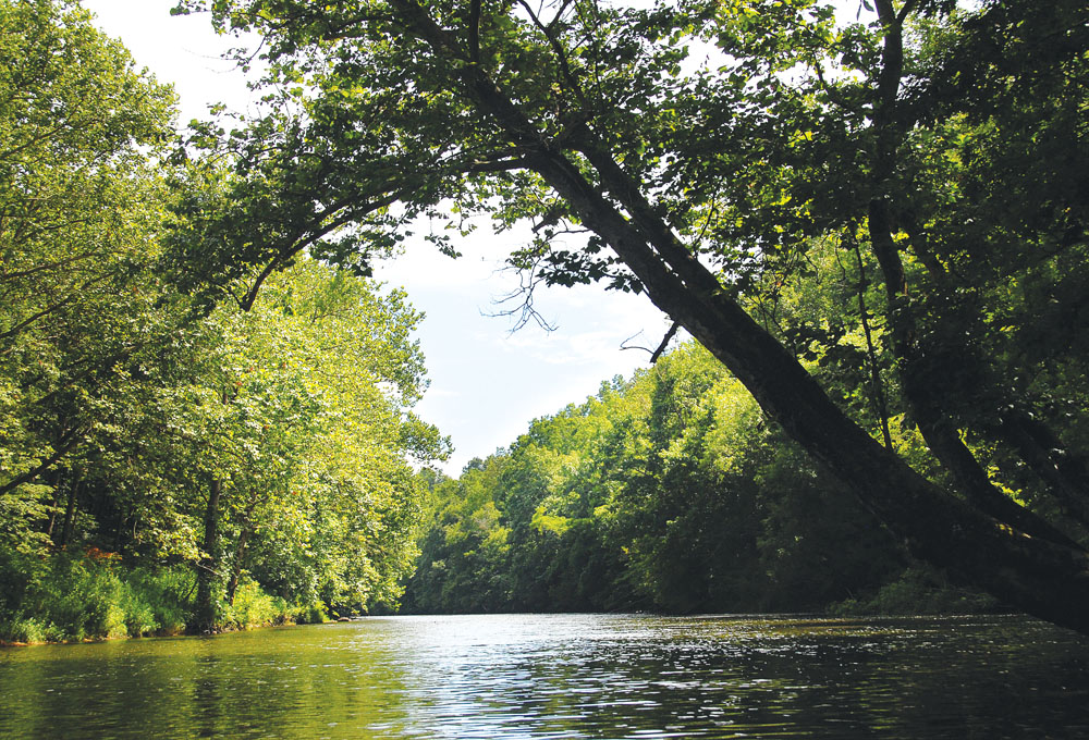
SOUTH FORK SHENANDOAH • VIRGINIA
The north-flowing Shenandoah River quite literally defines much of the Virginia landscape and has sparked devotion from farmers, songwriters, and paddlers alike. Nearly 100 miles of the Shenandoah can be paddled (with the occasional low-head dam portage), but we recommend a 28-mile stretch on the South Fork Shenandoah between Luray and Bentonville that exemplifies the river’s scenic beauty. You’ll paddle relatively calm water with the occasional ledge rapid through a combination of farmland, privately owned forest, and public land. The river runs through the heart of the valley with the Massanutten Mountain range rising to your left and the peaks of the Shenandoah National Park rising to your right.
day one
Launch at the Bixler’s Ferry Bridge, paddling 13 miles through small farms and privately owned forests. This section of the South Fork is less traveled, as most boaters and tubers focus their energy on the wilder water downstream. You’ll encounter some small ledges, but no real whitewater. The river is broad and shallow with a bedrock and boulder floor.
camp here
Public land begins to kick in on the left side of the river around mile marker 13. Look for a sandy beach between mile 13 and 14 at the class II High Cliffs rapid. This is a decommissioned forest service campground. The rangers no longer maintain the facilities, but it’s still legal to camp. Pick a choice spot close to the river and spend the rest of your day swimming below High Cliffs, which has a sandy beach on river left, and rocky cliffs on river right.
day two
The river gets progressively wilder as you paddle, but the biggest rapid you’ll encounter on the entire trip is Compton at mile 17.5, a class II-III wave train where the river narrows as it passes a stretch of sheer cliffs on the right. The water eddies out below the rapid, forming an ideal swimming hole and giving boaters an opportunity for repeat laps on the wave train.
camp here
Even on weekends, you can find a lonely spot on the islands below Compton, since most boaters choose to camp on the sandy beach directly adjacent to the rapid.
day three
The ten remaining miles of river provide ample solitude as when paddling through national forest land and undeveloped private land with conservation easements. “This is my favorite stretch of river,” says John Gibson, owner of Downriver, a canoe outfitter operating on the South Fork. Take out at the Low Water Bridge in Bentonville.
GREENBRIER RIVER • WEST VIRGINIA
The Greenbrier is one of the longest free-flowing rivers in the East. At high water levels, you can paddle 158 miles of the river for a dam-free, portage-free, week-long epic. Perhaps even more impressive is the user-friendly gradient of the river, which is characterized by easy-going class I and II rapids interspersed with calmer stretches. To find a river this long and friendly in mountainous West Virginia is unique, and the Monongahela National Forest scenery is as magnificent as the paddling.
“I get cussed by other locals occasionally because the river is such an attraction now,” says Virgil Henshaw, owner of the Greenbrier River Campground and the oldest canoe shop on the river. “People used to stop by and point at my kayak and ask, ‘What is that?’ They know what a kayak is now.”
The 79-mile Greenbrier River Rail Trail runs adjacent to the river, attracting bikers and hikers looking for a beautiful but mellow adventure. Overnight canoeists can take advantage of the infrastructure built for the rail trail by accessing the drinking water, campsites, and restrooms scattered along the trail.
The 32-mile stretch of the Greenbrier River between Beard and Anthony travels through some of the wildest country in the Southeast and offers ideal riverside camping.
day one
Launch at the Beard access point off County Road 31 across river from Calvin Price State Forest, paddling along the border of the state park before entering the Monongahela National Forest. The Greenbrier actually forms the border of the national forest in this region. On river right, you‘ll pass small towns, while the wild Monongahela dominates the banks of the river to your left. This 10-mile stretch is considered the last portion of the Upper Greenbrier, and water levels in mid summer can be low. If rainfall is scarce, expect to drag your canoe across shallow sections.
camp here
At mile post 28.5, you’ll find a primitive campsite with a tent pad, fire ring, and picnic table along the bank of the river. The site was developed for hikers and bikers pushing through the Greenbrier River Rail Trail, but canoeists are welcome to camp as well.
day two
At 15 miles, you’ve got some water to cover, but the river picks up between Rennick and Anthony. Large boulders are scattered throughout the river, and rugged scenery abounds. The highlight is the massive Coleman Cliffs, a 500-foot-high sheer rock wall on river left. Take out at the access on County Road 21 in Anthony.
SANTEETLAH LAKE • NORTH CAROLINA
The 3,000-acre Santeetlah Lake is almost entirely surrounded by public land, with the Nantahala National Forest comprising 80 percent of the lake’s shoreline. Other than a small stretch of second homes around the Town of Lake Santeetlah, the lake is surrounded by primitive forest. The lake was created in 1928 when a dam was built across the Cheoah River, flooding the valleys between the 3,000 and 4,000-foot mountains in this remote corner of Western North Carolina. The end result of that flooding is a web-like body of water with mountains rising almost directly from its waters. Santeetlah only has two wide expanses of water near the marina and Cheoah Point; the rest of the lake is comprised of sinewy fingers that branch off into mountain hollers fed by cold trout streams.
The lake is small enough to discourage fast-moving power boats. Instead, you’ll see a handful of large pontoon crafts moving slowly through the waters. And if you paddle deep into one of the remote coves on the edges of Santeetlah, you probably won’t see anyone at all.
day one
Cheoah Point makes the perfect launch point for an overnight exploratory trip of Santeetlah. As you make your way into the widest lake opening, you’ll see Funnel Top, a 3,000-foot mountain rising from the banks of the lake to the southwest. You’re headed to an island owned by the Forest Service directly south of the Town of Lake Santeetlah. It’s a three- to four-mile paddle from Cheaoh Point to the island.
camp here
The Forest Service island has flat, primitive camping for one or two tents. Set up camp and get back in your boat for some afternoon excursions. Directly south of the island is Bald Eagle Point, a long-time nesting ground of our national bird.
day two
Paddle the three miles north back toward Cheoah Point, but then head west for three more miles along Avey Branch, which will lead you to the mouth of Santeetlah Creek. Paddle upstream as far as you can, then park the boat and hike to a series of small cascades and cold swimming holes. If you arranged for a shuttle, there’s an access beach on Avey Branch near the mouth of Santeetlah. Otherwise, leave enough time for the three-mile paddle back to Cheoah Point.

LAKE JOCASSEE • SOUTH CAROLINA
This 7,500-acre manmade lake sits at the base of the Blue Ridge Escarpment. The foothills of South Carolina and mountains of North Carolina form the backdrop of the lake, which is surrounded almost entirely by public land. Other than a few scattered second home sites, the forests surrounding Jocassee are completely undeveloped. In fact, one of the South’s most diverse long trails—the Foothills Trail—runs along the northern edge of the lake. A few primitive backcountry campsites can be found where the Foothills Trail meets the lake (register in advance), enabling kayakers to put together overnight or extended multi-day trips.
What truly sets Jocassee apart from other mountain lakes, are the waterfalls. The lake is fed by ice-cold streams that drop dramatically from the surrounding foothills into remote corners of the lake. Half a dozen sizeable waterfalls can be found along Jocasee’s banks, some of which are nestled inside lush, remote coves.
What follows is a three-day itinerary designed to get you into the most remote corners of Jocassee. You’ll jump from cliffs, paddle to waterfalls, and camp on the banks of the lake without another boat in sight.
day one
Launch at the boat ramp at Devil’s Fork State Park on the southern end of the lake and paddle north for two miles to the state park’s backcountry campsites. These sites are first come-first serve boat-in only, and sit at the base of Musterground Mountain. Set up camp, then strike out for Lower Whitewater Falls, a two-mile paddle up the mouth of the Whitewater River. If you have enough time and energy, the waterfall on Wright’s Creek is just a short paddle up the mouth of the Thompson River right next door to the Whitewater.
camp here
Devil’s Fork State Park offers boat-in backcountry sites on the northern banks of Jocassee, directly across the lake from the boat launch.
day two
Break camp and paddle north through the Toxaway River branch of the lake to Jump Off Rock (roughly four miles from your campsite). Jump Off Rock is exactly what it sounds like: a 20-foot cliff rising from the green waters on the eastern edge of Jocassee. Jump, repeat, then head further north into the mouth of the Horsepasture River, until Mills Creek branches to the left. Follow the mouth of Mills Creek to a 30-foot waterfall set inside a lush, green cove. You can jump from it, or simply sit in your boat and admire its tropical beauty. Backtrack to the Horsepasture, then continue to paddle upriver until the Horsepasture meets the Foothills Trail.
camp here
Arrange for a backcountry camping permit at least two weeks in advance, and set up camp along this gem of a long trail, not far from where the trail crosses the river.
day three
Paddle south along the Horesepasture until it meets Jocassee. You’ve got nine miles to paddle from your campsite back to the Devil’s Fork State Park boat launch. Plan for a five-hour trip (longer if there’s a headwind). If you have time, check out Laurel Creek Falls, another impressive waterfall sandwiched between stone cliffs on the eastern bank of Jocassee. One way shuttles can also be arranged through Jocassee Outdoor Center if you don’t want to paddle back. •

FOUR MORE
Toccoa River Canoe Trail, Ga.
This 14-mile canoe trail flows through the Blue Ridge Ranger District of the Chattahoochee National Forest. Rapids are mild and the scenery is top notch. Float the whole stretch from Deep Hole Recreation Area to Sandy Bottom Recreation Area in a day, or set up camp between Margret and Butt Bridge on Forest Service land for a slower-paced two-day trip.
Tugalo Lake, S.C.
Located on the Georgia-South Carolina border, Tugalo is the takeout for paddlers running the wild Chattooga River. But it’s a flatwater destination on its own. Boat traffic is limited to small-motor john boats and man-powered craft. You’re likely to see more whitewater boaters crossing the lake after a Chattooga run than anything else. Head to the north end of the lake for steep, forested slopes and narrower water inlets. Roughtly 1.5 miles north of the Tugalo Boat Ramp, there’s a large sandbar perfect for camping. A mile farther north and you hit the mouth of the Chattooga River. Paddle south of the boat ramp and you’ll find yourself in the Tallulah Gorge, where the lake narrows and stone cliffs rise from the water’s edge.
Lake Moomaw, Va.
This 2,500-acre lake has 44 miles of primitive shoreline managed by the forest service. Mountains rise from the edge of the lake in all directions. You’ll be in the company of fishermen who flock to the waters for the stocked trout. It’s also a popular campground, with lakeside sites and a sandy beach. But serenity can be found in the remote coves of this 10-mile-long mountain lake. Put in at Coles Point near the center of the lake, and check out the nearby exposed rock cliffs left from an old quarry project.
Tennessee River Blueway, Tenn.
You can paddle the entire 45-mile stretch of the Tennessee River Blueway through the Tennessee River Gorge in three to four days. You’ll run from the Chickamauga Dam to the Nickajack Dam, passing through downtown Chattanooga along the way. The green, forested walls of the Tennessee River gorge will surround you, and multiple options for primitive camping exist on islands and riverbanks throughout the journey. You can even camp adjacent to downtown Chattanooga on Maclellan Island. This is deep-river paddling so you’ll probably share some time with barges, but that just adds character to the trip.


