You don’t have to be a thru-hiker to access these ten breathtaking views. We took Isabelle’s list and put together directions to guide day hikers to the ten best viewpoints along the Appalachian Trail.
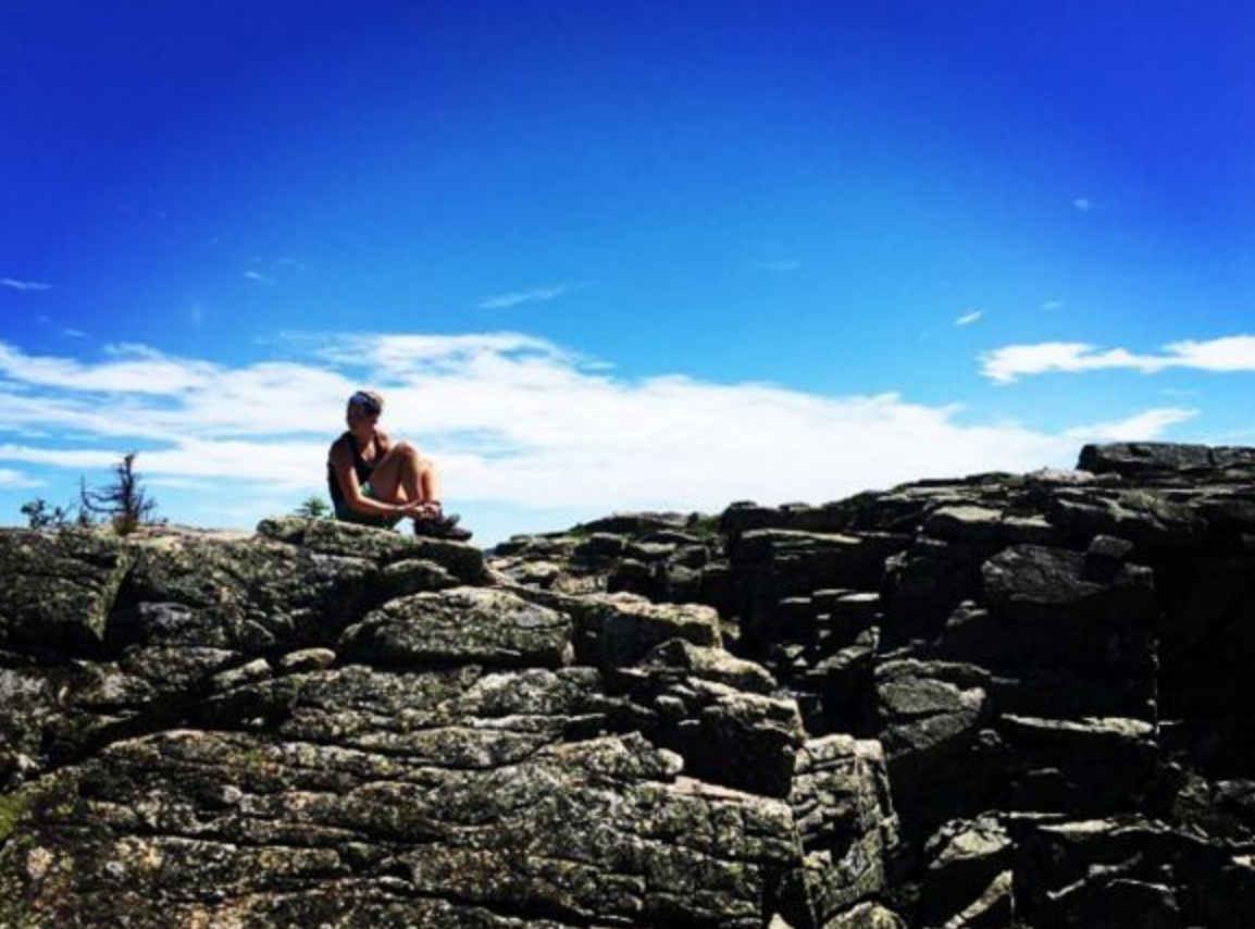
1. The Pinnacle , Pennsylvania
A mixture of thru-hikers, school groups and intrigued day hikers beat along the moderate trail to soak in the beauty offered by The Pinnacle Summit. Located along the Blue Mountain Ridgeline, this rocky viewpoint enables its visitors to gaze out over the picturesque, rolling farmlands of Pennsylvania.
Getting There
From the trailhead parking lot, located on Hawk Mountain Road, begin hiking through the yellow gates along the gravel road. Turn right on the white blazed Appalachian Trail. Follow the Appalachian Trail along a rock filled trail to Pulpit Rock. Keep straight on the Appalachian Trail until you pass the turnoff to Blue Rock Campground. Just ahead, take a right turn for The Pinnacle overlook by way of Blue Trail.
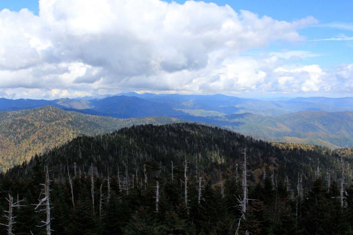
2. Clingmans Dome, Tennessee
Standing at 6,643 feet of elevation, Clingmans Dome offers a 360 degree viewpoint high above the tree line of the Great Smokey Mountains. The Appalachian Trail crosses here making Clingmans Dome the highest AT viewpoint from Georgia to Maine. From this man-made observation tower, hikers can peer out over a sea of mountains. On a clear day, all seven surrounding states; Tennessee, Kentucky, Virginia, North Carolina, South Carolina, Alabama and Georgia; are visible from the tower.
Getting There
Driving, take Newfound Gap Road to Clingmans Dome Road. Clingmans Dome Road leads up to a parking lot and visitor center. From here, the walking path up to the Clingmans Dome observation tower is paved but steep. The half-mile path is straightforward and easy to follow.
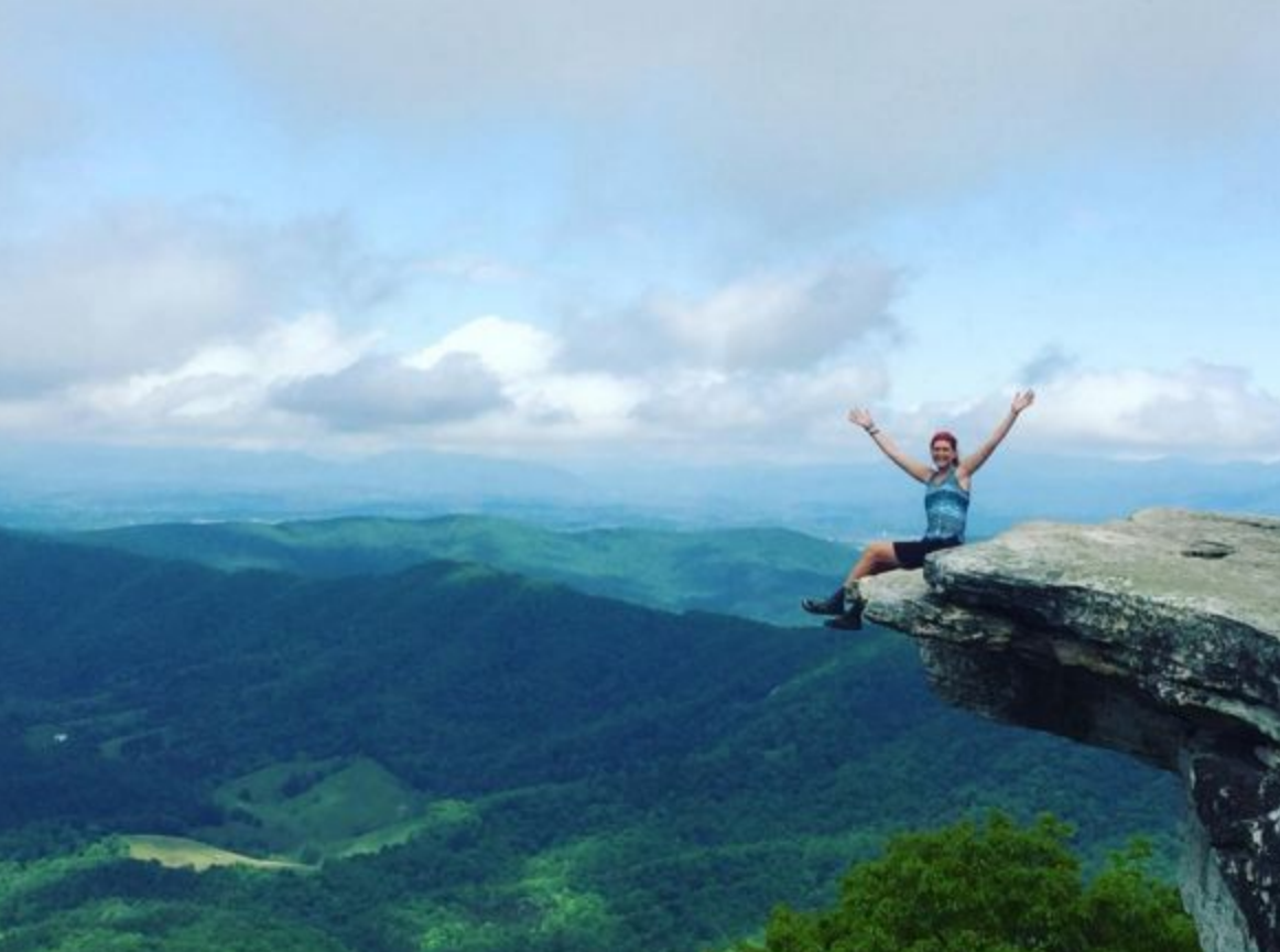
3. McAfee Knob , Virginia
Tucked in the Jefferson National Forest of Virginia, McAfee Knob has earned quite a reputation for its beautiful viewpoint. A hike of around 4.5 miles will take you 1,740 feet in elevation, which will be well worth the reward as you sit out on the ledge of McAfee Knob practically floating above the Shenandoah Valley.
Getting There
From the VA311 parking area, cross the street and pick up the white blazed Appalachian Trail. Remain along the Appalachian Trail until McAfee Knob Spur Trail. Turn left and the overlook will be just a few steps away.
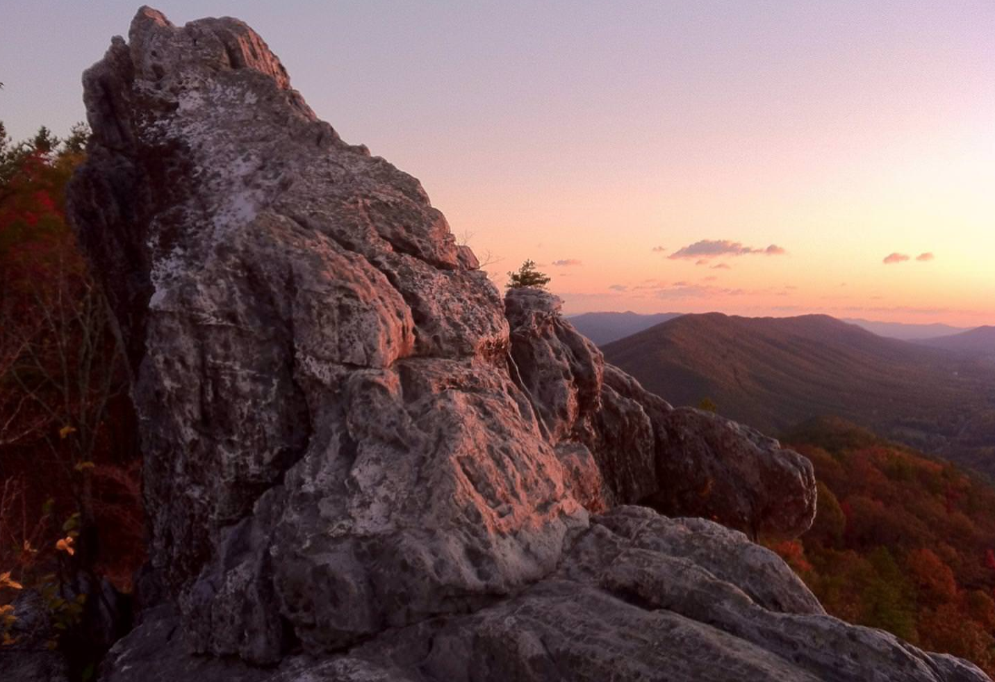
4. Tinker Cliffs, Virginia
Hanging 3,000 feet over the Catawba Valley, Tinker Cliffs is a great place to stop for lunch and soak in the gorgeous view. Though the hike is relatively strenuous, making it to Tinker Cliffs will give you a bird’s eyes view of surrounding mountains including McAfee Knob to the South.
Getting There
On Virginia Route 779, halfway between Catawba and Daleville, you will find the trailhead for Tinker Cliffs day hikers. Head out on the Andy Layne trail, yellow blazed, until it intersects with the white blazed Appalachian Trail (about three miles). Turn right onto the Appalachian Trail and Tinker Cliffs will be within a mile.
5. Dragon’s Tooth , Virginia
Dragon’s Tooth, another breathtaking viewpoints along the Virginia portion of the Appalachian Trail, stands out atop Cove Mountain. Join other hikers on the climb to this popular destination as you crisscross creeks and make an elevation gain of 1,505 ft.
Getting There
The Dragon’s Tooth parking lot is located along VA311. Start off on the blue blazed Dragon’s Tooth trail. About two miles in, the trail will intersect the Appalachian Trail. Turn right onto the Appalachian Trail for a strenuous 0.7 mile hike to pick up the Dragon’s Tooth Spur trail. A leisurely hike of less than a mile on this path will place you at the foot of Dragon’s Tooth.
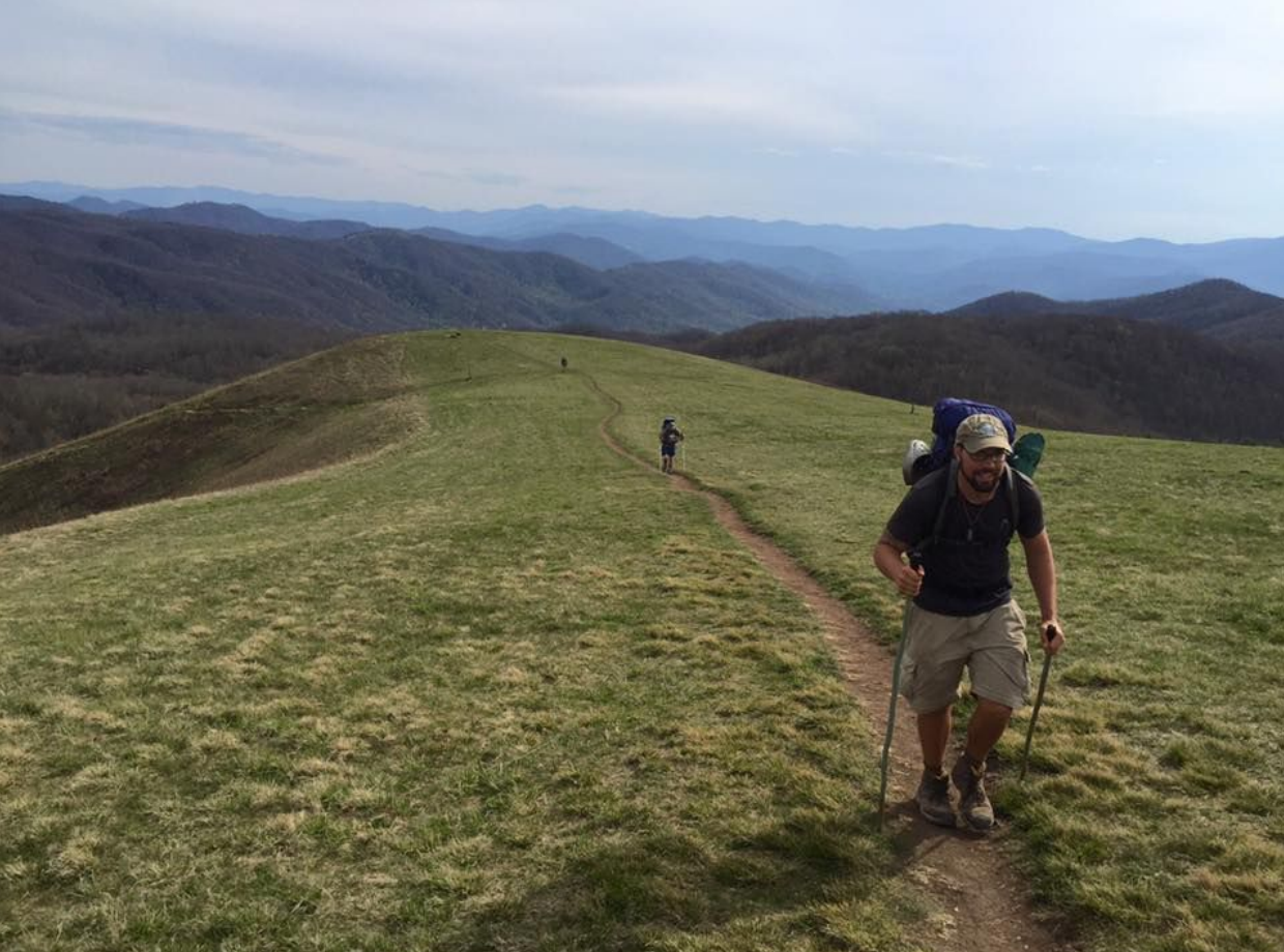
6. Max Patch, North Carolina
The perfect place for an Appalachian Trail day hike, Max Patch is a moderate hike with an open grassy field at the summit. If heading there in the winter, make sure to bundle up and be prepared to soak in the deep blues of the Great Smokies to the west and the Black Mountains to the southeast.
Getting There
Take State Road 1181 until you arrive at the intersection for Max Patch Road (State Road 1182). Turn right onto Max Patch Road and travel about a mile and a half to the Max Patch parking lot. From the parking lot, you can then choose from two direct hiking routes, differing in length, to reach the Max Patch viewpoint.
7. Grayson Highlands/ Mount Rogers, Virginia
Where else, but at Mount Rogers, might you catch a mountain view as a herd of wild ponies roam along the trail? From the Grayson Highlands approach to Mount Rogers, wild ponies are often sighted as visitors hike their way up to the state’s highest peak.
Getting There
The parking for Mount Rogers is located halfway between the cities of Independence and Damascus on U.S. 58. Day hikers have several trail options for reaching the summit. From the access point in Grayson Highlands, follow Massie Gap.
8. Mount Moosilauke, New Hampshire
The bare summit of Mount Moosilauke, located at an elevation of 4,802 feet, sits in western New Hampshire. Here, hikers are rewarded with a 360-degree view of the surrounding mountains of New England.
Getting There
For a moderate, but long hike, take Gorge Brook Trail to the Mount Moosilauke summit. Starting from Ravine Lodge, this trail is relatively easy though the route will put 7.4 miles under your feet. Other options for reaching the summit include more strenuous hikes with greater gains in elevation: Beaver Brook Trail, Glencliff Trail, Moosilauke Carriage Road and Benton Trail.
9. Mount Killington, Vermont
Mount Killington is a popular peak. Not only does the Appalachian Trail run along its summit, it is also the location of a bunkhouse for thru-hikers as well as a ski resort. Despite all the hustle and bustle that occurs on this mountain, Killington is still best known for its breathtaking viewpoint.
Getting There
Park in the Brewer’s Corner Parking lot, located on Wheelerville Road, and begin hiking by way of Bucklin Trail. After about 3.3 miles, you will reach the Appalachian Trail. Turn right onto the Appalachian Trail and the Killington Summit will be about a half mile ahead.
10. Baldpate, Maine
Baldpate offers two incredible summits. Connecting both the west peak and the east peak are a network of boardwalk-like structures and a wooden ladder. Stroll along the ridgeline and climb the ladder to take in the marvelous viewpoints of Bladpate. From the top, hikers can gaze out at the lush forests and rolling mountains of Maine.
Getting There
Hikers can choose from a variety of trails in order to reach the summit. The most direct route is by way of Micah Trail – an easy .6 mile hike. Parking for Micah Trail is located on Moose Cove Lodge Road. Follow signs for parking and Micah trailhead along the side of the road.


