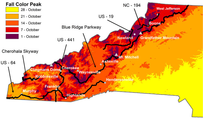
Are you planning a trip to the mountains of Western North Carolina to view fall foliage this autumn? If so, this map, put out by the department of biology at Appalachian State University, could be an incredibly helpful planning tool.
Maps claiming to predict the arrival of fall foliage come a dime a dozen this time of year, but the App State map incorporates multiple variables such as elevation change and latitude, making it more accurate than similar leaf peeping predictions.
“We constructed the map using the following assumptions,” writes Michael Denslow of the Department of Biology at Appalachian State University who created the graphic.”First, we assumed that fall color would start earlier at higher elevations. We then figured (guessed!) that for each 1,000′ increase in elevation, peak fall colors would occur about one week earlier, with the exception of those areas near the coast, where we divided the elevation into 500′ sections.”
According to the map, fall will come first to areas like Boone, Mount Mitchell, and Grandfather Mountain, with peak season arriving around October 1, while Asheville won’t experience peak viewing conditions until mid-October.