The sun was setting over the Gulf Coast. I sat with Cliff, a tanned Hawaiian turned Floridian, before a licking fire at a beach campsite in Everglades National Park. The Everglades offers hundreds of miles of canoe and kayak routes, and is a favorite winter destination for backcountry paddlers. Also known as the Mangrove Maze, the Everglades presents paddlers with navigational challenges with names like Ten Thousand Islands, The Labyrinth, and The Nightmare. Paddling here can be tough, GPS or not, due to winds, tides and a more-alike-than-not paddlescape.
I should know. I wrote A Paddler’s Guide to Everglades National Park, penning the first edition in pre-GPS days, and the second edition after navigating the Glades by map and compass had become archaic.
Then I took a wrong turn.
I canoed into a vein-like network of creeks, eventually realizing this wasn’t the Joe River anymore. I stopped, and sat still in the canoe. The mosquitoes took the opportunity, draining me into paddling like mad into the aquatic jumble. Despite my bug-inspired haste I found the Joe River and was on my way.
That wouldn’t have happened with a GPS.
The GPS has brought paddlers like Cliff to the Everglades. He couldn’t comprehend navigating the Glades without a GPS. Navigation existed before GPS and Google Earth. Mariners once used the sun, stars and sextants to find their way. Later came map and compass navigation, where you orient the appropriate map north with the compass, match the horizon with the map and away you went.
What if Cliff’s GPS had fallen off his sea kayak? What if his GPS batteries died? What then, Cliff?
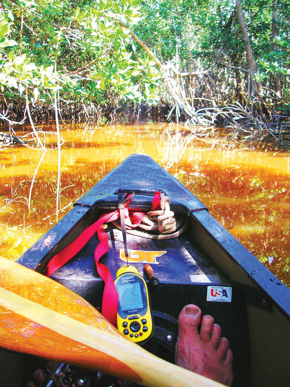
No doubt, GPS make navigation of the Everglades much easier. You can simply download nautical charts onto your device, then satellites circling planet Earth show your exact position in the park. Same goes for our Southern Appalachian Mountains. Or anywhere for that matter. A GPS gives novices an edge and a comforting reassurance of a known and exact position.
Then there are products like SPOT, the GPS-based system in which you can push a button and send a message to loved ones, giving your exact position and let them know all is well. It also has a “Need help” button, as well as an “SOS” button, even text messaging capability.
I use GPS when writing hiking and paddling guidebooks. The devices give exact mileages, allow me to mark significant waypoints and develop quality maps deserving of the book buying public.
However, it has its limitations. GPS can lead to bad habits, like those of Jeff Cochran. The South Florida fireman has plenty of time around the station while waiting for calls. It was there he became a video game junkie. When paddling the Glades, Jeff uses maps from GPS. He can see his exact position at all times on the GPS screen. And while paddling all he does is look down at the screen instead of the actual Everglades, the place he came to see.
Why navigate the Everglades when you can navigate the virtual Everglades? It’s a real life video game. Jeff was missing the Everglades’ famous bird life, dolphins surfacing for air, and the sun reflecting over the water for the lure of the backlit screen.
Using a map and compass has the opposite effect of those focused on their GPS. To find your way, paddlers must continually scan, study and absorb the land and water, matching the islands, creeks and channels to what lies before them. When learning the landscape you can’t help but notice what goes on, whether it is jumping mullet, a majestic osprey with a fish in its talons or a manatee creating its own wake.
This repetition of matching what lies before the eye to what is printed on the map hones your outdoor skills much like a knife blade to a whetstone. Using map and compass in the Everglades helps you in the deep forests of the Smokies, which helps you in the Piedmont’s Birkhead Wilderness, which helps you in the Virginia-North Carolina Dismal Swamp. Mind-landscape coordination aids your reading whitewater, skiing a knobby slope or mountain biking undulating terrain. It also helps you read a road map while getting to the trailhead.
Or you can be like Cliff, blindly following his GPS, not bothering to absorb the Everglades, or like Jeff, turning his GPS into a video game. Or you can exercise your mind with map and compass while developing your outdoor skills.
No one knows when their outdoor emergency will arise, when they will be lost on the Joe River or caught in a snowstorm on Blood Mountain. When will you be called upon to rise to the occasion? Will you be prepared or will you be caught in the woods with dead batteries in your GPS?