BY GRAHAM AVERILL & JEDD FERRIS
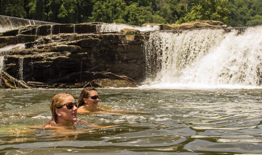
A plunge into a swimming hole should be a part of everyone’s summer. Relish the complete sense of surrender as your feet leave the rock, your body meets gravity, and everything goes silent as you fall toward the pool of water beneath you. The world disappears, and all you can see, all you can think of, is the calm depths beneath your feet.
BRO has found the best swimming hole jumps in the Southeast. Some of them are tried-and-true classics, others are further off the radar. Some send you leaping from great heights, others are more scenic than death-defying. Regardless of their height or popularity, they’re all out there waiting for you to surrender to the jump.
WHITEOAK CANYON
CEDAR RUN, VA.
Height: 20-40 Feet
Whiteoak and Cedar Run are connecting Shenandoah classics. The central section of the national park has long been a hiker’s delight for the abundance of waterfalls found on this popular circuit hike. Ledges for jumping from various heights are ready for the taking along the cool pools that sit beneath falls found on the Whiteoak Canyon and Cedar Run Trails. A long favorite option is Cedar’s natural waterslide with a pool 40 feet below.
Dangers: The high ledge at Cedar Run requires a little distance in the jump or it could mean disaster; not recommended for the timid. Be mindful of water levels.
Access: From Charlottesville, Va., drive north on US 29 for 26 miles until you reach SR 231. Head north until you reach SR 670, where you proceed to Syria. Turn right on SR 643/600 and drive to the White Oak Canyon trailhead. It’s a 1.5-mile hike to the pools.
Nearby: If you’re looking to spend a little more time in the park, hike on to Skyline Drive and grab a site (advanced reservations often necessary) at Big Meadows. The campground has a lodge where you can grab food and supplies.
SUMMERSVILLE
CLIFFS, W.VA.
Height: 30-100 Feet
If you don’t think we have any legitimate cliff jumping in the South, just head out to the big ledges and stunning views around central West Virginia’s Summersville Lake. Try the varying heights at Long Point, Waterfall, and Whipporwill cliffs (a popular spot for bolted deep water solo climbing routes), easily reached from Rt. 19, where you can spend the day yelling cowabunga at the top of your lungs as you plunge into the deep clear water.
Dangers: The water is nice and deep in Summersville Lake, but landing a 50-foot-plus jump in an awkward position could easily result in some cracked ribs. Some jumpers recommended bringing a life vest to throw into the water before you jump in-just in case you get one of those pesky leg cramps or need a breather before you swim to shore.
Access: From Fayetteville head north on Rt. 19. Whipporwill Road is on the left just before the Gauley River bridge. For Waterfall cross the bridge and turn right into a dirt parking area. A half-mile hike on the jeep trail will then lead to the cove and jumping area of Waterfall Cliffs. To reach Long Point continue north on 19 for a mile and turn left on Long Point Access Road. Follow this through the Summersville Lake recreation area until you reach a gate. Park here and follow the hiking trail for 1.5 miles to the overlook.
Nearby: While you’re in the area stick around and take a whitewater rafting trip on the New. If you’re looking for post-jump chow, head to Pies and Pints in Fayetteville for tasty gourmet pizza.
SWALLOW FALLS
STATE PARK, MD.
Height: 10-30 Feet
Swallow Falls State Park sits in the rugged Allegheny country of Maryland’s western peninisula. It borders the tumbling rapids of the Youghigeny River and also holds Maryland’s highest waterfall, the 53-foot Muddy Creek Falls, as well as the park’s namesake cascade. Both waterfalls flow into sets of refreshing natural swimming pools, bordered by craggy outcroppings for cannonball glory.
Dangers: The rocks along the side of the swimming holes get slippery, so watch your footing or wear some water shoes. Watch out for glass and other trash that often comes with state park disrespect.
Access: From Cumberland take I-68 west to US 219 and head south to Oakland. Then pick up Rt. 20 in Oakland and head nine miles northwest to the park.
Nearby: The park has a number of set-back wooded campsites and a network of well-maintained trails to satiate a needed singetrack fix. If you need more nighttime action, head toward Deep Creek Lake and get some Mexican at Santa Fe Grille. They pour a shot of Patron big enough to drop a horse.
Mill’s Creek
Waterfall, S.C.
Height: 20+ Feet
The jump itself is impressive, but what really gets people going at Mill’s Creek is the setting. The creek drops into Lake Jocassee, forming a 30-foot waterfall tucked deep inside a lush, green cove. All of it comes together for a tropical setting unrivaled in the Southeast. You’ll have to keep reminding yourself you’re in South Carolina, not the Caribbean.
Dangers: The logistics. The only way to reach Mill’s Creek waterfall is by boat. No trails or roads reach this corner of the lake, which is surrounded by federally designated Wilderness. The only way to reach the falls is by a half-day paddle or boat shuttle. (See below).
Access: You can paddle a sea kayak for three to five hours across Lake Jocassee or arrange for a boat shuttle with the Jocassee Outdoor Center. Either way, check with the JOC for maps, a guide service, or info on alternative jumps along the lake. www.jocasseeoutdoorcenter.com.
Nearby: Foothills Trail. The 80+ mile footpath skirts the northern edge of Lake Jocassee for miles, offering hikers a chance for a variety of day trips. The Jocassee Outdoor Center runs hiker shuttles for those who want to jump off a waterfall and catch a dayhike all in the same excursion.
Directions: From Greenville: Take Hwy 25 north to Hwy 11. Go south of Hwy 11 and turn right on Jocassee Lake Road to Devil’s Fork State Park, the only public boat access on the lake.
WILDCAT FALLS, N.C.
Height: 15 Feet
This is more of a rock jump than a cliff jump. At 15 feet, it’s a great way to introduce someone to the art of cliff jumping. And everyone will enjoy the hike into the Wilderness and the scenery surrounding the falls.
Dangers: Shallow rock shelf directly beneath the jump. Jump out away from boulder and you’ll clear any rocks hiding beneath the water. The pool at the bottom is only five feet deep, so tuck your legs in as you hit the water.
Access: Easiest way is to hike the Big Fat Trail for three miles from Big Fat Trailhead. But it’s steep and is a heck of a climb out of the wilderness after a day of rock jumping. The more scenic route would be to hike seven miles along the Slickrock Creek Trail from Hwy 129. You’ll follow the river the entire way and cross the creek multiple times.
Nearby: Joyce Kilmer Memorial Forest. Some of the biggest, fattest trees in the South are just around the corner. Cheoah River. Miles of constant class IV big water sits at the edge of this Wilderness area. Sweetwater BBQ. Robbinsville isn’t a bustling metropolis, but they have good Q. 828-479-6862.
Directions: From Robbinsville, N.C. follow 129 west for 13 miles. Turn left at the unmarked bridge that crosses the Cheoah and follow Forest Road 62. In .2 miles, take a hard right on FS 62 and follow it as it climbs for six miles to the Big Fat Gap Trailhead. For the Slickrock Creek Trail trailhead, stay on 129 to the Cheoah Dam and look for the dirt road and parking area on your left.
BOWATER HOLE, TENN.
Height: 18 Feet
Locals call this the “Blue Hole,” out of towners call it Bowater Hole. Whatever you name it, it’s a classic Tennessee jump that’s popular during summer weekends. The massive boulder sits in the middle of the North Chickamauga River surrounded by a small but scenic rock gorge. The boulder itself is perfect for sunbathing and the tallest end protrudes over the deepest section of the river, as if Mother Nature herself wanted us to jump into its depths.
Dangers: Broken glass. The jump itself is safe as can be, but watch out for broken beer bottles on the rocky shore leading up to the boulder. The spot is popular with college kids who obviously have no concept of Leave No Trace.
Access: The jump is located within the Bowater North Chickamauga Pocket Wilderness. Follow the unmarked trail at the lower end of the parking lot across the river and continue upstream for one mile.
Nearby: Cumberland Trail. Twenty miles of the C.T. traverses the North Chick gorge, perfect for backpacking or scenic day hikes. Park and Play. The two-mile run from the Bowater parking lot to route 27 on the North Chick is solid class III-IV water with boucoup park-and-play potential. Clumpies Ice Cream Company. Fresh ice cream hand-made at the shop with a variety of hip flavors like Chai sorbet. 423-267-5425.
Directions: From Chattanooga, head north on 27 to Montlake Road. Go west on Montlake Road for 1.1 miles to the Bowater North Chickamauga Pocket Wilderness sign on your left and take the gravel road down to the parking lot.
JACK’S RIVER FALLS, GA.
Height: 20 Feet
Jack’s River Falls is hardly a secret, but the narrow gorge that houses the 60-foot waterfall is so remote and picturesque, you won’t mind waiting in line to jump. The falls is so popular, the Forest Service has recently banned overnight camping along the river to help cut down on use. Regardless, it’s a jump that can’t be ignored. Jacks comes down in two dramatic tiers within a narrow rock canyon, and an imposing 20-foot tall rock chimney protrudes over the deep pool at the bottom of the last waterfall.
Dangers: The current. The falls is so powerful, it can either suck you back beneath its falling waters or push you quickly toward a rocky shelf beneath the water. After you come up from the plunge, be prepared to swim immediately to shallow water.
Access: The falls resides inside the Cohutta Wilderness. Take the 3.5-mile Jack’s River Trail for an easy walk along an old railroad bed.
Nearby: Cohutta Wilderness. The Cohutta has 95 miles of hiking trails. Check out the 13-mile Conasauga River Trail, which crosses the river 38 times. Edna’s Restaurant in Chatsworth offers classic meat-and-three style dishes. 706-695-4951.


