A new podcast explores the history found along Bicycle Route 76 in Virginia’s Blue Ridge, and its potential to be a major cycling destination in the region.
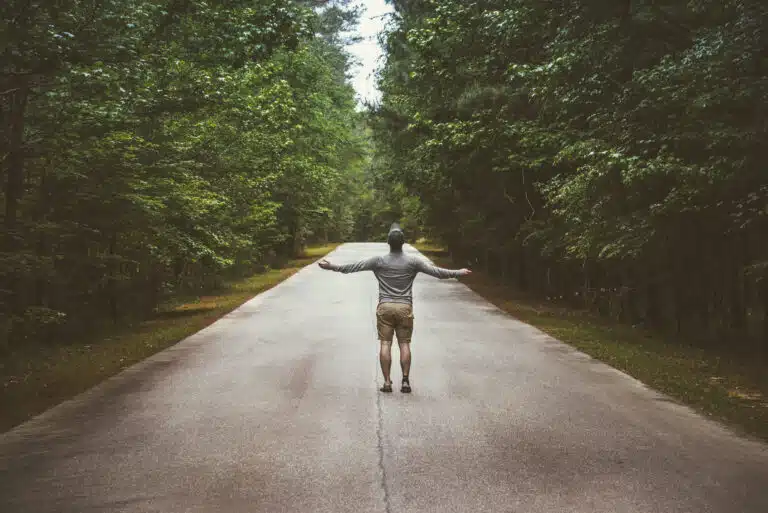
More than 300 miles of the United States Bicycle Route 76 bring cyclists through Virginia’s Blue Ridge region. From Breaks Interstate Park on the Kentucky border to Rockfish Gap west of Charlottesville, the route climbs over mountains, follows rivers and streams, and passes through towns, farmland, and forests.
Fifty years ago, this route was mapped as part of the planning for the Bikecentennial, designed for cyclists to celebrate America’s 200th birthday. Several thousand riders completed all or substantial parts of the route in the summer of 1976, following distinctive signs marked with a bicycle and the number 76. In the 1990s, most of this same route was officially recognized as United States Bicycle Route 76, and the signs (mostly) remain in place along this route across Virginia. Often called “the Transamerican,” the route is used by cyclists riding across the country, taking multi-day trips, or, most commonly, on day rides near their homes.
Route 76 through the Blue Ridge follows the original intent of Bikecentennial planners by following mostly rural roads. At least three-quarters of the miles across the Blue Ridge are on rural roads: usually just two lanes, sometimes with a center line and marked shoulders, but often with no lines or shoulders. Some sections run parallel with, and briefly on, busier roads, including Route 11. Just over 20 miles are on the Blue Ridge Parkway, between Tye River Gap and Rockfish Gap. Cyclists spend very little time riding through cities and towns, although these locations do provide opportunities to find lodging, food, stores, and museums.
Cyclists on Route 76 in the Blue Ridge will encounter many hills, with challenging ascents and rewarding descents. Westbound riders climb up Afton Mountain and the even steeper climb to Channels State Forest, with a 7% grade over three miles. Eastbound riders climb from Vesuvius to Tye River Gap, widely considered the steepest climb on the entire Transamerican Bicycle Route. The highest points are along the Blue Ridge Parkway and in the Mount Rogers Recreation Area, challenging rides with repeated ascents and descents with low traffic, excellent roads, and beautiful views.

History is present all along the more than 300 miles of this section of Route 76. That’s why I started the Bike 76 VA podcast, which offers cyclists (and local residents and visitors) 30 episodes that explore history across the entire stretch of Route 76 in Virginia. Each episode uses a location to explore broader themes across more than 500 years of Virginia history. Episodes are spaced about every 20 miles along the route, so a cyclist averaging 60-80 miles would cover three or four episodes in a day. The episodes are 15-20 minutes in length, designed for listening at the end of cycling day, while preparing for the day’s ride, or on breaks along the route.
My goal with this project was to provide more context for riders, to encourage them to think more broadly about the places and people encountered along the route, and to connect the origins of this route, in the 1976 Bikecentennial, with the upcoming semiquincentennial commemoration in 2026.
Many rural roads originated as walking trails for hunting, migration, and trade. Indigenous communities were generally located in valleys in proximity to streams or rivers, and thus walking routes allowed for communication between groups and the mobility necessary for growing crops, foraging in forests, and trading with other communities. The first European explorers followed these same walking routes as they moved inland, displacing Indigenous communities which mostly retreated further into forested or elevated regions.
Cyclists will observe how Route 76 follows the contours of the land, along streams and creeks or through gaps in ridges, thus confirming the centuries of foot travel which established these routes.
European settlement transformed relations with Indigenous peoples as well as the land in ways that remain evident in the present. As cyclists ride along the valleys west of the Blue Ridge, they are following the same general route taken more than two centuries ago by European settlers looking for land to establish farms, build churches, and sustain communities. The most visible evidence of sustained community presence are churches which list founding dates as far back as the early nineteenth century.
Enslaved people lived and worked in Appalachian Virginia prior to the American Civil War. Enslaved people in some counties west of the Blue Ridge made up one-fifth of the population, thus confirming the importance of slave labor to economic development and political power. As cyclists ride Route 76, they are often observing fields where enslaved people lived and worked across many generations in the decades before emancipation.
In the late nineteenth century, the expansion of railroads facilitated transportation at the same time that market demand grew for natural resources extracted from Appalachia. Timber brought the first economic boom to the Blue Ridge. Most Virginia forests were clear cut in the late nineteenth century, as timber companies established work camps, built railroads, and transported lumber for shipbuilding, home construction, and heating fuel. The timber industry brought work opportunities to local communities and contributed to economic growth. Once a region had been clear cut, however, the industry moved elsewhere, depriving communities of work and leaving businesses to fail. Evidence of boom-and-bust cycles can be seen in abandoned railway lines and closed mills along Route 76.
The economic dislocation of communities evident in the 50 years since the Bikecentennial resulted from economic and demographic shifts. The interstate highways bypassed many of these communities, depriving them of visitors and shifting businesses closer to major exits. Small industrial plants lost markets to national and global competitors. Populations decreased in many communities. Dickenson and Smyth counties have 15% fewer people now than fifty years ago (over the same period, Virginia’s population almost doubled). Local businesses that served communities were unable to survive as demand declined, and many closed their doors, leaving empty storefronts still visible along Route 76.
But I believe cyclists can help revive these communities, with Route 76 having the potential to provide a boost in the form of recreational tourism. The Virginia Creeper Trail, the New River Trail, and the Blue Ridge Parkway have national reputations as destinations for multi-day cycling trips. And Route 76 could be the same, as it approaches major cycling centers, including Roanoke, Charlottesville, Staunton, and Waynesboro. Most importantly, Route 76 can bring cyclists into small towns, thus providing opportunities for lodging, meals, and other activities that support local communities.
All of the historical connections outlined here are explored through podcast episodes along the route from Breaks Interstate Park to Charlottesville. The four episodes distributed along an 80-mile section in southwest Virginia provide a sense of both range of historical themes and the diversity of cycling experiences. The Logan Creek episode (27) examines the history of forests in Appalachia, from the regenerative practices of Indigenous Americans to the clear-cutting of the late nineteenth century, which shaped the environment now encountered by cyclists. Route 76 and the Appalachian Trail intersect in Damascus, so episode 26 explores the similarities and differences in outdoor recreation with roots in twentieth century visions of human-powered exploration. The Troutdale episode (25) examines how small towns in the early twentieth century experienced industrial booms due to railroad expansion and manufacturing booms, followed by economic dislocation causing population declines evident now in abandoned businesses and homes along Route 76. The Mill Creek episode (24) documents the lynching of Raymond Byrd in 1926, which is also commemorated by a historical marker on Route 76 in downtown Wytheville. For cyclists, the experience of riding this section, featuring a combination of rural roads, challenging climbs, rewarding descents, and beautiful scenery, is enhanced by learning more about the historical forces that shaped communities along this route.
Tom Ewing is a professor of history at Virginia Tech (Blacksburg) and director of the Bike VA 76 project, which features 30 podcast episodes, weekly blog essays, and other materials about Route 76 in Virginia: https://bike76-va.vt.domains/home/.