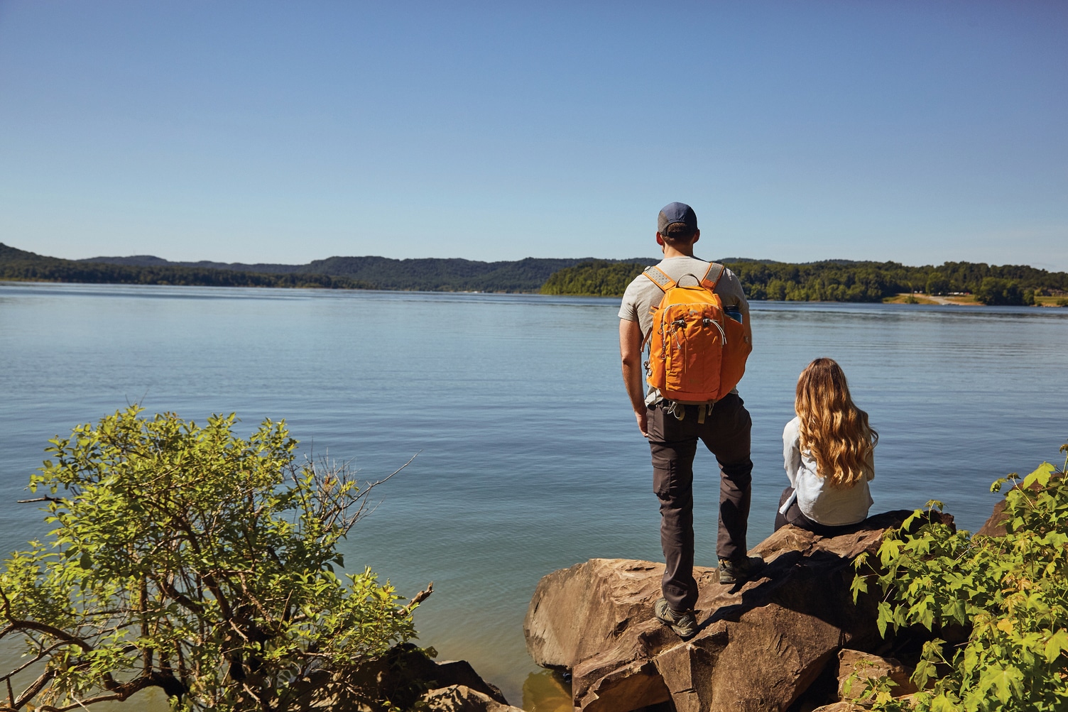
Communities across the Mid-Atlantic and Southeast are building more trails than ever as citizens look ahead to the future of local outdoor recreation.
When Ben Braman moved to Perry County, Ky., four years ago, he was used to wide-open spaces and miles of trail. “I grew up in Michigan, moved to Colorado, lived in Montana,” he said. “Those are traditionally places where outdoor adventure is just a way of life. When we moved here, the mountains are absolutely gorgeous, but we have very limited access. Everything was developed for one reason, and that was to mine coal. There wasn’t a lot of city planning or community planning for actually getting out and recreating for non-motorized use in this area.”
In early 2016, Perry County received a Recreational Trail Program grant. The county was responsible for matching the $100,000 grant with in-kind labor, materials, and professional services to build a 3.1-mile trail system at Perry County Park. Braman quickly got involved with the project, helping to design the trails and develop volunteer teams. The trail project became a collaboration between county officials, the community, and Pathfinders of Perry County, a local nonprofit dedicated to community engagement and outdoor recreation, which Braman now chairs. “It’s a labor of love,” he said. “It really started with just an absolute need to get out and stretch my legs.”
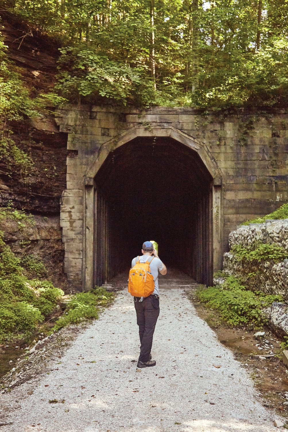
Due to quick, widespread community support, Perry County was able to stretch the original 3.1-mile trail system into six miles. “I’ve lived in a lot of different communities,” Braman said. “Southeast Kentucky gets a bad rap. But there are a tremendous amount of people working to change that. This community really is behind it. And the kids are behind it. What‘s very exciting is to see the youth that are out there helping day in and day out with all sorts of tasks. That’s the big buy in.” Members of the Perry community contributed to the trail development in a variety of ways, from donations and providing meals to backbreaking physical labor cutting natural surface trails through the Appalachian Mountains.
With COVID-19 highlighting the need for close-to-home recreation opportunities, investments like this are more important than ever. Trails and greenways are seeing increased use across the country as walkers, runners, and bikers seek out recreation spots they don’t have to drive hours to reach.
In addition to building the trails, the county also applied to the Kentucky Trail Town program offered by the Kentucky Department of Tourism. Seth Wheat, the state’s director of tourism development, said the program is similar to those that created the Great Allegheny Passage Trail Towns and national park gateway communities. From a tourism standpoint, it’s all about connecting outdoor recreation opportunities with nearby towns to create a significant economic impact. But it’s also beneficial for the people who live in the towns. “We’ve seen people in the community become more aware of what’s in their own backyard,” Wheat said. “We’re seeing folks utilize these things, which is vitally important. First and foremost, if you are going to be doing these things, it should benefit the local community before benefitting visitors.”
The program is also designed to encourage trail communities to work together on regional projects. “If I have a trail town down on a river or a creek, working with the people that are upstream and downstream of me makes a coordinated effort, so that we’re all singing from the same hymnal providing complementary services,” Wheat said.
Programs like Kentucky Trail Towns are just one way towns and states are leveraging outdoor recreation to promote jobs, tourism, and a healthier lifestyle. With the opening of the trail system last year, Perry County started offering boat rentals on the North Fork Kentucky River. “In our first year, we had over 200 people rent kayaks and float our little section to the park,” Braman said. “So there is a need here. We never had that recreational infrastructure that we’re working so hard right now to develop.”
But Perry County isn’t satisfied with just six miles of trails. Now they’re focusing on a rails-to-trails system that would start in downtown Hazard and run six miles outside of town, connecting downtown amenities, subdivisions, and the technical college to recreational spots. “We’re all trying to work together to give people more of an option when they come down to southeastern Kentucky,” Braman said. “We have a ton of land, beautiful land. We’re only an hour from Red River Gorge. It’s really just about land access right now, educating people that we can come through your private piece of land if you’re not using it and protect you from liability.”
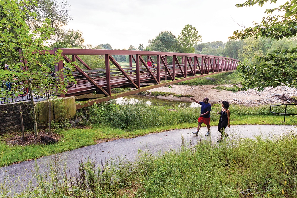
Hikers and bikers explore Herring Run Trail in Baltimore, Md. Photo by Side A Photography, courtesy of Rails-to-Trails Conservancy
Connecting Cities and Regions
As more cities implement this type of infrastructure project, advocates are looking beyond the recreational benefits of trails. Before joining the Rails to Trails Conservancy, Ethan Abbott was a recreation programmer for Baltimore City Recreation and Parks. “At outdoor rec, we really tried to address the city’s most disenfranchised communities,” he said. “They have recreational opportunities around them, or close to them, but for some reason or another they don’t feel like they’re made for them or designed for them.” Now as the Baltimore Greenway Trails Coalition Project Manager, Abbot is continuing his work to bring outdoor recreation to more of the city’s residents.
The greenway project aims to connect the city’s neighborhoods, amenities, and parks through existing trail infrastructure and new corridors.
Of the 35 miles needed to link the entire city, 25 miles already exist as established trail systems on their own. Once the final 10 miles are completed, Abbott estimates the trail network will link about 80 neighborhoods, 4,000 acres of green space, universities, the Inner Harbor, and countless other destinations around Baltimore.
In addition to the recreational benefits, the completed greenway system would improve current transportation infrastructure within the city. “The bus system, which is pretty extensive, happens to be a bit overworked and may not be that reliable all the time,” Abbott said. “We have an outdated metro system, which in the past few years has seen a need for maintenance but also dwindling ridership numbers. We have a light rail system that only goes north and south, which is great if you’re trying to travel in those directions. But the problem with that is north and south is largely along the economic center line that goes from downtown straight north into the suburbs. It eclipses literally all of east and west Baltimore, which are your lower income neighborhoods. So it really does disenfranchise a lot of the city.”
Those working on this project see the trail network as an opportunity to address some of the systemic issues that have left many of the city’s residents out of the loop for decades. Abbott said of the city’s 600,000+ residents, roughly a third do not own a vehicle. “That’s quite a significant amount that does not have a reliable method of personal transportation,” he said. If it were easier and safer to walk or bike to work, residents would have another option for commuting.
Throughout the entire planning process, coalition members have based their plans around community input. “Not just community input from communities that have high dollars, which translates to more talking power and clout, but really any community,” Abbott said. “The onus is on us to actually go out and make sure that outreach happens. That’s one of the overarching themes of this whole thing is the power of listening and amplifying voices.” That means connecting with everyone, even residents who might not support the project.
Whether the greenway network takes a few years or a few decades to be completed, Abbott said COVID has altered the way local governments are thinking about and prioritizing recreation and transportation infrastructure. As more residents turn to the outdoors for physical activity, there is potential in existing amenities as well as those still in the planning process. “There’s no turning back after this,” Abbott said. “Going forward, it’s a significant change in how people interact and live on a daily basis. I think this trail project is ready for that.”
In other places, trail advocates are looking at broader, regional trail planning. Tristan Winkler, director of the French Broad River Metropolitan Planning Organization, is working on the Hellbender Trail. The plan is to connect five counties in western North Carolina, including the communities of Asheville, Hendersonville, and Brevard, through 150 miles of greenways. “It bubbled up from the local levels,” Winkler said. “There have been a lot of bicycle, pedestrian, and greenway plans done in the different municipalities and jurisdictions in our region. We looked at all of these local plans and saw if you start to stitch them together, you really start to put together a big regional system.”
Other multi-use long distance trails in the region, like the C&O Canal Towpath and Virginia Creeper Trail, have proven to be big draws for recreationalists looking for multi-day adventures. The Hellbender Trail focuses on connections across county lines, a sort of interstate system for pedestrians and cyclists. “A lot of the data that we see is suggesting that our region is becoming more and more regional,” Winkler said. “The number of people living and working within their own counties is decreasing across the board. We’re seeing more and more people crossing jurisdictional lines to get to work.”
Although the Hellbender Trail will take years to complete, as each locality has to find the funding to actually put in the trails, there is momentum for community development projects around recreation. “We have seen a lot of people turn to walking, biking around as kind of an outlet,” Winkler said. “I think the safer infrastructure we can provide, the more we might see that carryover post-pandemic. A lot of places in our region have similar visions. And so the Hellbender kind of helps to recognize that your community is not alone in that push.”
Incorporating Technology into the Trail
For many, trails offer an escape from the modern technologies that dominate our day-to-day lives. But two Virginia trail systems are looking to technology as a way to enhance engagement with natural spaces.
At the State Arboretum of Virginia in Boyce, a new geocache trail takes visitors on a scavenger hunt through the unique ecosystems of the property. Jack Monsted, the arboretum’s assistant curator, said the goal of the new trail is to get people out to places they might never have experienced. “We have a lot of really cool natural areas, especially some nice woodlands and meadows that people just don’t visit because they are away from the core, main area of the arboretum,” he said. “We wanted to give people a reason to go out and explore some of these cool natural features that we have.”
Solving the puzzle at each location unlocks information about that site and gives users clues that will lead them to the next stop. “We wanted to find a way to engage people and help people think about nature and ecology in a more interactive way,” Monsted said. “A lot of the places that you go to will have some interesting natural phenomenons happening, whether it’s a really impressive fallen tree or a meadow that naturally arose in an area.”
Just down the road in Charlottesville, trails at the new Heyward Community Forest will connect existing pathways at Ragged Mountain Natural Area, Foxhaven Farm, and Birdwood Golf Course. It’s what Charlottesville Parks and Trails Planner Chris Gensic refers to as the missing link that will fill in the donut hole. Although Charlottesville is less than an hour from Shenandoah National Park and the Blue Ridge Parkway, the community forest is an important piece in creating local destinations for residents. “Not everyone has the means to get out to Shenandoah,” Gensic said. “Even though you can see it from here doesn’t mean you have a car or have time to get all the way out there before you even start hiking.”
One stipulation of the grant used to purchase the property is that plans include an environmental education component to teach visitors about the importance of forests in ecosystems. “Trails are being designed to go close enough to rock outcrops or special areas of trees, without messing with those ecosystems, to get people close enough to see them and educate themselves about the geology, ecology, and human history there,” Gensic said. Over the winter, they will start planning a series of educational posts along the trail. Instead of a traditional information kiosk, the posts would have a QR code that hikers could scan with their smartphones to learn more about the area. Building out the text online would allow the parks department to easily update the information or add interactive elements. If the posts are a success at the community forest, Gensic said they might look at implementing similar components at other city parks.
Discover Your Backyard
While many trail projects aiming to enhance local communities are in development, there are currently plenty of multi-use paths to explore around the region.
Will Skelton, Greenway, Tenn.
This paved greenway connects several natural areas in Knoxville’s Urban Wilderness along the Tennessee River, including Island Home Park, Ijams Nature Center, and Forks of the River Wildlife Management Area. Hike another 12 miles of natural surface trails at the nature center, or check out the climbing crag, a river boardwalk, and picnic spots.
Pennypack Trail, Pa.
Follow Pennypack Creek for 16 miles on this rail trail with something for everyone along the way. Walk, run, bike, or cross-country ski over hills and through multiple parks in the Greater Philadelphia Area. The trail ends at the Delaware River where you can fish off the pier.
Enoree Passage, S.C.
This section of the Palmetto Trail takes hikers and bikers 36 miles through Sumter National Forest. Keep your eyes out for a beaver pond, multiple lakes, and views of the Enoree River as you travel the corridor.
Oconee Rivers Greenway System, Ga.
A mixture of paved, multi-use paths, and natural surface hiking routes make up this network of trails. From the University of Georgia’s campus in Athens to extensive swamps with winding boardwalks, you’ll experience a variety of terrain along the way.
White Oak Rail Trail, W.Va.
A true connector route, this eight-mile rail trail links the three central West Virginia communities of Oak Hill, Summerlee, and Carlisle along a paved and packed gravel path. You’ll find more trails nearby in the New River Gorge.
