
Store shelves are stocking up on Halloween decorations and (hopefully) some crisper air is on the way. With fall just around the corner, states in the Blue Ridge region have recently begun releasing their foliage prediction maps for the season, showing when and where the best leaf-peeping will likely be. Here’s a look at a few forecasts for the peak autumn hues.
Western North Carolina
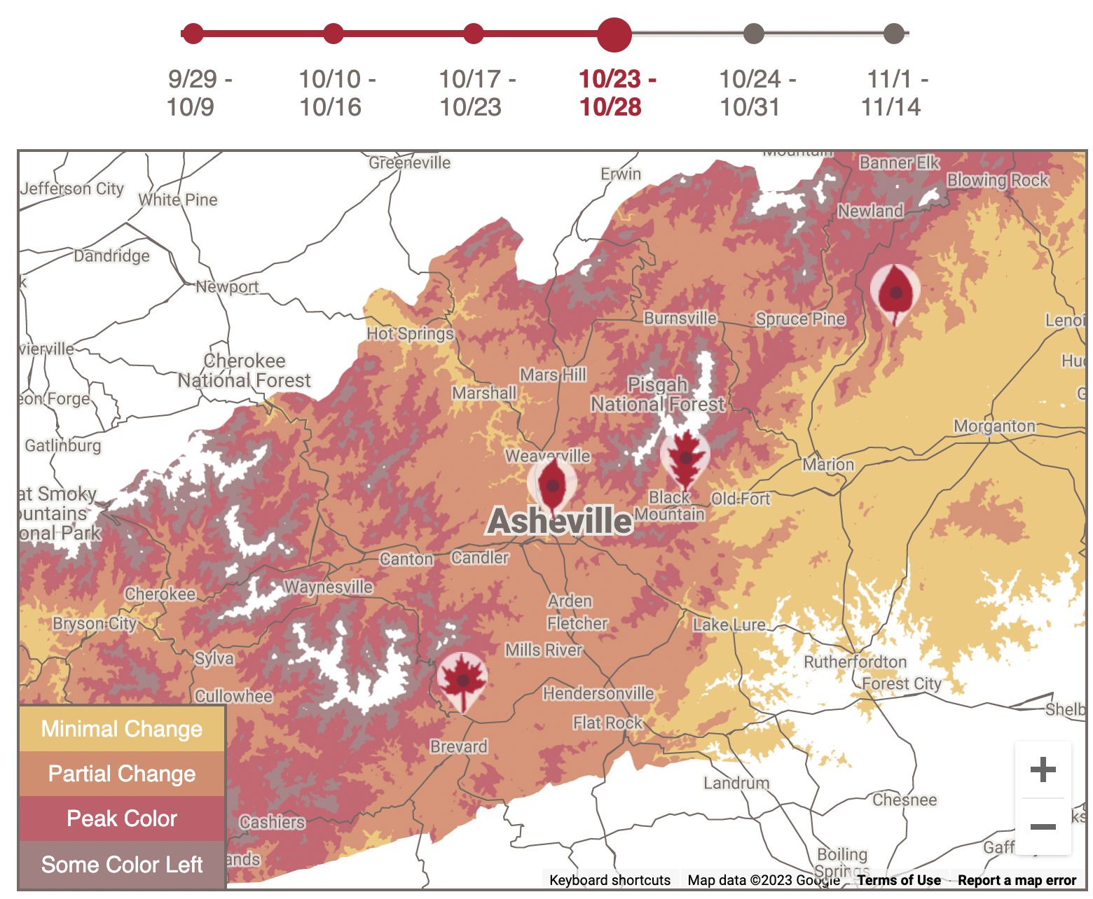
Asheville’s interactive map shows the progression of fall foliage from now until November, in the surrounding mountains of Asheville, N.C. Colors start to pop at higher elevations in late September before cascading downward into valleys and foothills in the following week. The map shows peak season landing around mid-October.
Virginia
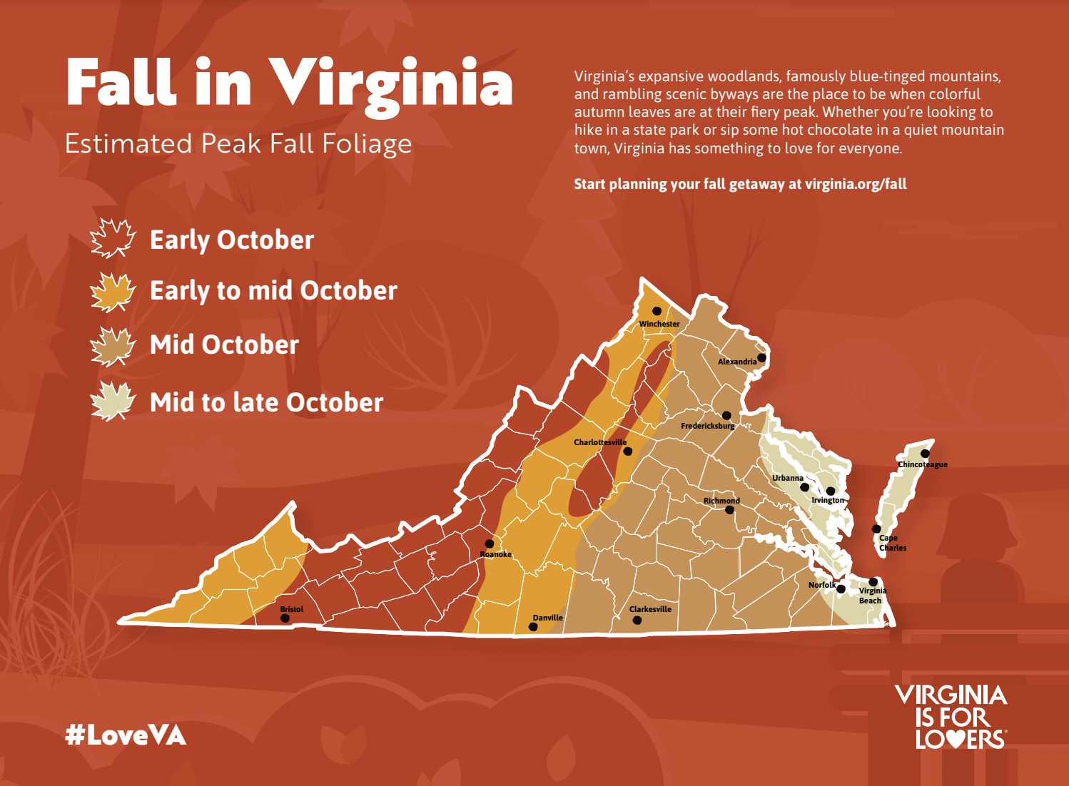
Virginia’s downloadable map shows when each part of the state is peaking throughout October, and the website Virginia is for Lovers will begin weekly foliage updates starting in late September. Foliage changes first appear in the higher elevation areas of southwest Virginia and Roanoke and move eastward throughout the season. Virginia’s has a long fall foliage season, due to the Commonwealth’s diverse landscape that stretches from the mountains to the coast.
West Virginia
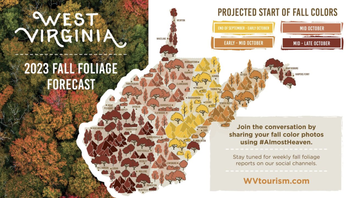
West Virginia’s fall foliage map is displayed similarly to Virginia’s, with sections of the state’s foliage broken down by time of month. Foliage starts near the center of the state from Aurora to Marlington and spreads outwards towards Fayetteville, Huntington, Martinsburg, and Weirton. As the third most forested state in the United States,West Virginia has plenty of open terrain to check out the changing leaves.
Cover Photo: Fall foliage on the Blue Ridge Ridge Parkway near Asheville, NC. Photo by Shannon McGowan @shanster3000 on Instagram.


