
Last week, a lightning strike ignited a forest fire on Collett Ridge, just south of Andrews, North Carolina. The flames have spread across 90 acres of the mountain’s forested area and continue to grow with 0% containment. The rugged terrain surrounding the location has prevented firefighters from getting too close to the fire, making containment a challenge.
“This fire will be on the ground for a while due to the terrain and accessibility issues making it unsafe for direct attack,” stated Peter Myers, Incident Commander of North Carolina’s National Forest Service (NFSNC). “Another factor is that the trees continue to drop their leaves adding to the fuel on the ground. It will take a significant rainfall to make a difference.”
Crews have been working to prevent further spread in more accessible areas surrounding the fire by creating hand and dozer lines, clearing leaf debris from around nearby structures and homes, and cutting back overhanging vegetation. Luckily, the fire is graded as a low-intensity burn, meaning its spread is slow, the damage is minimal, and, according to NFSNC, there are even some potential environmental benefits that could come from it.
“The low-intensity fire is working its way through fire-adapted ecosystems that include mountain laurel and pitch pine,” the organization posted on their Facebook page. “These types of wildfires tend to improve habitat diversity for wildlife and other plant species by reducing the amount of mountain laurel in the area, giving other plants such as wildflowers and grasses the opportunity to grow.”

Posted by the NFSNC.
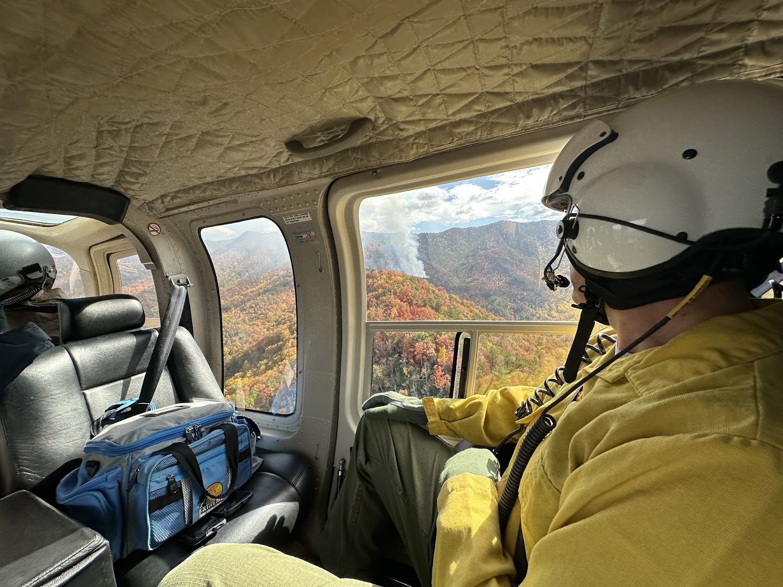
This week, fire officials have been able to utilize aerial tools such as a firefighting helicopter and an infrared drone to help assess the size and spread of the fire. According to NFSNC, the information gathered from the drones assists in developing “Management Action Points” or M.A.P.s, which are specific conditions or locations that when reached will prompt officials to begin implementing additional actions or strategies. In this case, MAPs will primarily be used to determine further action in protecting structures and communities north of the fire.
“Using infrared drones for wildfire assessment offers a range of advantages, including precision, speed, and safety,” the NFSNC wrote on their Facebook page. It’s particularly beneficial in challenging terrains and remote areas where traditional methods may fall short. Ultimately, this technology enables emergency responders to make informed decisions, leading to more effective wildfire management.”
There are currently no closures in the area, but the NFSNC asks the public to use caution with handling flames and to avoid the area to allow crews to work effectively and safely.
Cover Photo: Posted by the NFSNC


