Unequivocally, Virginia’s Blue Ridge is Virginia’s premier outdoor destination. Perfect for hiking, water excursions, mountain and road biking, backpacking. And what pairs well with all those activities but cold craft beer on draft, refreshing glasses of wine, a shot of ‘shine or a cocktail, and music, of course.
It’s time to take to the trails in whatever mode you choose. Be a #Trailsetter in Virginia’s Blue Ridge as you explore these 5 awesome trails!
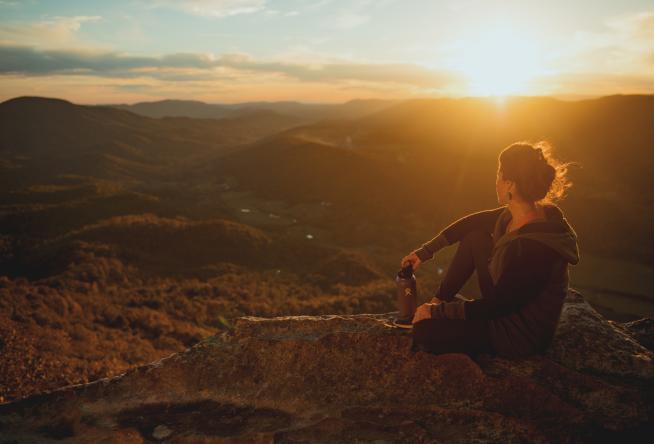
1. Appalachian Trail – Hiking
When you’re looking for a great hike, why not hit the tried and true Appalachian Trail? An iconic American path, the white-blazed way meanders through Virginia’s Blue Ridge from its north and south points at Mount Katahdin in Maine and Springer Mountain in Georgia, respectively.
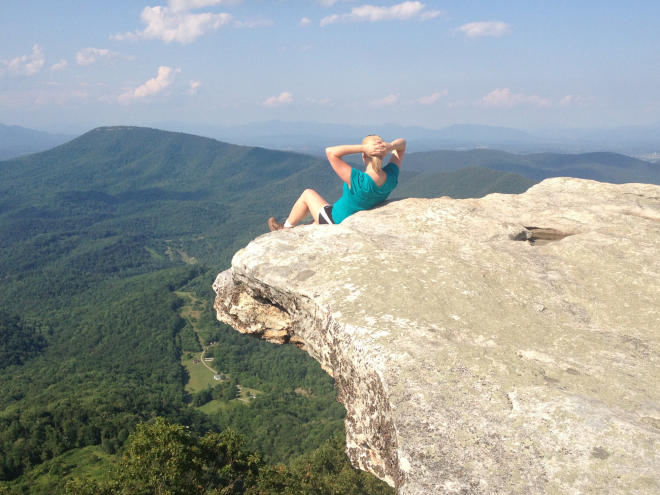
Did you know Virginia has more miles of Appalachian Trail than any other state? Did you know Roanoke is the largest city along the A.T.?
A number of points in Virginia’s Blue Ridge lead to the Trail, and Virginia’s Triple Crown is a part of the draw as well. Hike a portion at your leisure to see if you can discover the 10 Hidden Gems.
- The Appalachian Trail parallels the Blue Ridge Parkway from Blackhorse Gap to Bearwallow Gap (MP 90-97).
- Off Interstate 81 at exit 150 in Troutville is a parking lot and A.T. entry point with a kiosk. It’s about ¾-mile from U.S. 220 Alt.
- Near the previous point and on Tinker Mountain Road is an Exxon Gas Station. Behind the parking lot is a dirt path that climbs to Hay Rock on Tinker Mountain and connects with the Appalachian Trail.
- A well-used parking lot at the top of Catawba Mountain on Route 311 serves as the trailhead for McAfee Knob Trail, but it’s also a crossing point for A.T.
- Less than a mile south of Catawba Grocery on Route 311 is a parking lot trailhead for Dragon’s Tooth Trail and also an A.T. entry point.
Download the complete Appalachian Trail Map >
2. Upper James River Water Trail – Paddling
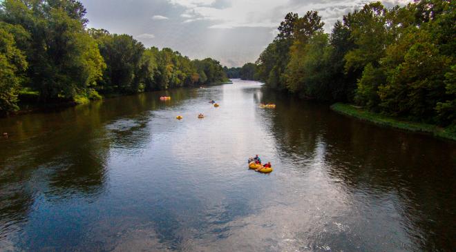
The James River can be as laid back or challenging as you want it to be, depending on where you put in. Personally, the lazy tubing with Twin River Outfitters is the way I’d choose to conquer this old gal, but plenty others seek out more swift waters after a downpour.
The Upper James River Water Trail is 64 miles of H2O that makes its way from the headwaters in Botetourt County to join with smaller tributaries and Maury River in Rockbridge County before descending toward the Richmond falls bound for the Chesapeake Bay. The first 61 miles are Virginia Scenic River complete with excellent fishing and pristine viewshed.
Tangle the tame rapids (Class I & II mostly) with your own vessel or one from our area outfitters. The perk to utilizing outfitter services is they often offer shuttles, maps, and even overnight trips for the more adventurous paddlers.
James River Trip Options with Twin River Outfitters >
3. Carvins Cove Natural Reserve – Mountain Biking
The sparkling 630-acre reservoir is the most obvious draw for visitors to Carvins Cove but challenge yourself to look beyond the obvious. Around the reservoir are 60 miles of multi-use trails and all 11,200 acres of the total 11,636 acres are protected by Virginia’s largest conservation easement to date.
The trails around Carvins Cove have earned rave reviews, including a nod in “The Best Mountain Bike Trails in the Southeast” list offered up by Singletracks, a premier podcast, website, and all around resource for the mountain biking community.
Here’s pro mountain biker Brice Shirbach talking about the experience of riding at Carvins Cove.
4. Virginia’s Blue Ridge Cheers Trail – Breweries, Wineries, Distilleries

Because Virginia’s Blue Ridge has become the hub of adult beverages on the western side of the Commonwealth, it only makes sense to create a map and passport for visitors to more easily taste their way along. Thus, the Virginia’s Blue Ridge Cheers Trail currently connects nearly 30 breweries, wineries, and distilleries between Eagle Rock and Meadows of Dan.
Spend time knocking out each spot on the trail with a friend or hop aboard a bus with Tour Roanoke. Both public and private tours are available, which gives you a designated driver and someone to keep the party going from point to point.
Sign up to download the VBR Cheers Trail mobile passport to check in at five locations. Once you do, you’re eligible to receive a free Cheers Trail t-shirt. Be a cool kid and earn the tee.
Map of Virgini (opens in a new tab)”>a’s Blue Ridge Cheers Trail >
5. The Crooked Road – Music & History
Finally, to wrap up the best of the best ways to enjoy the trails of Virginia’s Blue Ridge, it’s time for music with a side of history.
The Crooked Road is Virginia’s Heritage Music Trail and it stretches 300 miles from our very own Franklin County south to the North Carolina border and westward to the Kentucky line. Travel the road but also explore “the inside” points of interest in Virginia’s Blue Ridge.
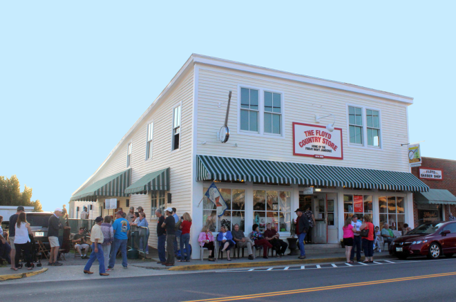
Our favorite Crooked Road destinations include the the Blue Ridge Institute & Farm Museum for their glimpse of homestead life and their annual Blue Ridge Folklife Festival, and the Floyd Country Store for their Friday Night Jamboree and other impromptu jam sessions.
Listen to our Crooked Road Spotify playlist >
Whichever trail is calling you, answer. Be a #Trailsetter in the outdoors, along scenic drives for well-deserved beverages, or while perusing the history of our mountain music scene. You’re sure to love what you find waiting.