The elliptical lakes with a mysterious geologic origin
Driving into Bladen County, I catch my first glimpse of why I’ve come. Brief gaps in dense vegetation reveal the inky blue waters of mysterious lakes that have baffled observers for centuries.
At Singletary Lake, I park and walk toward a small clearing. When viewed from ground level, they look like typical lakes. A few scientists in the 1800s noticed they were unusually round, but most folks dismissed them as regular wetlands. Locals suggested whale wallows from biblical floods. Then, in the 1930s, the invention of aerial photography revealed a different story.
Hundreds of elliptical depressions pockmarked the coastal plain. Some were bigger, some smaller. A few overlapped others. Most had been altered by agriculture or were filled with swampy vegetation. Others were encircled by sandy rims and brimming with open water. Each pointed the same direction, with long axes running northwest to southeast. In the black and white photos of the day, they looked like craters on the moon.
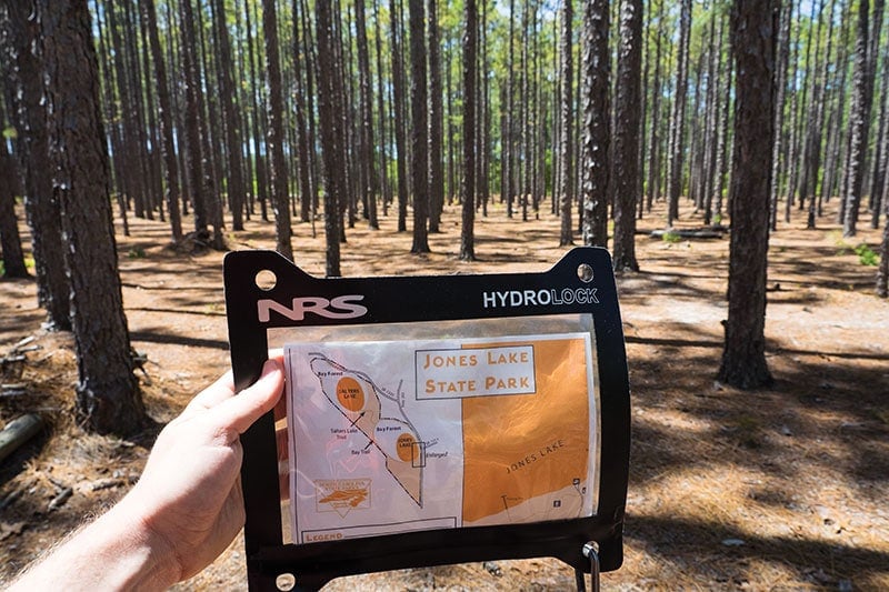
After exploring trails around Singletary Lake and Bladen Lakes State Forest, I drive to nearby Jones Lake State Park. It’s estimated there are 500,000 Carolina bays, stretching from northern Florida to New York state. Basically, one of the biggest—and mostly unknown—mysteries in the United States rests under the noses of 90 million people. The highest density of bays occurs in the Carolinas, and Bladen County, N.C., has some of the most intact and preserved ones, with many remaining year-round lakes.
Standing on the pier, the 224-acre Jones Lake is smaller but eerily similar to Singletary. Some hikers, covered in mud, emerge from the southeast side of the Bay Trail. Heavy rains in recent months caused the lake to spill its rim. The hikers laughingly tell about wading through water, shoes coming off in muck, running from snakes. They warn me not to go, which pretty much guarantees I’m going. Plus, I’m already packed.
After changing into sandals, I head clockwise around the southwestern side of Jones Lake. My goal is to hike 3.5 miles to Salters Lake. It’s one of the last undeveloped Carolina bays open to the public. On my back, I have a packraft. My hope is that seeing a near-wilderness bay from the inside, at water level, will help me understand this mystery better.

The Bay Trail runs just beyond the dense vegetation that rims the lake, a mix of pond cypress, pond pine, and three types of bay trees. This collection of red, sweet, and loblolly bay gives the landforms their odd name, Carolina bays, so often confused for coastal inlets.
I watch for snakes as I walk, while hilarious salamanders unnerve me with their best snake-like impressions, skittering through needles and leaves. The mud on this sunnier side of the bay is patchy and manageable. Eventually, the trail joins a sandy access road running between the bays.
Plodding through a fire-managed forest of candlestick pines, I consider the bay’s more exciting origin story. During the 1950s, the space age mentality was in full effect, and the prevailing theory became a prehistoric meteor bombardment. But in recent decades, computer-assisted geomorphologists began poking holes in this extraterrestrial concoction.
To start, the width-to-depth ratio of the Carolina bays is way off for a high-velocity meteor strike. Some bays are over a mile wide, but each has a shallow and mostly flat bottom. Lake Wacammaw is the largest bay, five miles long and three miles wide, but it’s only 30 feet at its deepest. In contrast, Meteor Crater in Arizona is 3,900 feet wide but has a depth of 560 feet.
Also, meteor impacts are high-energy events that leave behind evidence. At Meteor Crater, 66,000 pounds of the impacting asteroid have been found. Outside of such craters, tektites are expected in the ejecta—basically minerals melted during impact into ultra-dense glass. In the vicinity of Carolina bays, the only rock material that’s been found is sand.
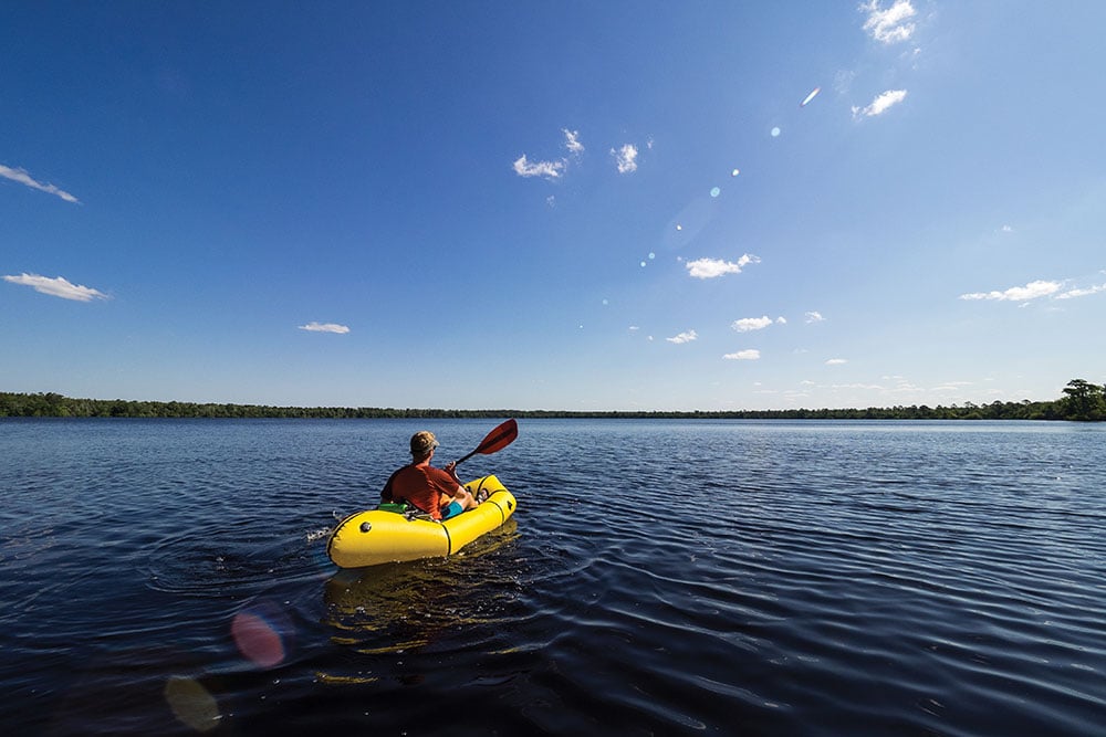
Speaking of which, after a few miles on the sand road, I turn onto the Salters Lake Trail (also sand). Overhead, a woodpecker patiently taps against a trunk. Pushing deeper into this new bay, the ground is blanketed with lush ferns, and the foliage reveals blue-water gaps. The trail ends at a man-made clearing, where I pump up my packraft and launch.
My paddle slices through blackwater. Up close, the lake is reddish-black, colored by tannins from decaying vegetation. There are no major inflows or outflows to most Carolina bays. They fill with rainwater during winter and spring, evaporate during hotter and drier months. Unlike the lakes in Bladen County, most bays are pocosins, aka seasonal marshes.
Paddling northwest, I watch for two things: resident alligators and breaks in vegetation. I don’t see either. The entire lake is surrounded by a wall of jungle, 30 to 60 feet high. At water’s edge, it’s mostly pond cypress, with lime-green needles on branches that are draped with Spanish moss. The only possible footings are occasional cypress knobs breaking the surface. If a sudden wind separates me from my boat, I’ll have to swim and wade back to the cove.
After checking out an old platform with observation hut, I decide to drift while having lunch. There’s a gentle breeze from the southeast pushing me toward the far corner of the ellipse.
This offers time to reflect on the scientifically accepted origin theory. It’s not nearly as exciting as the impact theories, especially when geomorphologists blurt jargon like aeolian and lacustrine. Basically, they claim wind-oriented lakes of similar shape can be found elsewhere in the world. During prehistoric ice ages, the coastal plain saw several changes in sea level coupled with fierce winds, which created large sand dunes. The lakes and sand rims formed slowly, from prevailing winds and currents, within these dunes.
While eating my lunch, I realize I’m being watched. A tiny periscope has risen from the water, twenty feet away. While reaching for my camera, the turtle dives under. A hundred yards away, I notice a curious white spot which might be a bald eagle. Zooming in, I instead see the massive shape of a robotic ant, like something from a sci-fi movie. Turns out it’s the shadowy root ball of a toppled tree.
In recent years, a fringe variation of the impact theory has been proposed. Unfolding like a CGI sequence, it suggests an ancient comet struck an ice sheet at a low angle near Michigan’s Saginaw Bay. The resulting butterfly ejecta, a hot slurry of sand and water, was dumped across the coastal plain. The bays are steam bubbles that popped upon landing. It’s definitely exciting, and worth a close look, but relies on some questionable assumptions. For now, my money remains with boring geomorphologists.
The wind is rising, swirling in from different directions. I cancel plans for a circumnavigation and return to the cove. There, I meet a local who visits often. He recommends nearby Horseshoe Bay, a lake half-filled with forest. A possible evolutionary step from year-round lake to drier pocosin.
He tells about a time, in winter, when he tried to machete slash his way through jungle to the northeastern corner of Salters Lake. He couldn’t reach the water, so he climbed a tree and called it a day.
Like me, he’s fascinated by the bays. And though my day is over, my curiosity is only beginning.
Cover photo: A paddler crosses Salters Lake in North Carolina. Photo by Mike Bezemek


