Take the scenic route on your next leaf peeping adventure with these 10 iconic drives and roadside hikes.
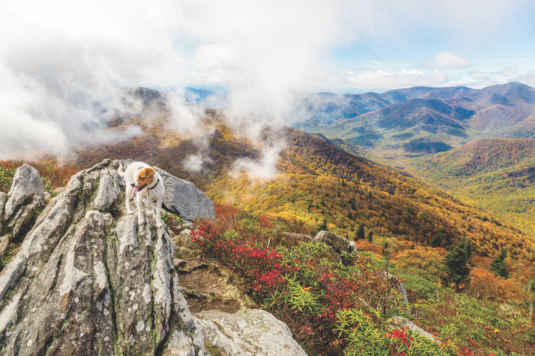
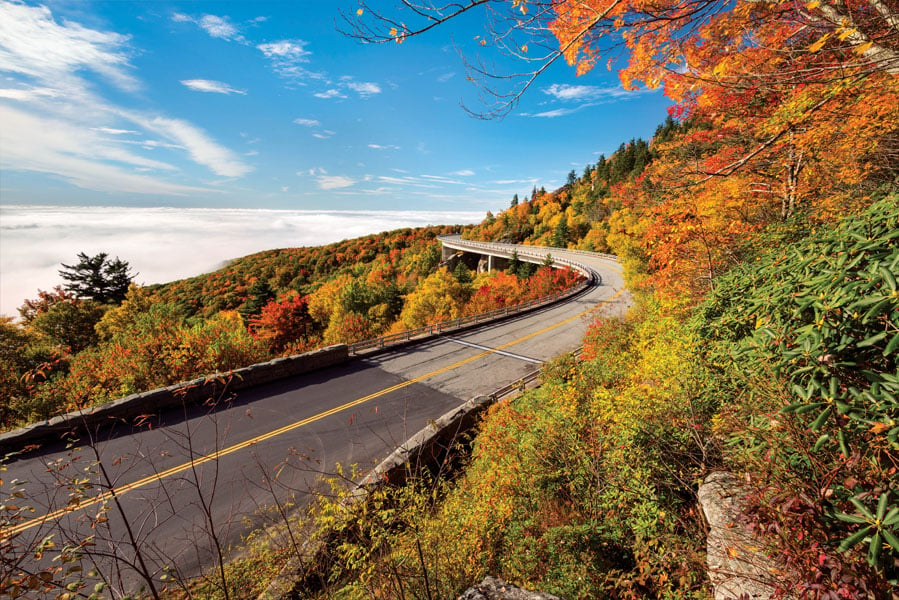
Blue Ridge Parkway
Virginia—North Carolina
The Drive: Weaving for 470 miles from Virginia to North Carolina, the Blue Ridge Parkway has consistently ranked among the top five most popular national park units for its accessibility, historical significance, and of course, those classic Blue Ridge views. The parkway is like a traveling timeline. Visitors can glimpse the life of an 1800s homesteader in the morning and sip on locally made wine from state-of-the-art vineyards all in a day. Consider the changes in elevation when on the hunt for fall colors. Peak foliage hits a lot later at 649 feet along the banks of Virginia’s James River than at 6,047 feet atop North Carolina’s Richland Balsam.
The Hike: For a moderate hike with outstanding views, head to Flat Top Mountain, the tallest of three peaks that form the Peaks of Otter. The parking area is located at milepost 83.5. Follow the Flat Top Trail into the forest, where the gradient is mellow and fast. Don’t be fooled—the summit trail climbs 1,900 feet over the course of 2.6 miles, making those tight switchbacks feel punishingly endless. Stick with it for picnic-perfect boulders and views from 4,001 feet of the Piedmont Valley.
Skyline Drive
Virginia
The Drive: This 105-mile paved drive traverses the spine of the Blue Ridge as it passes through Shenandoah National Park. Nearly every bend in the road here is bursting with life. The park and its backbone byway are home to 1,600 species of trees and plants, over 90 streams, and 60 peaks above 3,000 feet in elevation. With 75 overlooks stacked along the drive (that’s almost one overlook for every mile-and-a-half), you might get so caught up in the sightseeing you never make it to the trailhead.
The Hike: Short and ever so sweet, the Bearfence Mountain Trail has it all—rock scrambles, tough terrain, and front row seats to the best view in the park. Totaling 1.2 miles round-trip, this is the perfect excuse to get out and stretch your legs. Head to milepost 56.5 to begin your trek. At one point, the rocks atop Bearfence were volcanic lava, but millions of years of exposure have morphed them into greenstone.
Highland Scenic Highway
West Virginia
The Drive: Nothing brings out the vibrant reds and oranges of autumn like the stark evergreen of spruce trees. Driving along the tree-studded, 43-mile Highland Scenic Highway feels like a northeastern road trip, both in scenery and in temperatures. Meandering along the Allegheny Highlands above 4,000 feet, the drive cuts right through the heart of the Monongahela National Forest and alongside the Cranberry Wilderness for 22 miles. The weather here is notoriously stormy, so don’t be disappointed if the view is socked in—the moody fog just adds to the Mon’s mystique.
The Hike: For a short day hike, explore the Black Mountain Trail, which connects both the Williams River Valley and Big Spruce Overlooks. The 2.4-mile trail weaves in and out through a rhododendron-choked forest of birch, beech, and red spruce before arriving at a boardwalk and interpretive sign about a devastating wildfire that hit here in the 1930s. For an overnight backpacking trip, and a lesson in humility, head into the Cranberry Wilderness via the North/South Trail to Hell For Certain Branch. You might feel like hell once you slog your way to this creek, but the dreamy campsites there are like stepping through Heaven’s gates.
Laurel Highlands Scenic Byway
Pennsylvania
The Drive: Beginning just north of Johnstown, Penn., and traveling for 68 miles southwest to the Pennsylvania–West Virginia border, this backroads cruise will change everything you ever thought about the Keystone State. The byway links together some of southwestern Pennsylvania’s most cherished public lands like Roaring Run Natural Area, Bear Run Nature Reserve, and Ohiopyle State Park.
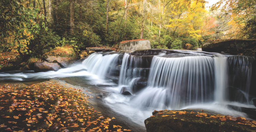
The Hike: Photographers, bring the camera for this one. The Meadow Run Trail is only three miles in length, so you won’t be far from the car, but the roaring Cucumber Falls will make you feel miles from the nearest anything. Get up early, or stay out late, to catch the falls in all of its golden hour glory. If the water levels are up, keep a lookout for kayakers paddling the rowdy section of the Meadow to its confluence with the Lower Youghiogheny.
[nextpage title=”Read on!”]
Red River Gorge Scenic Byway
Kentucky
The Drive: Travel through the land of pioneer Daniel Boone on this 46-mile drive. Beginning in Stanton, Ky., drivers will arrive first at the Nada Tunnel, a 900-foot passageway used to transport logs by rail in the early 1900s. Now considered the gateway to the Red River Gorge, this tunnel is only wide enough for one car to pass, so take extra caution when driving through. From here, the byway continues alongside sandstone rock formations and the lazy Red River, a designated wild and scenic river, before ending in Zacharia.
The Hike: The Red River Gorge itself is estimated to have over 500 miles of hiking trails, not to mention the nearly 2,000 rock climbing routes hidden among its endless sandstone cliffs and limestone rock faces. Hikers can still get a taste for the unique geology here without roping up. The Sand Gap Trail begins and ends in the Natural Bridge State Resort Park near the end of the byway. At 7.5 miles, this challenging loop, which utilizes part of the Sheltowee Trace National Recreation Trail, will take the better part of a day, but is well worth the hard-earned solitude and access to the 78-foot long Natural Bridge.
Roan Mountain
Tennessee—North Carolina
The Drive: Begin on either side of the state line. In North Carolina, take NC Highway 261. In Tennessee, follow TN State Route 143 to the entrance of Roan Mountain State Park. The drive itself climbs high into the Roan Highlands, crossing Carver’s Gap at 5,500 feet. Even in the dead of summer, visitors to Roan Mountain should definitely bring a jacket, as the higher elevations can be upwards of 20 degrees cooler than your starting destinations. This is one of the few mountain passes that is maintained year-round, so you can still hit the road if the temperature drops below freezing or there’s an unseasonably early snowstorm.
The Hike: Roan Mountain is revered for its mountain vistas and treeless balds. Experience both by beginning at the Carvers Gap trailhead near the North Carolina–Tennessee state line and taking the Appalachian Trail north. Veer off of the white blazes onto the spur Grassy Ridge Bald Trail to climb up and over a total of three mountain balds. Soak in the distant mountain views of Grandfather Mountain and Mount Mitchell in all of their autumn majesty before heading back to the car for a 4.7-mile out-and-back hike.
Indian Lakes Scenic Byway
North Carolina
The Drive: Through sprawling farms and quaint art districts, unspoiled wilderness and mountain lakes, the Indian Lakes Scenic Byway takes visitors on a 60-mile tour of western North Carolina’s natural splendor. This two-for-one route connects both the Cherohala Skyway and the Nantahala Byway. Though it can easily be driven in a day, with multisport adventure pitstops like the Nantahala Outdoor Center, Fontana Lake, and Santeelah Lake, what’s the hurry?
The Hike: Hike beneath the ancient boughs of the region’s few remaining old-growth trees at Joyce Kilmer Memorial Forest. If you’re starting from Almond, N.C., this pristine chunk virgin forest is located around mile 41.5 off of the Indian Lakes Scenic Byway near Santeetlah Lake. An easy two-mile hike gets you into the heart of Joyce Kilmer, with the upper Poplar Cove Loop sporting the most impressive trees. Many trees here are over 400 years old and skyrocket more than 100 feet in the air.
Mount Mitchell Scenic Byway
North Carolina
The Drive: Take exit 9 off of I-26W to begin your journey. Short of a few quiet mountain towns, this route is nothing but you and the open road set against a backdrop of soaring ridgelines and dense canopy. For 52 miles, this western North Carolina drive climbs up to Mount Mitchell, the highest peak east of the Mississippi at 6,683 feet, by way of N.C. 80 and the Blue Ridge Parkway. Start out with a full tank, as the fueling options are few and far between once you start ascending.
The Hike: A short hike en route to the summit is Roaring Fork Creek Falls. It’s only a half-mile to the base of this 100-foot cascading beauty, so there’s no excuse to pass it by. The dense canopy above the falls is pure magic when the colors are peak, so don’t get distracted solely by the allure of mountain landscapes. While you can and should drive to the summit of Mount Mitchell, you’ll never truly know how rugged the terrain is without walking it yourself. The 5.5-mile summit trail begins just past the parkway and climbs a grueling 3,500 feet to the top. A shorter option is the Deep Gap Trail, which is only two miles round-trip and begins and ends at the summit of Mount Mitchell.
Cherokee Foothills National Scenic Byway
South Carolina
The Drive: Once used by the resident Cherokee Indians and early fur traders of centuries past, this 130-mile mostly country roads route is a Sunday driver’s dream. Riding along the base of the Blue Ridge Mountains, Highway 11 takes drivers past some of the Upstate’s gems like Lake Jocassee, Table Rock, Keowee-Toxawa, and Lake Hartwell State Parks. Don’t bypass the Table Rock entrance off of 11 without taking a shot of the granite monolith’s mirror reflection in Carrick Creek. No matter the season, the view here feels like a scene plucked from the Rockies, not the base of the Blue Ridge Mountains.
The Hike: The hike to Table Rock’s summit is a classic and extremely popular on the weekends for the wide-open mountainscape at the top. But what’s even more appealing about this hike is the trail itself. Chugging for 2,000 feet over the course of 3.6 miles, the path initially curls through a hardwood forest littered with boulders, eventually morphing into dense stands of pine and hemlock. Avoid the crowds by coming when the weather looks iffy or early on a weekday. Having that formidable rock face to yourself is a powerful experience.
Russell-Brasstown National Scenic Highway
Georgia
The Drive: Journey into the heart of the Chattahoochee National Forest, past the Bavarian modeled town of Helen, and up to Georgia’s highest point along this 40.6-mile north Georgia drive. The underrated Southern Appalachians here are magnificent in the height of fall, and driving along the byway you’ll have plenty of views of the mountains and piedmont alike.
The Hike: Park at the Tesnatee Gap Trailhead off of the Richard B. Russell Scenic Highway and head south on the Appalachian Trail. Immediately from the parking lot, the trail begins to ascend, switchbacking and becoming increasingly rocky for the next three-quarters of a mile. Though steep, the hike is short, and in just under a mile, you’ll arrive at the summit of Cowrock Mountain. Compared to Amicalola and Blood Mountain to the south, Cowrock as a destination is often overlooked but the views here are quintessential Appalachian. Continue for another half-mile past the official summit for prime sunset seats.


