“At Three Forks, the Left Fork of Raven Fork seems relatively gentle and benign, but by the time it gets there it has descended through some of the most forbidding wilderness in the eastern United States from its source under Tricorner Knob, on the backbone of the Smokies.”
- Ted Alexander, timber cruiser and fishing guide, from his 1920’s account of working in the Raven’s Fork watershed, Mountain Fever
—
I had never seen a handheld GPS unit go haywire, but there it was, cradled within my friend Hugh Irwin’s cold and shaking palm, making no sense as we stood in pouring rain and lightning somewhere along a spine of mountain aptly titled Breakneck Ridge. We had left that morning out of Three Forks, a wild area of virgin spruce forest deep within the eastern half of the Great Smoky Mountains National Park, where we had spent the last two nights in what many consider one of the most pristine and remote places left in southern Appalachia. Though overnight camping is not allowed in this area, the park service granted us permission due to Hugh’s reputation and credentials as a forest ecologist, along with his interest in documenting the area’s old growth characteristics. Becoming more anxious and hypothermic by the moment, we at last find the small saddle of land that will take us over to Hyatt Ridge, where we can walk our remaining soggy miles out on a somewhat established trail.
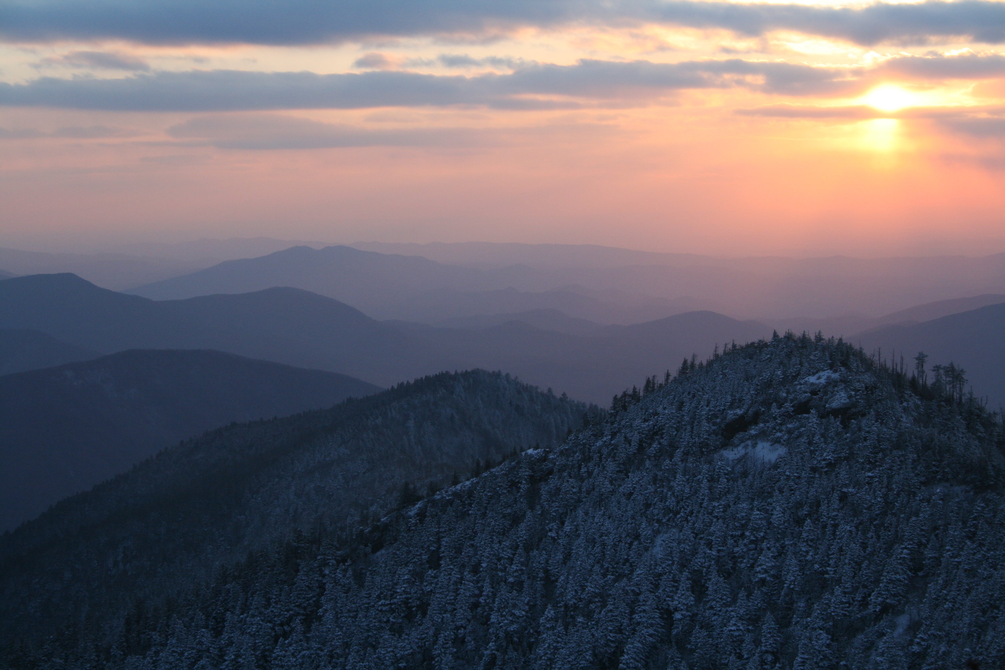
Perched within a high elevation valley, and cut off from the more established visitor locations and trails by a rugged and narrow gorge, Three Forks is a hydrological and forested wonder. Its name derives from the fact that three streams come together at a shared terminus, forming a long, deep pool and the beginning of Raven Fork, one of many large and iconic streams that characterize the Great Smokies. Though native Americans likely accessed Three Forks for thousands of years, the first documented exploration of the area began in 1799, when crews surveying the Tennessee-North Carolina state line attempted to enter it, only to abandon their efforts after becoming entangled in the dense rhododendron, spruce, and fir. Another failed attempt occurred in 1821, and it was not until 1858 when Swiss-born Geographer Arnold Guyot explored the area that some accuracy was provided as to the location of the state line. But as Ravensford timber cruiser Ted Alexander noted while exploring the area in the 1920s, even Guyot made mistakes mapping the Smokies main range in the area, as well as subsequent US Geological Survey attempts.
Much like the survey crew of 1799, my first attempt to enter Three Forks failed for the exact reasons. My wife and I had camped with Hugh at McGee Springs, thinking we would bushwhack out Breakneck Ridge and descend along the old manway that Ted Alexander forged almost eighty years ago when creating a fishing camp at Three Forks. Unable to find even a remnant of this path, we retreated after hours of entanglement in dense rhododendron and ancient fallen spruce and hemlock. At one point, Hugh’s pack was unknowingly unzipped by a rhododendron snag, spilling his GPS unit into the thickly vegetated forest floor. Upon realizing this a half hour later, we backtracked on hands and knees for close to two hours, scouring the ground until at last seeing an alien glint of metal within the thick carpet of green. Beaten, bruised, but undeterred, we decided that night around our campfire at McGee that we would return with more determination and preparation for our next attempt.
When we finally made it to Three Forks on our second attempt, I had felt a sense of timelessness like I had never experienced before – the forest primeval, untouched by senseless modern human hands. It is fairy tale like in its appearance, Jurassic in its feel. We had found a bit of the old manway, hacked out in the nineteen twenties by Tom Alexander and George Masa, and had crawled, slid, and prayed our way down it over several hours, wondering all along about how we were going to turn around and crawl our way back out after making our destination, since we had again decided to camp at McGee Springs and day trip the excursion. At last reaching the great confluence of the three streams, we enjoyed a brisk swim and brief exploration of the area before making the brutal climb out and returning to camp.
On our second successful trip into Three Forks, Hugh obtained permission for us to overnight. Fires are forbidden, so that first evening we huddled quietly around candlelight, listening to wood thrush in the crepuscular light, the only sound we heard but for the continuous babble of Raven Fork. Hugh and another friend who was along, Rob Cox, were to set out and explore the watershed the next day. With no trails, and a topographic map as their only guide, it would be a challenge. The only early descriptions we have of the area are from Tom Alexander’s journals, and these are almost a century old. Alexander explored the area as a timber cruiser in the 1920’s for the James D. Lacey Company, and its client Ravensford Lumber Company, tallying the commercial value of the ancient forest prior to its sale to the Department of Interior and the establishment of the Great Smoky Mountains National Park. Ravensford owned 35,000 acres in the high elevation basin, and Alexander fell in love with it, so when the Lacey Company went broke in 1929, owing him $600 dollars in back salary, he quickly seized upon the opportunity by negotiating the use of the camp at Three Forks and all of its gear as a settlement.
Alexander referred to Three Forks as one of the “finest trout streams in the southern Appalachians even if only the most dedicated fishermen could actually get to it.” He quickly established a tourist fishing camp there, hiring a cook, and declaring that if fishermen “had any trout fishing skill at all, we could practically guarantee them all the fish they wanted.” Almost a hundred years later, I have fished these waters and caught between forty and fifty Brook trout a day with little effort. There was an old hunters’ cabin at Three Forks at the time of Alexander’s explorations, and he soon added a few canvas wall tents and a cook shed to accommodate his many visitors willing to make the rugged nine mile walk in from Smokemont.
One of these was Japanese photographer George Masa, who became close friends with Alexander, travelling to Three Forks to photograph the stunning beauty of the area. Like all great photographers, Masa captured the spirit of the place, and I refer to his images in Alexander’s book often when conjuring up my own memories. Masa photographed Alexander’s fishing camp often, and in one of his last photographs taken in 1931, there is a large group of Asheville men and women huddled around a campfire with Masa’s famous converted bicycle measuring wheel leaning against a tent pole. The camp is large and hospitable in appearance and camp cook Avery Gouge stands in a professional looking apron with buttoned up collared shirt.
Masa was also close friends with Horace Kephart, and worked alongside him in his efforts to build support for the Great Smoky Mountains National Park. He died of influenza in Asheville in 1933, destitute, with an unfulfilled wish to be buried next to Kephart in Bryson City. There are no remains of Alexander’s camp left today, though someone did make it in at some point with some large sheets of plastic tarp that lay rolled on the ground in a miserable state of decay. Unless we can pack it out, this ugly desecration will likely be here a hundred years before vanishing from human sight. There is also an old wooden picnic table made from rough cut logs and lashed to two stout young spruce trees. I have since met another explorer of the area who wishes to remain anonymous and who thinks he knows the origins of the trash and table. Here is his explanation:
—
After I moved to Asheville, I did a hike with my wife and two friends and camped at the Backcountry site where the Enloe Creek Trail crosses Raven Fork Creek. This was my first time to see Raven Fork Creek and I was impressed by how beautiful and wild it is. I knew that the Harvey Broome Group (A local Sierra Club chapter) had come downstream here and had read that there used to be an old trail coming down beside the creek. There were two guys fishing the creek in the vicinity of the camp. We knew they were there when we saw two backpacks stowed under a boulder near the camp. Later in the day we ran into them fishing in the stream. One guy was a local who lived in the Cherokee area and was very talkative (too much so). The other guy didn’t say anything and avoided us. The talkative guy said they had caught over 100 trout that day – most they had released but they were planning on cooking some. When we got back to camp the talkative guy proceeded to retrieve all kinds of equipment he had stashed nearby – a pan and Crisco was stored in a hollow tree. He had a saw and talked about an axe he had under a rock nearby. He said he came to the area a lot and kept this stuff there to use when he was there.
The other guy kept to himself and kept his face in the shadows but he was fairly close since the campsite is tiny. He was supposedly the talkative guy’s cousin from Tennessee. There were extremely weird vibes going on. The guy talked about the Park Service picking up garbage in the backcountry and the next morning when we got up there was a big garbage bag of trash hung in the bear bag pulleys for the site – we carried it out. The guys were gone; they had apparently hiked out after we went to bed; they had actually talked about their intention to do this. This was when Eric Rudolph was at large. We saw a photo of him shortly after this. My wife is convinced that the reclusive guy was Rudolph, and I’m more than half convinced myself it was him. Hey, fugitives need vacations too. I do think that some of the camp remains – tarps, trash, nails and structures built in trees are left by the talkative guy. It’s his style and I’m pretty sure he gets up in the Three Forks area – in fact he referred to this while he was talking.
—
I can easily imagine Rudolph staying hidden out in here without much worry of being detected. That he was found dumpster diving in Murphy does not say much for his backcountry skills, but he no doubt hid out within these wildest of places for years before the most expensive and exhaustive manhunt in US history ended with him being retrieved from a metal container sorting trash.
A week after Hugh and I survive the storm and confusion of this fourth and most recent trip, Lamar Marshall, a friend who is documenting ancient Cherokee trails and trade routes, travelled to Three Forks with three Cherokees to see the magnificence and experience the sacredness of the place. When I ask him how the trip was, he writes back to say that it was one of the toughest days he had ever spent in the woods. This is quite a statement coming from someone who has spent more time in the woods than probably anyone I know. They had rode horses to McGee Springs, then started out looking for the manway on Breakneck Ridge. They had found old survey tape, then “crawled, slid, and descended for 2.6 miles” to the confluence of the three streams. They all swam there, and the Cherokees told Lamar that to do so was good medicine. They then attempted to go up McGee Springs, thinking that it could be no worse than the “trail” they had attempted on the way down. This route was also to be over a mile shorter, and more direct to McGee Springs where the horses waited. On their way up, Lamar tells me, one of the strangest things that has ever happened to him occurred. It is worth quoting at length.
—
I slipped and fell into a small pool that was only 3 feet across and about 3 feet deep, and about 6 feet long. The water fell into the pool upstream only a few feet, and went out a small chute right where I slipped. My left hand with my GPS in it went under water and it felt like somebody snatched my GPS out of my hand and it disappeared. I watched to see if it would pop up and go over the little chute – I never saw it. I fished in the rocks underwater to see if it was trapped. The three Cherokees went back downstream for several hundred yards to see if it had floated down. We looked and looked and I realized it was gone forever. All I had was my compass and a very old crummy Smokies map with a scale of 1 mile per inch. I got a rough compass bearing to McGee Springs and drew a course on the map and it was now after 4:00. We still had to climb Breakneck and were getting worried now about getting out before dark.
I can summarize to say it was one of the toughest days in the woods of my life. Gil Jackson is a helluva 58 year old Cherokee. He had his two Cherokee acquaintances who live way back in the Qualla Boundary past Big Witch Road to load their horses and we three drove to Round Bottom. Rode horses to McGee Springs, cross-tied the horses to trees. Found the faint trace with sparce ribbons on it and started over Breakneck. I was GPSing the way. That trail was the absolute worst I have ever slid, crawled and descended. It was 2.6 miles to Three Forks. I knew I was in trouble to have to walk that trail back out. We all swam in the pool which was at least 7 feet deep and a real gonad freezer. It was 3:30 by then and we decided that it would be easier to walk Raven Fork upstream and find where McGee Spring Creek joined Raven and we would go up there. As the crow flies, GPS said 1.4 miles and it was fairly a straight shot up the creek. We waded up Raven about 1/4 mile slipping and sliding, climbing through and around giant log jams in the laurel, and the only reservation I had was going up Breakneck if we hit laurel as bad as on the trail in, except with no trail at all.
About this time the strangest thing that ever happened to me happened. I slipped and fell into a small pool that was only 3 feet across and about 3 feet deep, and about 6 feet long. The water fell into the pool upstream only a few feet, and went out a small chute right where I slipped. My left hand with my GPS in it went under water and it felt like somebody snatched my GPS out of my hand and it disappeared. I watched to see if it would pop up and go over the little chute – I never saw it. I fished in the rocks underwater to see if it was trapped. The 3 Cherokees went back downstream for several hundred yards to see if it had floated down. We looked and looked and I realized it was gone forever. All I had was my compass and very old crummy Smokies map with a scale of 1 mile per inch. I got a rough compass bearing to McGee Springs and drew a course on the map and it was now after 4:00. Still had to climb Breakneck and getting worried now about getting out before dark.
We continued wading up Raven looking for Rapid Creek to enter on left. Finally found that. Gil took two bad falls on the slick rocks and I monkey crawled as I did not want to bust a knee. I slipped once and slid on my pack down into a pool but as I was already soaked what the hell. At 5:30 we found McGee Spring and a flag where somebody marked the confluence. We went up and there was no laurel but thick umbrella plants. Tough with boot fulls of water. Tough keeping up with any one of them as they have been running the mountains all their life. Only Gil had been to Three Forks before. We lost the spring somewhere up the mountain and angled off to the south to keep from missing McGee too far east where we would really be good and lost and we intersected the trail a quarter mile or so north of McGee Spring. Got lost near where Breakneck drops into the saddle of McGee Springs and circled until nearly dark. It was looking grim. I was about to pull the old space blanket out and build a fire when Gil found the trace and we found the horses and rode out at last light. Riding down those narrow trails at dusk with the night birds sounding off on horses almost gave me the eerie feeling that I had traveled back in time and would soon smell the 100 campfires of the village as we gained the bottom. It also left me with an eerie feeling that the Little People or some other Cherokee force snatched my electronic device attuned to government satellites out of my hand and told us to go out according to the Old Ways.
One of the Cherokees knew many plants along the trail, most by other names and what could be ate and used for medicine, learned from his grandpa who was long gone. One was called bean plant. We ate it and it did taste like green beans. This guy killed 18 deer last year and several hogs. Hunts with a bow, a crossbow, a muzzle loader and modern rifle.
I’m a little sore today but not too bad. Gil says special thanks to Hugh and Brent and whoever else toted the plastic out of Three Forks. It is a special place to the Cherokees.
—
Walking out now on weak and wobbling legs, with torn clothing and pack sagging with water and ancient trash, I am wondering if I will ever return. It is my third “successful” trip into Three Forks, and I am pretty sure I have asked myself this upon every leaving. Hopefully the memory of this tortuous exit will soften and the memories of catching wild brook trout all day long, drinking wine while several of them simmered on our small gas stove, and the crepuscular wood thrush singing the evening in will win out and I’ll be back before I’m too old to even consider it. But if I don’t, I’ll take pleasure in knowing that it’s there.


