Bear collisions with vehicles are increasing, especially in places like Interstate 40 adjacent to Great Smoky Mountains National Park. What can be done to keep the roads safe for motorists and wildlife?
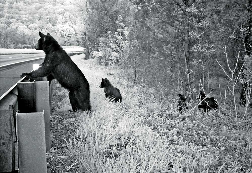
Although Interstate 40 runs 2,560 miles from the coast of North Carolina to California, a 28-mile stretch through the Smokies is the deadliest and most dangerous. The Smokies section of Interstate 40 winds through the Pigeon River Gorge and alongside the Great Smoky Mountains National Park and the Cherokee and Pisgah National Forests. It’s one of the wildest spots on the map, and also one of the most heavily traveled by vehicles. The corridor is the intersection of wildlife habitat and human safety.
Now, a team of transportation officials and wildlife biologists are studying the corridor. Dr. Liz Hillard, a wildlife scientist with the Wildlands Network, is one of the lead scientists on the project, studying animal behavior and how they interact with the roadway.
“Interstate 40 acts as barriers to animal movement, whether it’s reducing habitat connectivity or just increasing animal mortality,” she said.
Bear, deer, and elk also pose a danger to the people driving through this mountainous landscape at high speeds. Over 26,000 vehicles pass through this corridor every day.
When Interstate 40 opened through the Pigeon River Gorge in 1968, the bear population was a fraction of what it is today. With an estimated population of more than 1,500 in the area today, bears are increasingly attempting to cross the road in search of food and habitat.
“These animals did not evolve with the road there,” said Jeff Hunter, senior program manager at the National Parks Conservation Association. “They’ve been moving across this landscape for millennia. These travel corridors are a learned behavior. Adults teach the young how to move through this landscape.”
Hunter and Hillard are part of a coalition of stakeholders working on identifying hotspots where wildlife vehicle collisions are more likely to occur and finding solutions to prevent future damages.
The project is also a proactive attempt to prevent a similar situation from happening with the growing elk population. Elk had largely been eliminated from the landscape by the late 1700s until the species was reintroduced to Great Smoky Mountains National Park in 2001.
A full-grown bull elk can weigh upwards of 900 pounds, causing more damage to cars and injuries to drivers than bears and deer.
A report issued by the Federal Highway Administration estimated that over 300,000 vehicular accidents in the United States are caused by wildlife every year. These collisions result in more than $8.3 billion annually in car repairs, medical bills, and law enforcement services.
Safe Passage
From an ecological perspective, Interstate 40 probably never should have been built in its current location. It’s one of the most dangerous stretches of interstate anywhere in the U.S. It also bisects some of the most biologically diverse public lands and creates a major barrier to wildlife movement.
Adding underpasses or overpasses would not only help animals safely cross major roadways but would also reduce the money spent on accidents and prevent future human injuries.
Hunter hopes the study will answer some important questions. “Where are animals being killed? Why? Is it the topography? Is it the ridges? Are they following streams? What is it about the landscape that the road cuts through that’s causing animals to be killed with greater frequency in some areas than others?”
The study includes a GPS collaring program of 11 elk in the area. A satellite confirms the elk’s location every hour, allowing researchers to understand their movement patterns along these roadways, specifically where they’re crossing. “We’ll also learn how these roadways might be barriers to movement,” says Hilliard. “We’ll even be able to figure out seasonally and what months elk are more likely to be in roadways.
With this detailed location information, scientists will have a better understanding of where a new culvert or overpass might be beneficial or where an existing structure could be modified to work better.
“Bears do really well with underpasses, as do bobcats,” Hunter said. “White tailed deer will use culverts and underpasses if they are large enough. Elk, not so much. Elk like open landscapes and large structures. Elk like overpasses.”
Once the data has been collected, researchers will work with transportation officials and other stakeholders to figure out how to blend the science, engineering, and economics. The coalition is looking at a variety of funding sources, from state and federal government funds to private donations.
“We have to be sure that we can put some funding mechanisms in place,” said Dr. Liz Rutledge, a wildlife specialist with the North Carolina Wildlife Federation. “Usually, that requires public support to get accomplished. This could be used as an example of how you can do conservation and habitat work in other areas of the state for other species. It’s a model of how you develop a network.”
While the exact cost of wildlife crossings depends on the location and a number of other factors, building a new structure can cost millions of dollars. Researchers are looking at ways they can improve existing structures, such as adding fencing, to help keep costs down.
And land trusts such as the Southern Appalachian Highlands Conservancy (SAHC) are working with the coalition to buy available properties or secure conservation easements throughout the Interstate 40 corridor. SAHC has already purchased two key parcels in the corridor that could provide safe passage for wildlife. One of them, the Wilkins Creek tract—a 187-acre parcel in the Interstate 40 corridor—was just purchased last month using funds donated from a generous philanthropist. The property is across from Great Smoky Mountains National Park, adjacent to the Interstate 40 Welcome Center, and shares a half-mile border with Pisgah National Forest. Best of all, it already has two concrete box culverts that pass under Interstate 40 which wildlife can use to cross from the park to adjacent national forests.
“This property was a top conservation priority for us, and it will provide important permeability and connectivity for wildlife,” says Michelle Pugliese, Land Protection Director for SAHC.
Down the Road
The Interstate 40 project is only one part of a larger issue concerning habitat connectivity on the East Coast.
“In the western United States and Canada, they’ve been doing habitat corridor work for a long time,” Rutledge said. “Now it’s heading east.”
While the North Carolina Wildlife Resources Commission has been doing some of this corridor work since the 1990s, there is now a push for larger-scale projects.
“You want large parcels of land that are actually connected where the wildlife can traverse into another habitat for part of their annual cycle,” Rutledge said. “You have to not only expand your habitat but have quality habitat.”
Dr. Ron Sutherland, chief scientist for the Wildlands Network, said he and his team are working on mapping a more extensive wildlife corridor that would extend from Everglades National Park to Quebec.
Plans for the Eastern Wildway show a wildlife corridor connecting protected places like the Adirondacks, Shenandoah Valley, and Great Smoky Mountains National Park. Especially in an era of climate change, the ability of species to move across the landscape enables them to adapt and survive.
“Nobody wants to see a species become inbred in a given park,” Sutherland said. “Maintaining the connections between these places allows genes to flow back and forth and allows populations to maintain healthy levels of genetic diversity.”
Looking to the future, a more connected landscape will be important as climate change affects more habitats.
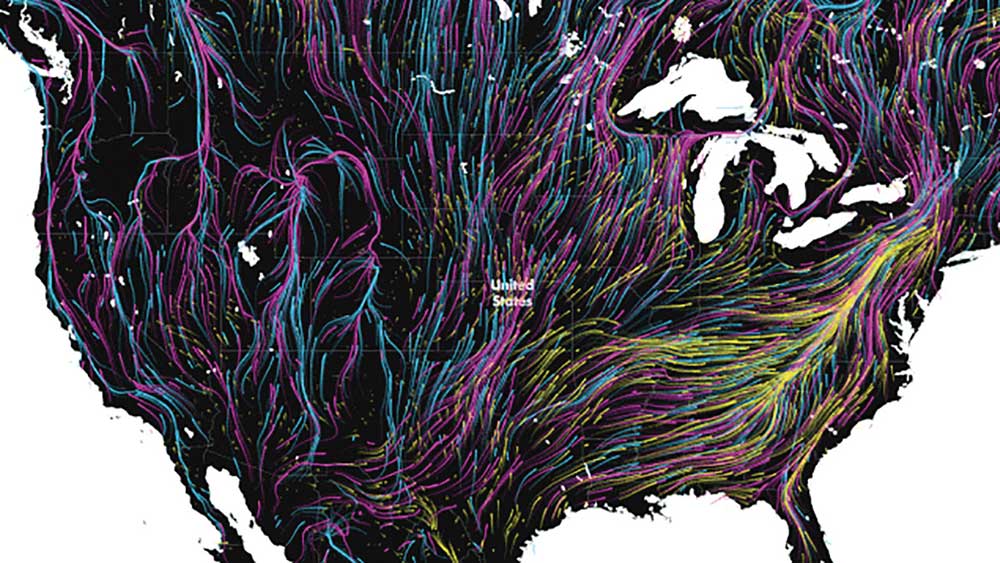
“As it continues to get warmer, many species are going to want to migrate northward in this hemisphere and uphill to higher elevations,” Sutherland said. “So, keeping movement pathways open is how we let not just animals, but plants migrate to keep up with their acceptable climate conditions.”
While most road crossing projects focus on larger animals like bear and elk, there is less research being done on the smaller animals that are equally important to habitats and ecosystems.
“It’s harder to think about how we get box turtles, snakes, or salamanders across an I-40,” Sutherland said. “A chain linked fence doesn’t work very well to guide small animals to a wildlife crossing. It might work well for bear and elk, but a salamander would go right through it.”
For now, the Interstate 40 connectivity project will continue to collect data and study the best ways to implement solutions.
“If we can connect animals into a broader network of habitats, then they are much more likely to survive,” says Sutherland, “especially as more and more people move into Southern Appalachia.”
