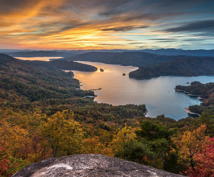
It’s no wonder Jocassee Valley held a central place in Cherokee myths. Places like Jocassee inspire stories. Water tumbles off the sides of the mountains from rivers and countless unnamed creeks, all converging into a crystal clear lake. The lake’s surface reflects mile after mile of pristine shoreline steeped with jagged rock formations, fading into uninterrupted mountain vistas for as far as the eye can see. The area is also a hotspot for diversity. Some of the rarest plants and animals in the world make this lush gorge home.
Lake Jocassee has been called many things over the years, from the “Lake Tahoe of the East” to “South Carolina’s Little Switzerland.” But perhaps the greatest praise came in the autumn of 2012 when National Geographic named Jocassee Gorges as one of “50 of the World’s Last Great Places.” Most of the list includes destinations of a lifetime, like Easter Island or Loire Valley. By comparison, Lake Jocassee in South Carolina is right in our own backyard.
While part of the area’s appeal is the area’s inaccessibility, it seems a shame to have a world-class destination so close to home be unseen by folks who live within a few hours drive. Devil’s Fork State Park offers lake access, and the Jocassee is ideal for many different types of lake paddling trips, from a leisurely afternoon paddle to a multi-day kayak camping trip.
How the Valley Became a Lake
The name “Jocassee” is derived from a Cherokee word that means “place of the lost one.” The name was created from a Cherokee legend, but it would also foreshadow the events that would unfold in the area centuries later.
Cherokee legend goes that rival tribes lived in the area, and one day, a young warrior broke his leg while hunting in territory claimed by the rival tribe. A young maiden named Jocassee came to the young warrior’s rescue and nursed him back to health. The two fell in love, but the warrior was killed in a battle between the tribes. Heartbroken, Jocassee entered the water to end her life. But her body didn’t sink. She walked across the water’s surface to be embraced by, and forever disappear with, the young warrior’s ghost.
The Cherokee fair maiden Jocassee wasn’t the only thing to disappear here. Jocassee valley once provided an idyllic summer retreat for families. When Duke Energy Co. dammed the river in the 1970s, an entire valley became forever submerged. Duke Energy bought most the land in Jocassee Valley and razed all the buildings. But the owners of Attakulla Lodge Hotel refused to sell. Scuba divers report the hotel remains unscathed 300 feet below the lake’s surface. The peeling paint is just as it was back in the 1970s, and the basketball court remains intact. Divers have also found an underwater cemetery.
Many feared that the fairy tale of the idyllic summer get-away gave way to progress when the dam caused water to flood the valley. Fortunately, Duke Energy partnered with dozens of local, state and natural conservation organizations to forever preserve the 43,000 wild acres surrounding the lake, including Gorges State Park.
Gateway to the Gorges
Devil’s Fork State Park, the aptly dubbed “Gateway to the Gorges,” offers the only public access to Lake Jocassee. Lake Jocassee’s relatively remote location and small parking lots limit the number of visitors. Even on busy summer weekends when boaters, anglers, and swimmers fill other lakes to capacity, Lake Jocassee remains relatively empty.
If you don’t have your own boat, both Jocassee Lake Tours and The Jocassee Outdoor Center rent kayaks, as well as offer tours and provide shuttle services for hikers and kayakers.
If you do have your own boats, bypass the main boat ramp and parking lot area to avoid pontoon and power boats and head over to Devil’s Fork remote ramp. Duke Energy recently rebuilt the ramps there and added changing facilities. Either way, consider stopping by the park store to buy your own waterproof map of the lake.
Lake Jocassee is shaped like a hand with three fingers extending outward. The boat launch facilities are located deep at the palm of the hand. All the options below outline routes to explore the fingers of the lake.
Day Trippin’
Even at the launch ramp, when the sun’s rays hit the lake water at just the right angle, you’ll see just how clear and green the water is. If you only have an afternoon, paddle left. Within a few minutes, you’ll see houses on the point of Fisher Knob, where about twenty massive summer homes provide the only reminder of development in this otherwise wilderness area. The homes disappear when the lush canopy provides a welcome disguise, and the docks remain the sole reminder of civilization.
To really get a sense of wilderness area, paddle past Fisher Knob toward Whitewater River and Thompson River. Stay left and paddle all the way to where Whitewater River flows into the lake. Pull your kayak well up onto shore and hike alongside the river. In the summer months, the eddies along the river provide nature’s version of cold water plunges, where small falls massage knots out of shoulders and the oxygenated water provides an energizing boost. Hours can be spent boulder-hopping, discovering waterfalls or cooling off at the river’s edge. The intrepid hiker can piece together a path to view both Upper Whitewater falls and Lower Whitewater falls.
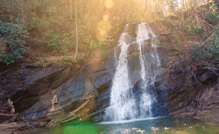
If you still have time, paddle toward Wright Creek Waterfall and Thompson River. When lake levels are high, the falls flows directly into the lake and kayakers can paddle behind the waterfall. Lower lake levels reveal golden sandy beaches around the falls that make ideal picnic spots. When the lake is low, walk behind the falls and be treated to a view of the lake from the lens of the watery curtain.
Overnighter
Devil’s Fork State Park maintains Double Springs, a boat-in campground. Some say that Double Springs provides the best stargazing spot in the Southeast. Brooks Wade was skeptical of the claim initially. When his friend told him about the phenomenal camping in South Carolina, he replied, “You drink too much moonshine.” Reluctantly he agreed to visit. After a week of camping at the lake, he and his wife moved and opened the guiding company Jocassee Lake Tours. He spends every day on the lake, which he describes simply as paradise.
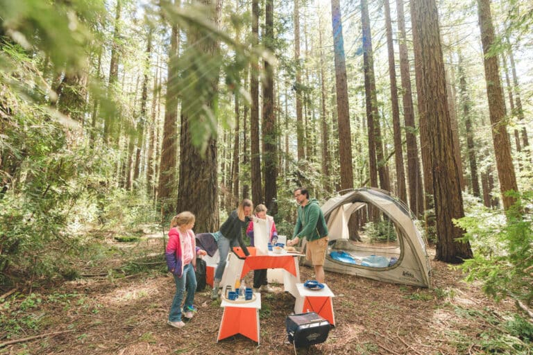
Most kayakers paddle across the lake to unload their boat and set up camp before exploring the endless inlets and waterfalls. The paddle across the lake takes between forty minutes to one hour, depending on your paddling speed and wind conditions. Double Springs is a primitive campground with ten boat-in campsites. Because of low lake levels, wooden steps help visitors negotiate the steep embankment, beyond which the campsites are located.
With an empty boat, you’ll have an easier time paddling, and can either follow the day trip route above or paddle up to Mills Creek Waterfall and the Horsepasture River.
Along the way to Mills Creek Waterfall, you’ll notice the low lake levels. Ever since the summer of 2011, the lake has been at drought levels, which means that incredible rock formations are exposed. Marvel at the granite formed 500 million years ago, and the beautifully intricate roots systems that have eroded off the mountainside.
Expedition Style
The only other legal option for camping lakeside is to paddle all the way up the Toxaway River and camp along the river’s banks and share campsites with hikers walking the Foothills Trail, an 80-mile footpath from Table Rock State Park in the east to Oconee State Park in the west. The sites are remote and secluded, rewarding kayakers willing to paddle a fully loaded kayak ten miles each way. Plan to paddle for at least three and a half hours.
As you paddle up the Toxaway River, the shore transforms from outcrops of pine trees to a marsh-like setting where sea grasses grow and birds build nests. At the mouth of the river, the dirt ribbon that is the hiking trail can barely be viewed from the vantage point of a kayaker. When you see the trail, pull your kayak securely on shore and unload to carry your gear. In low water years, it’s impossible to paddle up the river all the way to the campsites, and slugging along the inlet involves sinking into knee deep mud. Within approximately a hundred feet, you’ll see an opening under a canopy of evergreens and will see remains of other campfires. Here you’ll find camp spots along the river’s bank, and will be lulled to sleep by the flowing water and gentle breeze.
The Oconee Bell
Included among the rare plants found in the area are 90 percent of the world’s Oconee Bells. The Oconee Bell is only found in a few isolated locations in Southern Appalachia. The Gorges provides a perfect habitat, meeting the wildflowers’ requirements for humid, rocky outcrops and cool, shady woods. The flower’s nearest relative lives in China and Japan. The Oconee Bell, a white, delicate bell-shaped wildflower blooms from mid-March to April in the Jocassee Gorges.
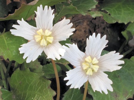
A French botanist, Andre Michaux first collected the Oconee Bell in 1788. He placed the specimen in a herbarium in Paris, where it went unnoticed for fifty years. Then American botanist Asa Gray discovered the specimen. Botanists searched without luck for the flower. But in 1877, a teenager named George Hymans found Oconee Bells when walking along the Catawba River in North Carolina.
Related Articles:
