Preserving precious patches of habitat across the country, America’s national wildlife refuges are hubs of biodiversity and havens for native wildlife. In the Southeast, more than 85 different national wildlife refuges provide sanctuary for endangered and imperiled species, including red wolves, loggerhead sea turtles, and red-cockaded woodpeckers. For recreational paddlers, the region’s refuges offer an abundance of extraordinary waterways to explore.
Alligator River National Wildlife Refuge
North Carolina
Just west of the beaches of the Outer Banks, North Carolina’s Alligator River National Wildlife Refuge protects a mosaic of hardwood swamp forests, pocosin wetlands, and salt marshes, bounded by the Albemarle Sound and the Alligator River. The 157,000-acre protected area is a haven for threatened and endangered species, including red-cockaded woodpeckers, American alligators, and red wolves, which were reintroduced to the refuge in 1987 as part of federal effort to reestablish a wild population in the Southeast.
In 2013, about 130 red wolves were roaming the region, but the refuge’s population has dwindled in recent years—and in the last two years, there haven’t been any pups born in the wild. While wolf numbers have fluctuated, the protected area remains a stronghold for black bears, with as many as two bears per square mile in the refuge.
However, paddlers are more likely to spot cottonmouths and basking alligators along the refuge’s 13-mile network of color-coded water trails. All four paddling trails are accessible from the shallow kayak launch on Buffalo City Road in the northern portion of the refuge, named for a boom-and-bust logging town that sprang up in the region after the Civil War. For paddlers, the shortest and most-sheltered option is the three-mile out-and-back paddle to Sawyer Lake, along the refuge’s red-blazed water trail. For a longer tour, paddle Milltail Creek to the Alligator River following the yellow-blazed trail, and keep an eye out for bears crossing narrow sections of the blackwater creek along the eight mile trip.

Back Bay National Wildlife Refuge
Virginia
Situated along the Atlantic Flyway just south of Virginia Beach, the Back Bay National Wildlife Refuge contains a conglomeration of shifting sand dunes, scruffy shrublands, and hardwood forests of oak and pine, spread around the shallow waters of Back Bay. The diverse habitat supports a wide range of wildlife, including endangered loggerhead sea turtles, piping plovers, and brown pelicans. The refuge also serves as a portal to remote False Cape State Park, spread over a pristine expanse of coastline accessible only by foot, bike, or boat.
For visiting paddlers, the refuge offers three different boat launches dotting Back Bay, including a secluded soft launch at Horn Point, on the estuary’s western edge. For a multi-day adventure, launch from Little Island Park at the refuge’s northern edge (where overnight parking is allowed), and head south toward False Cape State Park to snag a campsite at Barbour Hill Bay or False Cape Landing Bay for epic sunsets. During the summer, keep an eye out for hatching osprey chicks, along with blooming swamp hibiscus and cardinal flowers—and be ready to battle wind-generated tides. With the nearest inlet to the Atlantic Ocean more than 60 miles south in North Carolina, Back Bay’s isn’t shaped by lunar tides, so expect persistent southerly winds during summer paddles.

Blackwater National Wildlife Refuge
Maryland
A hotspot for birders along Maryland’s Eastern shore, the Blackwater National Wildlife Refuge protects a patchwork of estuarine marshes and shadowy loblolly pine forests spreading over more than 29,000 acres, threaded by the Blackwater and Little Blackwater rivers. The protected area contains nearly a third of Maryland’s tidal wetlands, and the refuge’s medley of wetlands and woodlands is frequented by more than 250 types of birds, including one of the highest densities of bald eagles on the East Coast.
On dry land, the refuge’s hardwood forests harbor once-endangered Delmarva fox squirrels and pint-sized Asian sika deer, introduced to the region in 1918. The protected area also has historical significance. In 1822, Harriet Tubman was born on a plantation in Peter’s Neck, near the refuge’s western boundary. This spring, the home of Tubman’s father Ben Ross was discovered on a tract of property acquired for the refuge by the U.S. Fish and Wildlife Service last year.
The best way to experience the refuge is on the water, as the protected area’s three paddling trails offer more than 20 miles to explore. For seasoned paddlers, the Purple Trail offers nine routed miles traversing Coles Creek and the open water of the Blackwater River. For a route more protected from wind, the eight-mile Green Trail snakes through the wildlife-rich marshes, along a narrow stretch of the Blackwater River. Just be sure to download or purchase a paddling map before heading out; cellphone service is patchy on the water, and it’s easy to get confused in the refuge’s labyrinthine marshes.
Cape Romain National Wildlife Refuge
South Carolina
An easy day-trip from Charleston, the Cape Romain National Wildlife Refuge spreads over a 66,287 acre swath of coastline with extensive history. The refuge’s coastal creeks, maritime forests, and wind-battered barrier islands were first roamed by the region’s resident Sewee Indians, and later frequented by seafaring English settlers, retreating British warships, and opportunistic Atlantic pirates.
In 2014, the remains of the USS Planter were also discovered along a shoal just off the refuge’s Cape Island. Commandeered by enslaved crewman Robert Smalls in the Charleston harbor in 1882, the massive vessel was skillfully piloted through hostile waters and handed over to the Union Navy, ultimately bringing Smalls and 17 others to freedom.
For a taste of the refuge’s ecology and colorful history, launch from Garris Landing and paddle to 5,000-acre Bulls Island, the largest of the refuge’s barrier islands. The three-mile trip takes paddlers along serpentine coastal creeks frequented by sun-seeking alligators and migratory roseate spoonbills. Once on Bulls Island, allow some time to explore Boneyard Beach. The photogenic, three-mile ribbon of shoreline along the island’s northeastern edge is littered with weather-beaten live oaks, cedar, and loblolly pine limbs resembling weathered human bones.
Great Dismal Swamp National Wildlife Refuge
Virginia
Preserving a tiny slice of a million-acre wilderness that once spread over southeastern Virginia and northeastern North Carolina, the Great Dismal Swamp National Wildlife Refuge also has a rich human history. Before the arrival of European colonists, the massive mire was utilized by the region’s original indigenous inhabitants, including the Nansemond, Meherrin, and Nottoway tribes. And later, the swamp’s dense forests provided a secluded sanctuary for people escaping slavery and was used both by freedom seekers along the Underground Railroad and by resourceful maroons, who established communities in the wilderness’ remote interior.
However, by the mid-1700s, newly arrived colonists were eyeing the swamp’s resources, including George Washington, who harvested the region’s timber as part of the Dismal Swamp Land Company. Today, the 112,000-acre refuge is a hub of biodiversity, centered around 3,100-acre Lake Drummond, the largest natural lake in Virginia. Paddlers can explore the cypress-studded lake, or paddle the Great Dismal Swamp Canal, a 22-mile link in the Intracoastal Waterway tracing the eastern edge of the refuge. For a swamp sampler, begin at the boat launch on Ballahack Road and paddle the Feeder Ditch Canal to Lake Drummond, an eight mile out-and-back.
Eastern Neck National Wildlife Refuge
Maryland
Cradled by the Chester River and the Chesapeake Bay, the Eastern Neck National Wildlife Refuge extends over a 2,285-acre island blanketed with brackish marsh, grasslands, and uplands forests. Originally a hunting ground for the region’s Ozinie people, the spit of land was explored by Captain John Smith in 1608 during one of his extended journeys through the Chesapeake Bay. By the early 1700s, the island had been claimed by tobacco-producing colonists, and served as a stop for packet ships cruising the Chesapeake Bay. The U.S. Fish and Wildlife Service acquired the area in the 1960s, and today the refuge is a global hub for wintering waterfowl.
More than one percent of the planet’s tundra swans visit the protected area every winter to nosh on clams, along with black ducks, mallards, and canvasbacks. On the water, the cove-pocked atoll is ideal for paddlers. Beginning from the Bogles Wharf Boat Launch near the mouth of the Chester River, the 10-mile Eastern Neck Island Water Trail rings the entire island, offering seven points of interest showcasing avifauna hotspots and historical sites. Be sure to plan for lines of choppy waves in the shallows near shore, and formidable winds from the southwest in open water of the Bay during the summer.
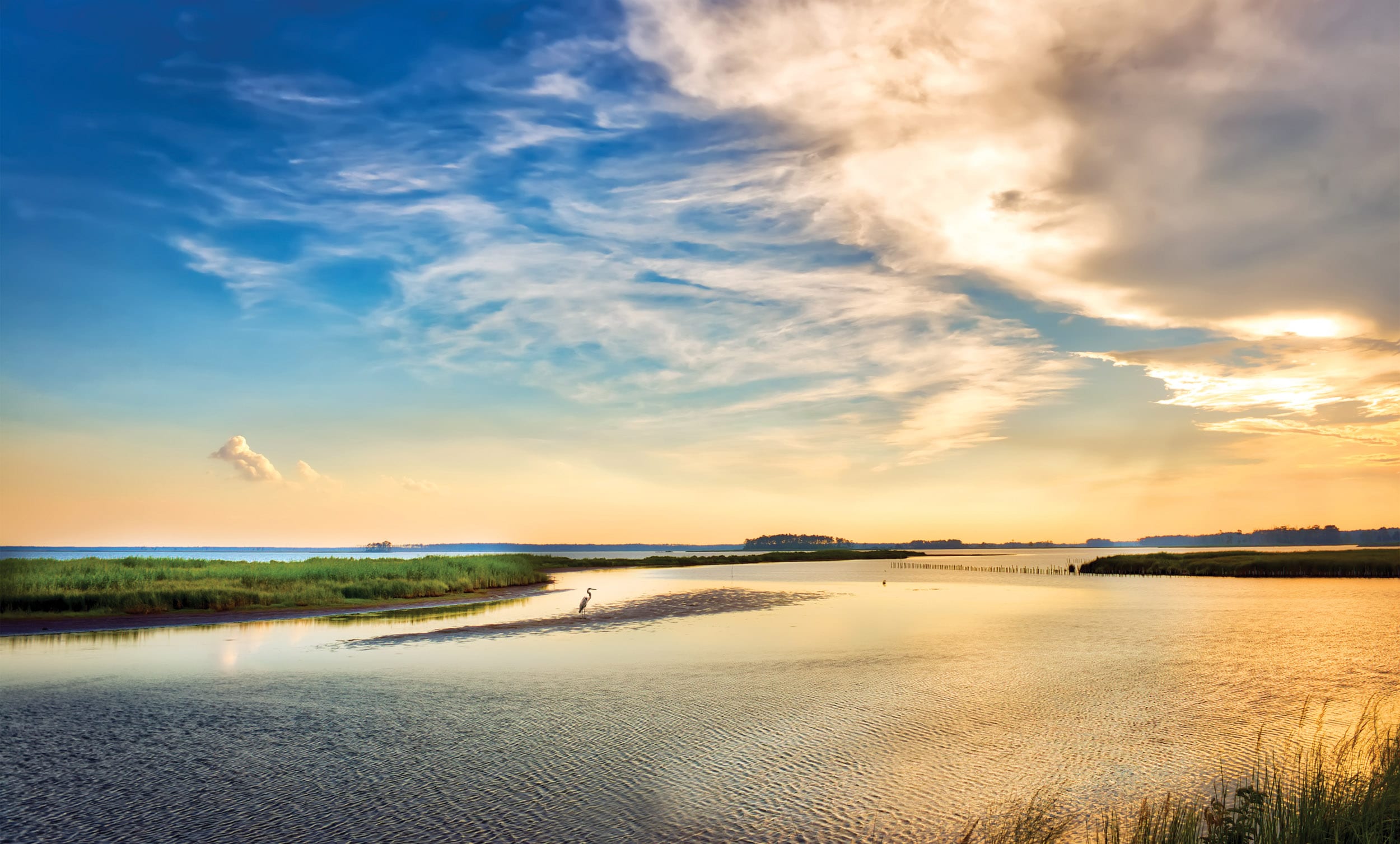
Cover photo: Great Blue Heron fishing on a sandbar during a beautiful Chesapeake Bay sunset at Blackwater Wildlife refuge. Photo courtesy of Getty images


